Ireland day 0171. Friday 18 March 2022- Wicklow-1
| Today’s summary | Drove up to Ballymakellett to re-walk the Carnavaddy Loop, this time with Bev and Pete. Unsuccessfully tried to find the link path between Carnavaddy and the Tain Way | ||||
| Today’s weather | Bright and sunny over the whole of Ireland except the Carnavaddy range where today we enjoyed cold thick mist and a strong south easterly wind (again), but no rain. About 6C | ||||
 |
 |
||||
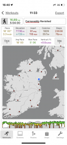
| Today’s overview location (The blue mark shows the location of our route) |
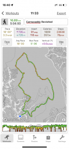
Close-up location (The green line shows where we walked) (Click button below to download GPX of today’s walk as recorded, or see interactive map at bottom with elevations corrected): Carnavaddy again |
||||
Commentary
It looked like it was going be a beautiful day today – all the omens were hopeful, including clear blue skies when we got up, and a good forecast. So we abandoned plans to go into Dublin and instead, Bev, Pete and I decided to head up the M1 and pay a return visit to the Cooleys. The aim was to start getting our walking legs into gear ready for the Wicklow Way starting on Sunday, and also to see if we could find the elusive path linking the summit of Carnavaddy to the well made-up Tain Way about 1 km to the south.
Things looked promising as we drove up the M1 – the skies just got clearer and clearer until we reached Dundalk and the Cooleys came into view. I noticed that they had a cap of fluffy white cloud on the tops – but I assumed it was ephemeral and would soon burn off in the sun.
Unfortunately that didn’t happen. We parked the car in the Lumpers pub at Ballymakellett (I am becoming a bit of a regular there) and headed up towards the “faux” dolmens at Anaverna*. As we climbed , the cloud failed to lift – in fact if anything it got thicker and the cloudbase descended quickly to meet us not long after our brief lunch-stop at the dolmen. Soon we were enshrouded in mist which cocooned us all the way along the top until we were well down in the forestry on the way back.
*Bev subsequently managed to discover that the dolmens mark the start / finish of the poc fada course so were probably built in the 1980s
We didn’t really succeed in our objective of finding the path onwards from Anaverna, either. This time, I carefully followed the exact line of the path marked on the map, using my GPS – but it just wasn’t visible. The “path” route was no better than the meandering track I’d followed the last time I was up here – which in a sense I found partly reassuring in that at least I hadn’t missed the blindingly obvious last time. Anyway it’s only a short stretch and doesn’t really detract from the overall enjoyment of the walk.
Once off the pathless section, we joined the Tain Way and were quickly back down at the pub. There was just time for a quick Guinness (or cup of tea for the driver) before driving back to Malahide. In the few short minutes we were in the pub, however, annoyingly most of the cloud lifted and a sparkling clear evening ensued.
But despite the disappointing weather and the failure to find the path, a great day out, and an excellent way to get our walking legs back into gear again.
And best news of all – Val has tested negative twice now and I’m off to meet her at the airport right now! Hoorah!
Today’s photos (click to enlarge)
 |
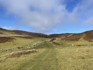 |
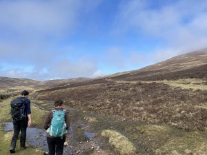
| Setting out from Ballymakellett. Lovely and sunny when we started out – I had high hopes it would clear completely as we got higher up | Heading up the Doolargy valley – the notch on the horizon is the short term destination |
 |
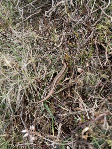 |
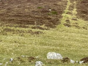
| Ridge and furrow cultivation in the lower part of the valley. Probably potatoes, most likely abandoned in the famine | A surprising visitor – a lively lizard high up on the fell. Even though the temperature was low, this cold-blooded reptile moved pretty smartly as we approached. I think this must be a particularly cold-tolerant species as I saw an identical specimen high up in the Lake District in April 2019 |
 |
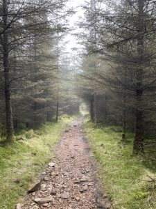 |
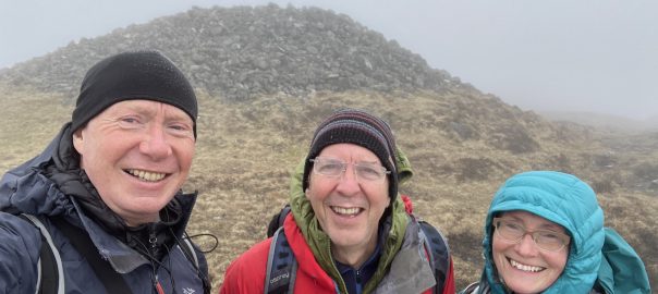
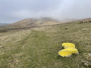
| Up at the start of the poc fada course heading towards the faux dolmens. By this stage, the mist was coming down and it just got worse during the course of the hike | Skipping straight to the forestry descent from Carnavaddy with no intervening pictures because there was nothing – literally – to see once we got into the summit mist. Except the cairn at the top of Carnavaddy where we posed for the picture in the banner image at the top of the blog |
 |
|
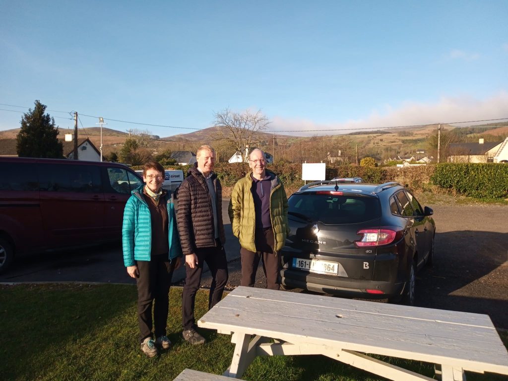
| Back at the Lumpers again. And before you ask, no – that isn’t our car in the background. Taken by a slightly inebriated customer of the pub, so it’s surprisingly level! (Photo: Bev) |
|
Interactive map
(Elevations corrected at GPS Visualizer: Assign DEM elevation data to coordinates )
Max elevation: 471 m
Min elevation: 58 m
Total climbing: 677 m
Total descent: -678 m
Total time: 05:03:57
You can read earlier and later days’ blogs below
Previous day’s blog
Next day’s blog
Ireland home page
 Save as PDF