Ireland day 0162. Wednesday 09 March 2022- Carnavaddy
| Today’s summary | Drove up to Ballymakellett, Lumpers pub, then same circular walk in Cooleys as a couple of weeks ago, with Carnavaddy summit added in. A recce for possible DWC walk in May. Very wet but very enjoyable | ||||
| Today’s weather | Heavy cloud and rained all day. Strong to gale force wind, mostly northerly or north westerly. About 6C | ||||
 |
 |
||||
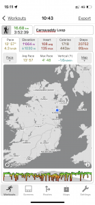
| Today’s overview location (The blue mark shows the location of my route) |
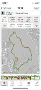
Close-up location (The green line shows where I walked) (Click button below to download GPX of today’s walk as recorded, or see interactive map at bottom with elevations corrected): Carnavaddy loop |
||||
Commentary
At about half past ten this morning, I began seriously to doubt my sanity. I was sitting in the car in the car park of the Lumpers pub in Ballymakellett, being gently shaken as the wind battered the car and the rain lashed down. I had the windscreen wipers going (well – the windscreen wiper, actually, as the Yaris really only does have one) peering disconsolately out in to the grim weather and wondering if perhaps I had chosen the wrong day to do a potentially quite difficult walk across some of the more remote Cooley summits.
Now, if “Lumpers” and “Ballymakellett” sound familiar, that’s because they are. We were here only ten days ago for a walk with the Boyne Valley group and I had enjoyed it so much that I had rashly volunteered to lead a repeat visit round a similar route for the Dublin Walking Club in May. I say “similar” because I decided to add in an extra bit, to reach the highest point of this part of the Cooley peninsula, at Carnavaddy, as well as returning a different way to the car park, via the Slí na Tána (Tain Way). But before I finally committed to anything, I thought I had better recce it and, while Val was away skiing and I didn’t have any other commitments, I decided today would be an ideal choice.
Unfortunately, it wasn’t. The weather was appalling. Not the worst I’ve ever known, but not great and I did for a moment wonder if I should call it a day, stay dry, and return to Malahide without stepping out of the car. But I’m not one for giving up, and I enjoy a challenge, and as it turned out I’m glad that I decided to stay and give it a go.
One of the first things you learn as a hillwalker is that once you are out in the weather, it’s often the case that it is actually not quite as bad as it seems to be when you are peering out at it through the car windscreen. One of the second things you learn – though this is based solely on personal experience and has no basis in science or fact – is that as you climb the hills, the wind gets stronger and stronger but for some reason, once you get to the very top, it often declines a bit. I have no idea why, but it does mean that quite often you don’t get as battered and soaked as you expect.
Both of these observations turned out to be true today. The climb up, following the same route as on the 27th Feb, was a steady slog and the mist didn’t come as far down the hillside as I had expected. So I did have some views pretty much as far as the poc fada route on the slopes of Anaverna, and beyond. I quite enjoyed being in my water- and wind-proof bubble of Goretex as a I plodded along steadily upwards (though I have previously offered some view on my own personal experiences with Goretex over the last 40 years and won’t repeat them here). And although I very much enjoy the chat and banter you get when walking in a group, I sometimes find it a bit exhausting so I enjoyed the solitude today and, for once, not having to talk to anyone at all.
The walk as far as the point where February’s route dropped back down to the start was straightforward – though I rapidly found that if I stopped for more than a few moments, I got very cold. Because it was too unpleasant to go through the faff of stripping off the waterproofs, putting extra layers on, then replacing the cold wet outer shell every time I wanted to have a break, I decided not to stop at all. So my sandwiches and hot coffee made it all the way back to the car untouched.
The route carried on straightforwardly enough, right to the top of Carnavaddy. There’s a big stone cairn up there and I suppose expansive views to the left over Carlingford and to Dundalk on the right, but today all was enveloped in mist. But the next kilometer or so to the trailhead above Corrakit was quite tough going. Some maps show a path heading roughly south across the summit plateau but I think I missed it as from examining the GPS trace afterwards, it looks like I was consistently a bit too far to the north. So I found it hard going. As its relatively flat, it was boggy and after today’s rain, exceptionally wet.
Anyway, fortunately the tough section was relatively short and I soon met the better track again. From there it was plain sailing, as it soon joins the Tain Way, which is a well maintained long(ish) distance walking route (there’s more about it in the photos below). The path becomes a stony track which is easy walking, then runs into some forestry and rapidly drops down into the valley. I’m not normally a fan of forest walking, as the trees stop you seeing anything, but today actually I quite appreciated the shelter they afforded from the wind. And actually the planting was quite sparse so there were good views through the clearings as the path descended and the mist cleared.
I was back at the car sooner than I had expected. I had roughly guessed the route would be about 20km but it was less than 17, so the five hours I had allowed to complete it was a big over-estimate and it actually took a full hour less. So – was I glad I felt the fear and did it anyway? Yes, of course. I actually loved pretty much ever step of the way, and wouldn’t have missed it for the world. I think it will make a good walk for the Dublin group – though I will spend a bit longer next time, trying to find the right route over the Carnavaddy summit quagmire. Hopefully the weather will be a bit better – after all, it can hardly be much worse!
Today’s photos (click to enlarge)
 |
 |
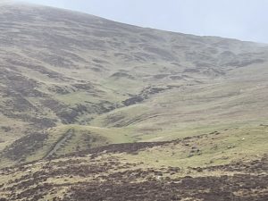
| After leaving Ballymakellet you get to the top of Carravane then drop down a bit to cross the stream coming down from the hillside at the right, before climbing again to the faux dolmen at Anaverna. Towards the top of the stream I think you can see the distinctive “eggs in a basket” topography which suggests they are drumlins, an echo of the relatively recent glacial past | The summit cairn of Carnavaddy (appx 470m) is in the background but in the foreground is the high point of the roughly-square poc fada route, where it makes a right angle turn here to the west and heads back down the hill again. My “path”, such as it was, left the poc fada and carried on more or less in a southerly direction |
 |
 |
| At the top of Carnavaddy you leave the relatively clear path alongside the poc fada route and head for about a km across this confusing boggy plateau till you reach the good path again above Corrakit. There is supposed to be some sort of a track across it, but I couldn’t find it so it was hard going and very wet | The path improves again where it meets the Slí na Tána (The Tain Way) long distance path. It looks like it might be a good walk to do over a couple of days sometime. Its about 40km long (so you could actually do it in a day if you didn’t want to linger) and is a circular route spanning both sides of the Cooley peninsula, from Carlingford on the east to Ballymakellett on the western side. A worn-out old sign, depicting a worn-out old walker, perhaps, indicates the route |
 |
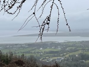 |
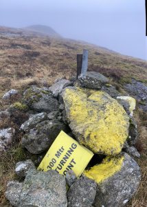
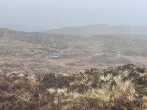
| Well, it’s good to know | Below the cloud line again, looking south over the Irish Sea towards Dundalk |
 |
|
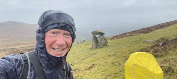
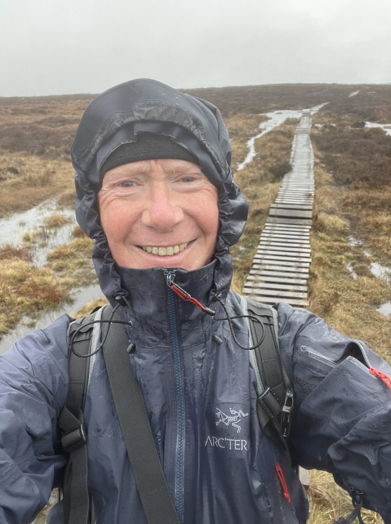
| Looking happy – and I was. It was great to be away from it all – just me and the rain. And even better because this bit of the Tain Way is board-walked so I wasn’t getting quite so wet | |
Interactive map
(Elevations corrected at GPS Visualizer: Assign DEM elevation data to coordinates )
Max elevation: 470 m
Min elevation: 58 m
Total climbing: 693 m
Total descent: -693 m
Total time: 03:51:42
You can read earlier and later days’ blogs below
Previous day’s blog
Next day’s blog
Ireland home page
 Save as PDF