Ireland day 0424. Saturday 26 November 2022- SlieveBloom2
| Today’s summary | Val was working all day so I drove down to the Gandon Inn to meet up with Walking Club friends then on to a circular walk in the Slieve Bloom mountains. Overcast and wet as last year, but not too cold and very enjoyable. | ||||
| Today’s weather | Drizzly and heavily overcast virtually the whole way, with low cloud like a lid on all the hills. Strong to gale force southerly wind. Feeling much milder than recently at appx. 13C | ||||
 |
 |
||||
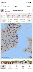
| Today’s overview location (The blue mark shows the location of our route) |
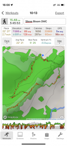
Close-up location (The green line shows where we walked) (Click button below to download GPX of today’s walk as recorded, or see interactive map at bottom with elevations corrected): Slieve Bloom from Glembarrow DWC |
||||
Commentary
(Summary blog only. Last full blog was Day 0368).
Drove down to the Gandon Inn near Emo to meet up with the rest of the Club members walking in the Slieve Bloom hills today. Consolidated our cars then two of us drove down to the Glenbarrow car park.
Completed a circular walk, mostly on the Slieve Bloom Way, and added a spur on to the Stoney Man cairn at the top of the Cappard Ridge. Like last year when we did this walk, it was heavily overcast and much of the higher level was in mist and drizzle (but no torrential rain, fortunately). Very windy but not unmanageable.
An enjoyable leg stretch, despite the lack of views, and great company as always. Val was doing a double shift (Museum + Castle) so was unfortunately unable to come today.
Today’s photos (click to enlarge)
 |
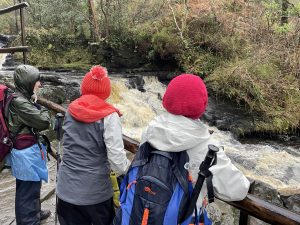 |
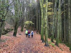
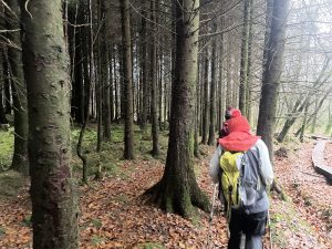
| Setting off into Glenbarrow. Apparently the Barrow is the second longest river in Ireland | Checking out the Clamp Hole waterfalls |
 |
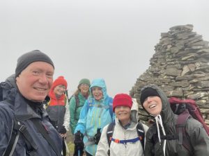 |
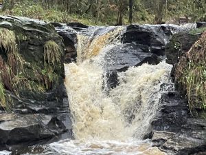
| The upper falls at Clamp Hole. Despite all the rain the river wasn’t as full as I thought it might be – it can be at least three times as wide, judging from the scouring of the banks. But it was a nice Guinness-ey colour though | On the top of the Cappard ridge, with the Stoney Man cairn in the background (it isn’t actually right on the top – that’s a largely inaccessible featureless hummock in the middle of a vast bog) |
 |
 |
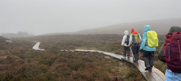
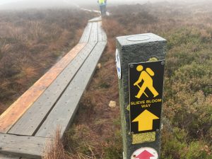
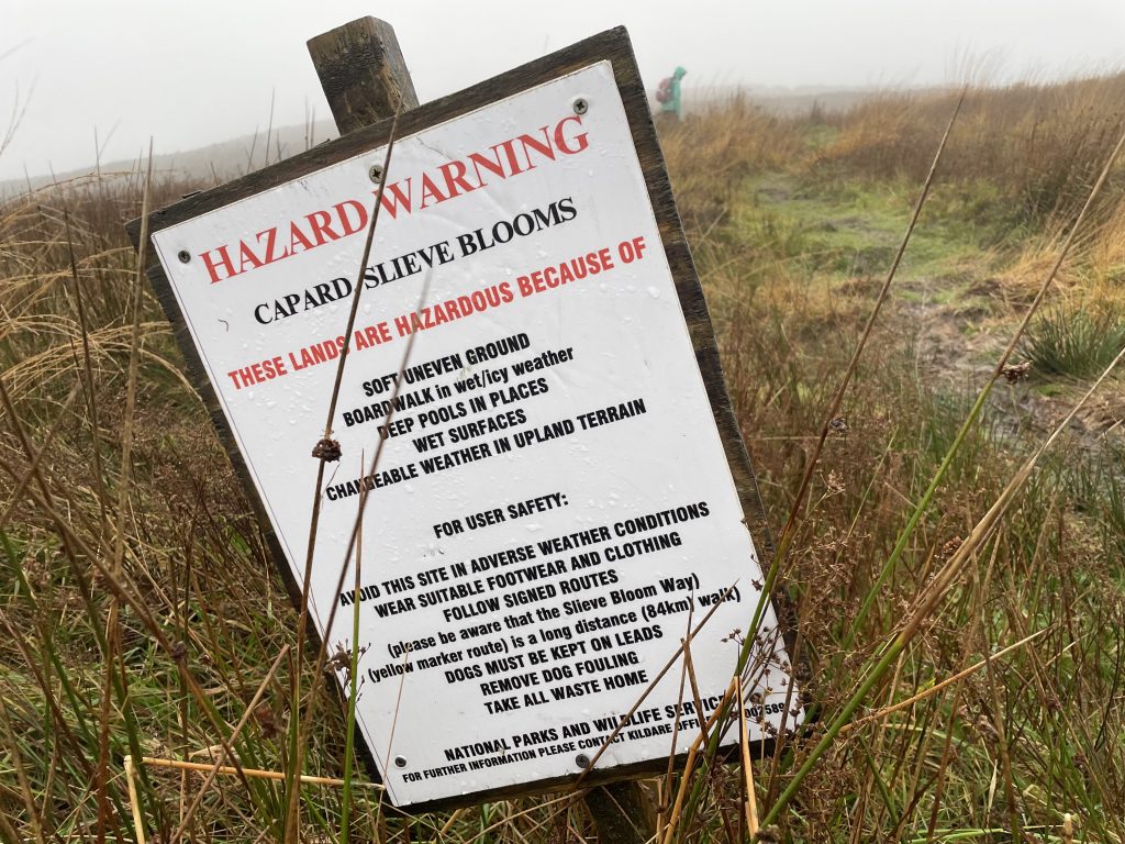
| The wooden boardwalks were great for keeping your feet dry but deadly slippery when wet (which I think is probably almost all the time) | Heading back down to the car park at the end |
 |
|
| I suspect these hazards apply to just about every upland area in Ireland (and the UK for that matter, too) | |
Interactive map
(Elevations corrected at GPS Visualizer: Assign DEM elevation data to coordinates )
Max elevation: 452 m
Min elevation: 186 m
Total climbing: 472 m
Total descent: -472 m
Total time: 05:45:44
You can read earlier and later days’ blogs below
Previous day’s blog
Next day’s blog
Ireland home page
 Save as PDF