Ireland day 0290. Friday 15 July 2022- Dalkey2
| Today’s summary | Returned with Val to do the loop walk up Dalkey and Killiney Hills, and back via Sorrento terrace. A lovely way to spend a warm summer afternoon after Val had been at work in the morning | ||||
| Today’s weather | Dry and bright all day. Some sunny intervals in the afternoon. Light westerly wind. Feeling warm at 21C | ||||
 |
 |
||||
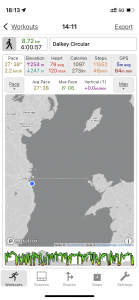
| Today’s overview location (The blue mark shows the location of our route) |
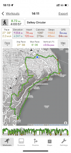
Close-up location (The green line shows where we walked) (Click button below to download GPX of today’s walk as recorded, or see interactive map at bottom with elevations corrected): Dalkey Killiney loop walk |
||||
Commentary
A few weeks ago, while Val was away on her travels, I took a walk around the Dalkey and Killiney hills, and then back along the coast to Dun Laoghaire. At the time, I had enjoyed it very much and thought that I should take Val to follow in my footsteps, once a suitable occasion arose.
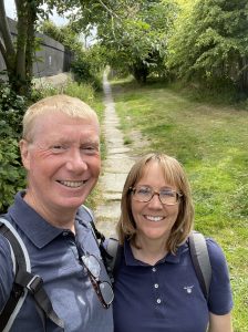
Today was that suitable occasion. The weather seems set fair for a bit and although Val is working a morning shift at the moment, that still gave us a whole afternoon of warm sunshine to look forward to. So once she was back from work and recovered over a cup of tea, we packed up the lunches I’d spent the morning making, and headed off on the first available DART down to Dalkey to start the walk.
I do like the area on the south side of Dublin Bay. It feels smart and it has a sense of depth to it that’s hard to put your finger on. It just seems like that some of the settlements – Killiney, Dalkey, Dun Laoghaire – have been there a long time and developed that attractive patina of comfortable robustness that only time can bring.
The trip didn’t disappoint. We set off up the “Metals” – you can see the explanation to this in the photo captions below – and into Dalkey quarry. It felt good to be walking in a rocky outcrop surrounded by sheer cliff faces. For a few moments you can make yourself believe you are in the Alps – except of course the surroundings here are completely man-made.
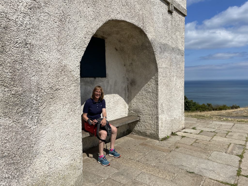
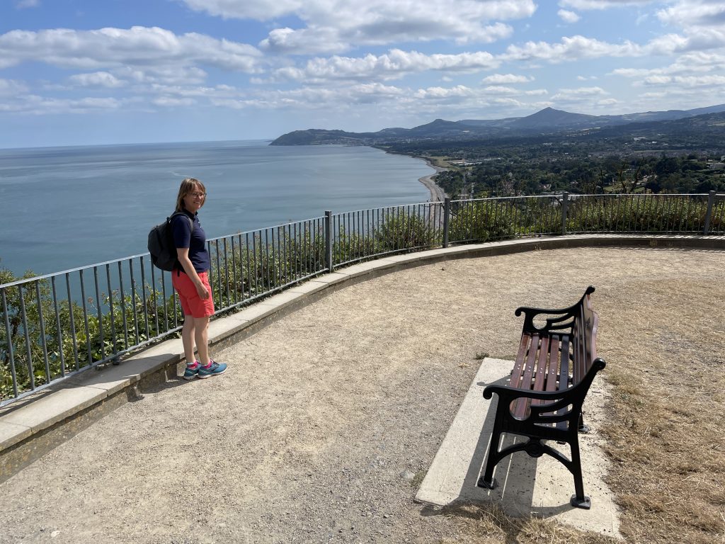
Once up at the top and by the old telegraph station, the views really opened out. I love the way that from up here you can see right over Dublin Bay to the north and then suddenly, as you come over the top of the hill, the views south over Killiney bay to Bray and beyond open up too. It was especially nice to be able to linger and enjoy it today, rather than having to seek shelter from a biting cold wind, as has usually been the case the last few times I’ve been up here.
We stayed up high and made our way from Dalkey to Killiney Hill – the taller of the two – and stopped at the Obelisk to have our lunch looking south over the Sugarloaves. I also noticed a conspicuous tower-like structure in the distant south, standing on a hilltop to the west of the M11 motorway. I eventually worked out that it was probably a chimney at the disused lead mines on Carrickgologan Hill – anyway it looked interesting and may warrant a visit at some point.
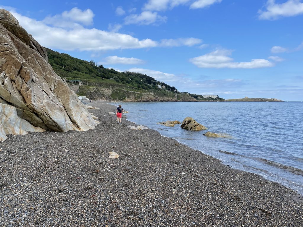
We lingered over lunch and enjoyed the sun, then dropped down into Killiney, and under the railway track onto the beach. I decided I ought at least check the water temperature, so dipped a toe into the chilly Irish Sea. To me it did feel absolutely freezing still (someone told us a couple of days ago, while visiting Ireland’s Eye, that it had reached a “very comfortable” 13C now – which didn’t strike me as comfortable at all). But judging by the number of families all enjoying splashing around in the water I thought probably it at least wasn’t lethally cold any more. I can feel that awful moment when I am going to have to go in edging ever-closer.
The tide was favourable today, as it had been when I had visited a few weeks ago, so we could walk all the way along the shoreline from Killiney station round to White Rock, and back up onto Vico Road. (Vico by the way is an allusion to the Bay of Naples, which Killiney Bay is said to resemble. It is a shortened version of the Italian word “Vicolo” which means “narrow path”, and it’s commonly used in street names around Naples).
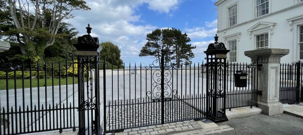
We stopped to have a look at the newly-restored “Eire” sign at Hawk Cliff and then moved on to the final part of our Neapolitan exploration – Sorrento Terrace, which sits on a prime spot near Dalkey Island, looking south over the bay. The end house – no. 1 Sorrento Terrace (which you can see in the featured image at the top of this blog) – is reputed to have been sold recently for a cool €10.5mln. Sounds like a lot for a terrace house to me, but there you go. At least it’s got a good view).
We dropped in to have a quick look at Dillon’s Park and then went to have a look at Colliemore Harbour – it’s a charming little harbour with a couple of boats and a ferry which shuttles over to Dalkey Island. Buoyed up by our successful trip to Ireland’s Eye, we decided that we should try and get back down here to take the ferry over to Dalkey Island one day soon. Like Ireland’s Eye, it has a Martello Tower and looked like an interesting place to spend a sunny afternoon exploring.
We cut the trip short at this point, as it was starting to get late and we were hungry, so turned inland back to Dalkey station to complete the circular walk and grab the next DART back to Malahide. We’re back at the flat now, finishing off the last of the gin (catastrophe!) and enjoying a belated dinner. It was a wonderful day out – a joy to be warm and dry all day – and in a beautiful part of ireland looking its very best right now. And thanks to the generosity of the DART pricing scheme, the whole journey there and back only cost us €4 each. Fantastic value for money!
Today’s photos (click to enlarge)
 |
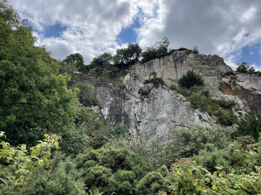 |
| Setting off up The Metals in Dalkey. If you have been paying attention to earlier editions of this blog you will know this is the site of the old railway track where wagons loaded with granite from Dalkey Quarry were lowered by the force of gravity down to sea level, from where the rock was taken to be used to build Dun Laoghaire harbour walls and the Bull Wall – and the cathedral in St Johns, Newfoundland, for some reason. (I have always found the latter surprising as I’d have thought there was plenty of suitable rock in Newfoundland to build a cathedral without having to transport it all the way across the Atlantic. Perhaps it was used as ballast in otherwise empty ships returning to North America to pick up cargoes?) By the way the down-going trucks pulled the empty trucks back up via a counterbalance pulley system. | Dalkey quarry – now disused and the site of some of Ireland’s best climbing pitches. Certainly looked suitably vertiginous to me. |
 |
 |
| Val enjoying a spot of lunch in the shelter of the Killiney Obelisk (which was built in 1742 by Lord Mapas as a famine relief project, after the devastatingly cold winter of 1740-41) | Overlooking Killiney Bay, with Bray Head and the Little and Great Sugarloaves on the horizon. If you google “View of the Bay of Naples” you will see the uncanny resemblance, with Vesuvius replacing the Great Sugarloaf. The only thing different is that the bay is on the right not the left. |
 |
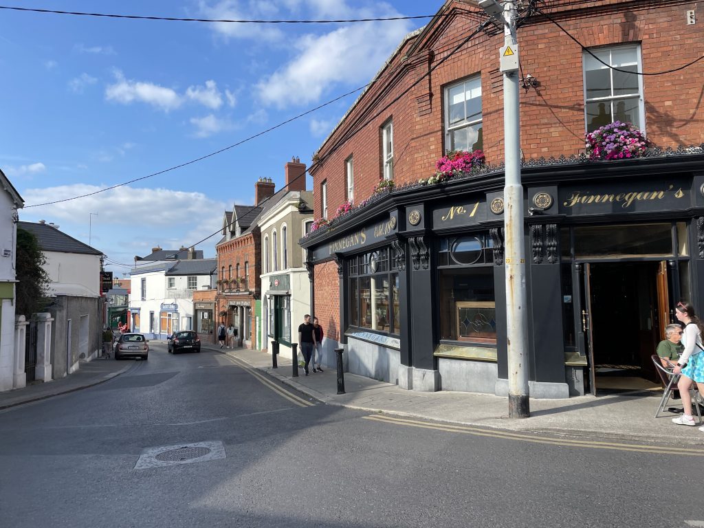 |
| Down on the shore, between Killiney DART station and the White Rock swimming area. When the tide is in, it covers the bottom of the rocks on the left, meaning you either have to climb over the top of the outcrop, or paddle, to get past. Fortunately we timed it right today and the tide had just fallen enough to let us get by. | Downtown Dalkey with Finnegan’s Bar in the foreground. It’s a nice, prosperous, village with a real buzz. It seems ideally suited for summer living. |
 |
|
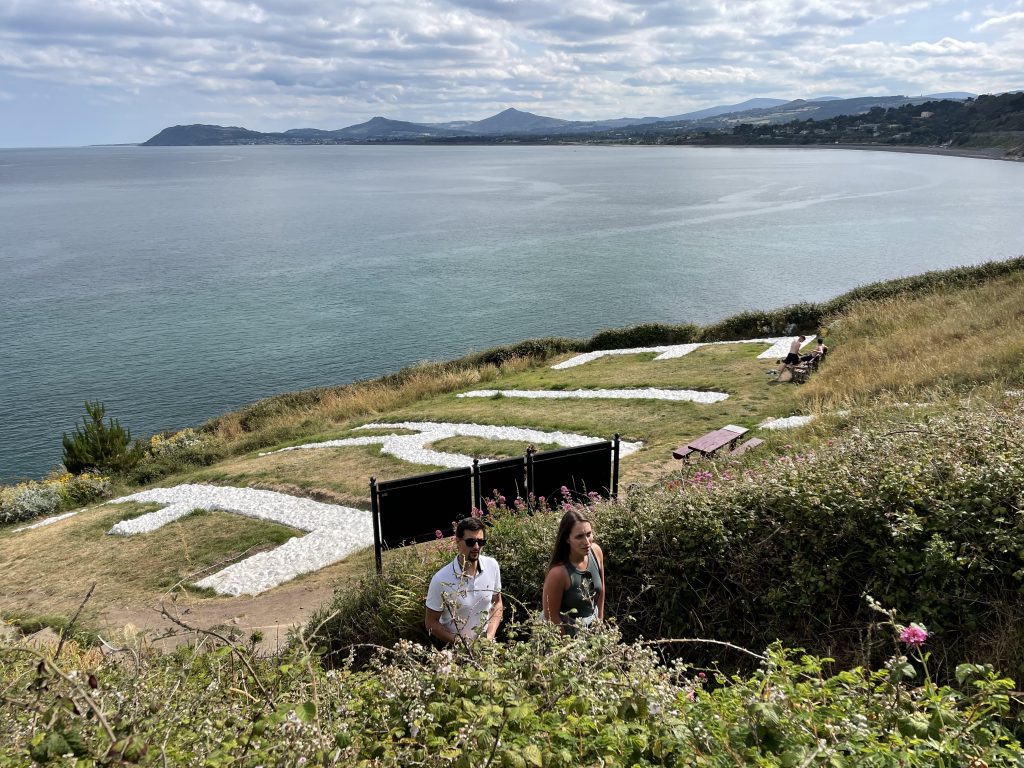
| The “Eire 7” sign off Vico Road at Hawk Cliff. It’s a relic from the Emergency (AKA Second World War) and is one sign of about 80 which were displayed at sites around Eire’s border to try and protect its neutrality from bombing raids. The sign had become all but invisible until it was restored by volunteers in 2019. Eire 6 is on Howth and Eire 8 is on Bray Head – though the latter is overgrown and slowly disappearing | |
Interactive map
(Elevations corrected at GPS Visualizer: Assign DEM elevation data to coordinates )
Max elevation: 148 m
Min elevation: 0 m
Total climbing: 437 m
Total descent: -439 m
Total time: 04:00:07
You can read earlier and later days’ blogs below
Previous day’s blog
Next day’s blog
Ireland home page
 Save as PDF