Ireland day 0270. Saturday 25 June 2022- Croaghanmoira
| Today’s summary | A lovely walk with DWC from Glenmalure exploring a new part of the Wicklow mountains. Cool and very windy with heavy rain showers but some sunny periods. Fabulous views | ||||
| Today’s weather | Bright and breezy with heavy downpours. Gale force southerly wind. About 12C | ||||
 |
 |
||||
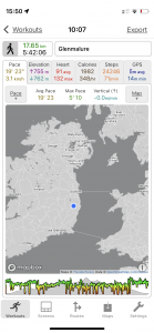
| Today’s overview location (The blue mark shows the location of our route) |
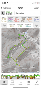
Close-up location (The green line shows where we walked) (Click button below to download GPX of today’s walk as recorded, or see interactive map at bottom with elevations corrected): Croaghanmoira |
||||
Commentary
According to the weather forecast, today was to be “unseasonably cold”. Which came as something of a relief as I’d hate to think that 12C, gale force wind, and torrential sleety rain was as good as it ever gets in this part of the world at the end of June. But I wasn’t deterred by the gloomy outlook so a friend and I car-shared down to Glenmalure to see what we could make of the day.
On the agenda was another outing with the Dublin Walking Club, this time tackling a hill and a ridge in the southern part of the Wicklow hills. The summit was Croaghanmoira and the ridge was Fananierin. They are straight in front of you, and slightly to the left, if you stand in front of the Glenmalure Lodge and look west.
We arrived a bit early so there was time for a cup of tea and one of those famous Irish scones, before we set off. That was very welcome, as it had taken me until going up to 1 am this morning to retrieve the car from where I had abandoned it because of the concert road closures last night. And then I was up again at 7 to prepare my sandwiches and get ready for today. So I was feeling a bit bleary eyed and not completely tip-top this morning when we pitched up at Glenmalure. I was glad that I wasn’t driving on this occasion.
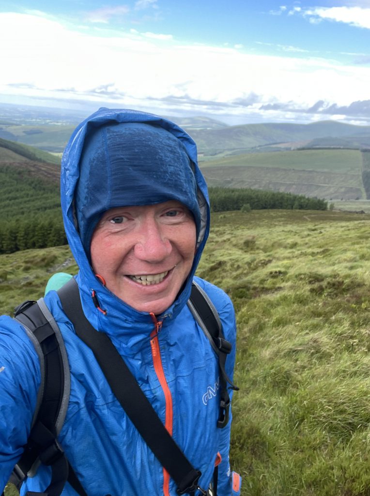
It was dry and reasonably warm when we set out along the Wicklow Way, heading up into the forestry which cloaks the eastern slopes of the Aghavannah pass. But shortly after we crossed over the military road at the top of the pass, there was a sudden and dramatic shift in the weather. Black clouds piled up, and the wind sharpened, so we paused for a quick bite to eat and to get our waterproofs on. And only just in time, because the heavens opened and we were caught in a heavy deluge, which lasted for most of the rest of our climb up Croaghanmoira.
Then, just as we were reaching the summit, the rain stopped as suddenly as it had started, the sun came out and a truly remarkable 360 degree panorama opened up. There was a bit of residual haze which meant that we couldn’t quite see as far as Wales, but the coast, vast swathes of Counties Carlow and Kildare, and the Lugnaquilla massif itself, were all laid out before us like a map, bright green and freshly washed by the rain.
We would have liked to have paused for longer on the top, but the wind hadn’t dropped and was so strong that as well as feeling very cold, it was practically blowing us off our feet. So we beat a hasty retreat towards the road but halfway down, veered off to the east to head over the Fananierin Ridge. It’s not a craggy ridge like Crib Gogh or Striding Edge, rather it’s a wide heathery whaleback of a mountain arm, heading down towards the Glenmalure valley. But is was wonderfully quiet today – apart from the wind – and from the end you’re on a lofty lookout with excellent views right back to the Lodge where our cars were parked.
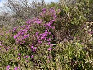
I was quite surprised to see abundant, ripe, bilberries (fraughans in Irish) lining the path – normally I wouldn’t expect to find them for another month or two. Bilberry crumble is one of my favourite desserts so perhaps one day we will come back up here with our tupperware boxes, and infinite patience, and do a bit of harvesting.
From the ridge, it was only 30 minutes back down to the car park – a nice easy descent to round off the day. I’d really enjoyed the walking and was particularly surprised how few people there were out and about today. In fact even though it’s presumably quite a popular hiking area, and it was a weekend, I think we only saw two others out on the hill. I did wonder what everyone else knew that we didn’t – or maybe it was just the depressing weather forecast that had put people off.
So now I’m back in the flat, contemplating ham salad for dinner, and enjoying the dulcet tones of Lewis Capaldi drifting over from the castle demesne. At least this time the car is safely in the garage, so no more midnight excursions will be needed to rescue it from its lonely resting spot.
Today’s photos (click to enlarge)
 |
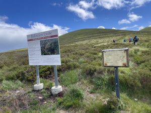 |
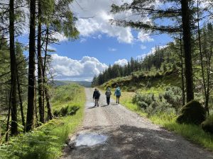
| The first part of the route follows the Wicklow Way out of Glenmalure. If Val and I had continued onto the next section of the Way when we did our walk back in May, for a fifth day of walking, this is where we would have been going. | But once you reach the Military Road below Slieve Man, today’s route left the WW and headed south east up Croaghanmoira. The access to the summit path is through a wire fence with a big “Private Property” sign on it, followed by signs about public liability. It’s at times like this that I appreciate being in a club with other members who know where it is “accepted” that walkers can go, and which spots are strictly off-limits. Croaghanmoira is apparently “OK” |
 |
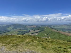 |
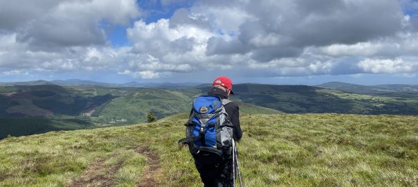
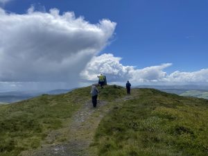
| Approaching the top after getting a soaking on the way up. The contrast between the white clouds, blue sky and green fields was stunning | Looking South West from the summit, into Co Carlow. it’s not a massive hill – “just” 664m / 2178ft but it was a rewarding climb and the views were stunning today |
 |
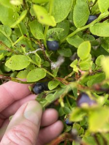 |
| Heathers just coming into flower. I reckon they will be pretty impressive in a couple of weeks or so | Bilberries (called fraughan in Irish) were abundant on the Fananierin Ridge – quite unusual to see them ripe in June – I’m more used to them ripening in August |
 |
|
| Looking a bit battered on the way up. We were hit with an icy deluge driven through by a storm force wind. I’m pretty sure there was even a bit of sleet in it. It wouldn’t have been out of place on a poor day in February. But I had to keep reminding myself that this was actually midsummer | |
Interactive map
(Elevations corrected at GPS Visualizer: Assign DEM elevation data to coordinates )
Max elevation: 653 m
Min elevation: 125 m
Total climbing: 905 m
Total descent: -905 m
Total time: 05:42:07
You can read earlier and later days’ blogs below
Previous day’s blog
Next day’s blog
Ireland home page
 Save as PDF