Ireland day 0237. Monday 23 May 2022- Glenmalure
| Today’s summary | Final day of our four day reprise of the first half of the Wicklow Way. Walked from Glendalough (starting from overnight in Laragh) over the hills to Glendalough. Superb views all the way until the very end when we got soaked in a downpour | ||||
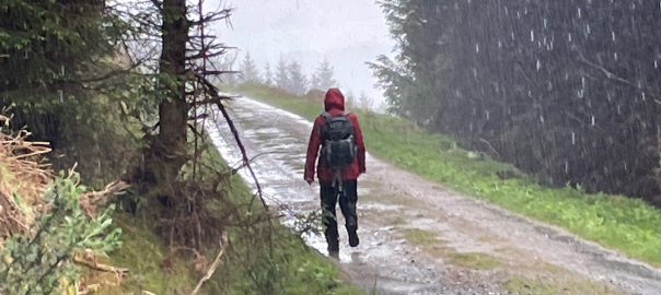
| Today’s weather | Bright and sunny most of the day, with billowing white clouds in a vivid blue sky. Mostly dry until we were hit with a torrential downpour an hour from the end. Light westerly wind. About 13C | ||||
 |
 |
||||
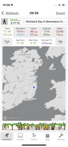
| Today’s overview location (The blue mark shows the location of our route) |
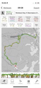
Close-up location (The green line shows where we walked) (Click button below to download GPX of today’s walk as recorded, or see interactive map at bottom with elevations corrected): Wicklow reprised Glendalough to Glenmalure |
||||
Commentary
When you have to meet a taxi at a fixed time at the end of your day, it certainly galvanises you into action and gives your morning routine a bit of a turbocharge. Probably a good thing for Val and I, as otherwise when we are on holiday we are inclined to take our time over breakfast and sometimes don’t make it out into the world until late morning. But today we knew we had to be over in Glenmalure this afternoon by 4pm at the latest, as we had arranged for a taxi to meet us there and bring us back to Malahide. I had a feeling that the driver wouldn’t hang around if we weren’t there, which would cause no end of hassle in finding an alternative way of getting back from this remote spot.
So we packed up quickly and had breakfast, and were away from our B&B in Laragh shortly after 9 am. In fact, as I discovered a bit later in the day, we were a bit too hasty in our packing, as it turned out I had left my trusty Thermos back in the b&b when we left. Luckily we had picked up a couple of cans of Coke with our packed lunches, so we didn’t go thirsty. But it was a bit annoying, anyway. Although it, it has to be said, it was a bit clapped out and I know Tesco sell replacements for €9 so overall, and especially as it was our last day, it was a nuisance not a disaster.
Apart from this minor mishap, it was another superb day today. The weather was lovely when we set off. The sun was out and after yesterday evening’s rain, everywhere was looking fresh and almost unimaginably green. We found a quiet and little-used path back up the valley from our accommodation in Laragh to the official start of our day on the Wicklow Way in Glendalough. It was especially nice as there was nobody on it apart from us.
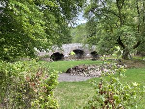
We paused in Glendalough to have a good look at the Upper Lough – which was beautiful and, being early on a weekday morning, blissfully free of tourists. From there, the Way takes a sharp turn out of the valley and up the banks of the Poulanass waterfall. As you climb up through the woods, native broadleaves give way to serried rows of pine, but in the gaps through the forestry, the views today were spectacular. Not a hint of haze, so we could see right up the Glendalough valley to the lead mines and over to the pumped-storage reservoir on Turlough Hill. As we got to the top of the Mullacor ridge, the views to the south opened up too, with Lugnaquilla and the zig-zag access path on clear display.
Unfortunately , the clear skies also gave us an excellent view of the storm clouds which were brewing over to the west. But being eternal optimists, we thought they would take a long time to reach us, and may not even get to us at all. So we found a sunny spot at the summit of the col and had a leisurely lunch before sauntering off down into the Glenmalure valley. Unfortunately, our optimism was unfounded as the clouds, propelled by a strengthening wind, arrived with us a bit ahead of schedule and for the last hour of our walk down the valley and to the shelter of the Glenmalure Lodge, we got soaked in what was actually the worst deluge of the whole four days’ walking.
Anyway, a bit like the loss of the Thermos, the severity of the calamity was significantly reduced because it was our last day. So we retreated into the Lodge bar, got a quick drink, and dried out while we waited for the car back to Malahide.
So now we are here back in Malahide. I must admit we are basking in a warm glow that its a combination of smug satisfaction and wind abrasion. It was a four day great walk – we really enjoyed it, and it made up for the Covid disappointment of March. We were only sorry that Bev and Pete couldn’t have been with us to enjoy it. So now it’s back to the more mundane world of work (for Val) and chores (for me). But we will start planning our next expedition before the memories of the last fade too quickly – though as a bit of a spoiler I wouldn’t be too surprised if we tried to fit in a quick break sometime soon-ish at the Loughdan B&B – simply because it was so excellent. I’m getting excited already!
Today’s photos (click to enlarge)
 |
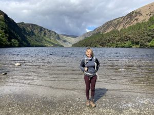 |
| Setting out from Laragh this morning for the short walk up the valley to the start “proper” in Glendalough. Did a bit of pre-planning and discovered a little used track through the woods which avoided the busy and unpleasant road-walk we’d taken in the opposite direction last night | Val doing her Ursula Andress thing on the shore of the Upper Lough. It’s a beautiful spot but you have to get there early to avoid the tourists |
 |
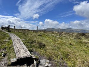 |
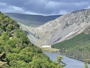
| Looking up to the head of the Glendalough valley, with the upper lough in the foreground. You can just about make out the scars of the galena (lead sulphide) mining operation which was active here from 1825 to 1957 | On the summit col (about 538m / 1765ft) between Mullacor (off picture to the left) and Lugduff (off picture to the right). We just went straight over the col, out of the Glendalough valley and dropping immediately down into the Glenmalure valley on the other side. Though we did stop for lunch in a sheltered spot right next to the col |
 |
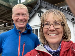 |
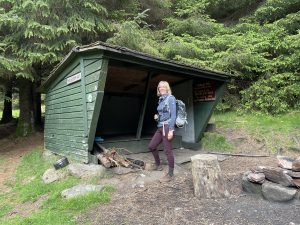
| Val checking out the Mountain Meitheal hut on the way down below Mullacor. It’s a carbon copy of the one at Brusher Gap. The design is apparently called an “Adirondack hut”, which belies its geographical origins | At the end – outside the Glenmalure Hotel. Just time for a quick drink before the taxi came to take us back to Malahide and the “real” world |
 |
|
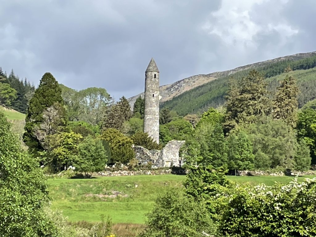
| The “iconic” round tower at Glendalough first thing this morning. It was looking spectacular but I think I need a better telephoto lens to reduce the pixellation | |
Interactive map
(Elevations corrected at GPS Visualizer: Assign DEM elevation data to coordinates )
Max elevation: 568 m
Min elevation: 125 m
Total climbing: 814 m
Total descent: -815 m
Total time: 05:17:09
You can read earlier and later days’ blogs below
Previous day’s blog
Next day’s blog
Ireland home page
 Save as PDF