Ireland day 0157. Friday 04 March 2022- Howth2
| Today’s summary | Took the car down to Sutton and walked round the Howth headland clockwise, taking in the very summit at the Ben of Howth. A stunning day | ||||
| Today’s weather | Clear blue skies and sunshine pretty much all day. Very little wind though a light breeze on the top. About 8C | ||||
 |
 |
||||
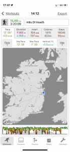
| Today’s overview location (The blue mark shows the location of our route) |
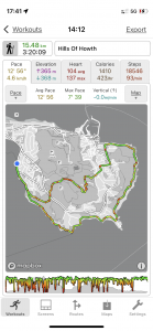
Close-up location (The green line shows where we walked) (Click button below to download GPX of today’s walk as recorded, or see interactive map at bottom with elevations corrected): Hills of Howth walk |
||||
Commentary
What a difference a few days can make! When Val and I visited Howth last Saturday, the wind was so strong it was blowing sea spray hundreds of meters inland, and we could barely stand. Yet today was one of those near-perfect days that hikers worldwide dream about when they are hunkered up in their tents, listening to the rain lashing down outside.
In fact it was as near perfect as it could be in March. Bright sun, clear air, and almost no wind. Certainly no rain! As I slowly came to life this morning and enjoyed my first cup of tea, I opened the blinds and peered out and could tell that this was a day that was too good to miss. Stung by our defeat in the face of the stormy onslaught a week ago, I thought I would pay a return visit today, to try and put right the injustice. So with the new wheels(!) Howth was only a 20 minute drive away and I was there easily by lunchtime.
We have done circular walks right round the Howth headland a couple of times before but never actually managed to find a way up to the very highest point – the Ben of Howth. Actually, with a bit of careful map reading it wasn’t too difficult, although the route I chose did involve a bit of scrambling to get over some of the steeper rocky sections. But that was actually enjoyable in itself, and made a welcome change from the flatness of beach-walking.
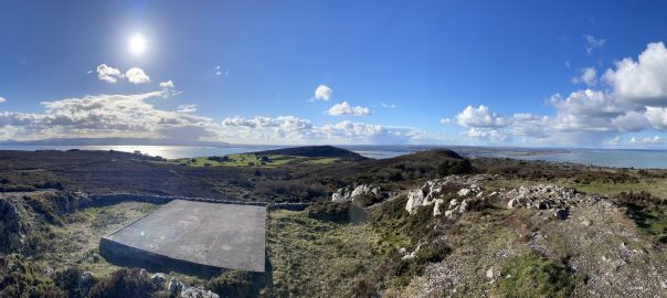
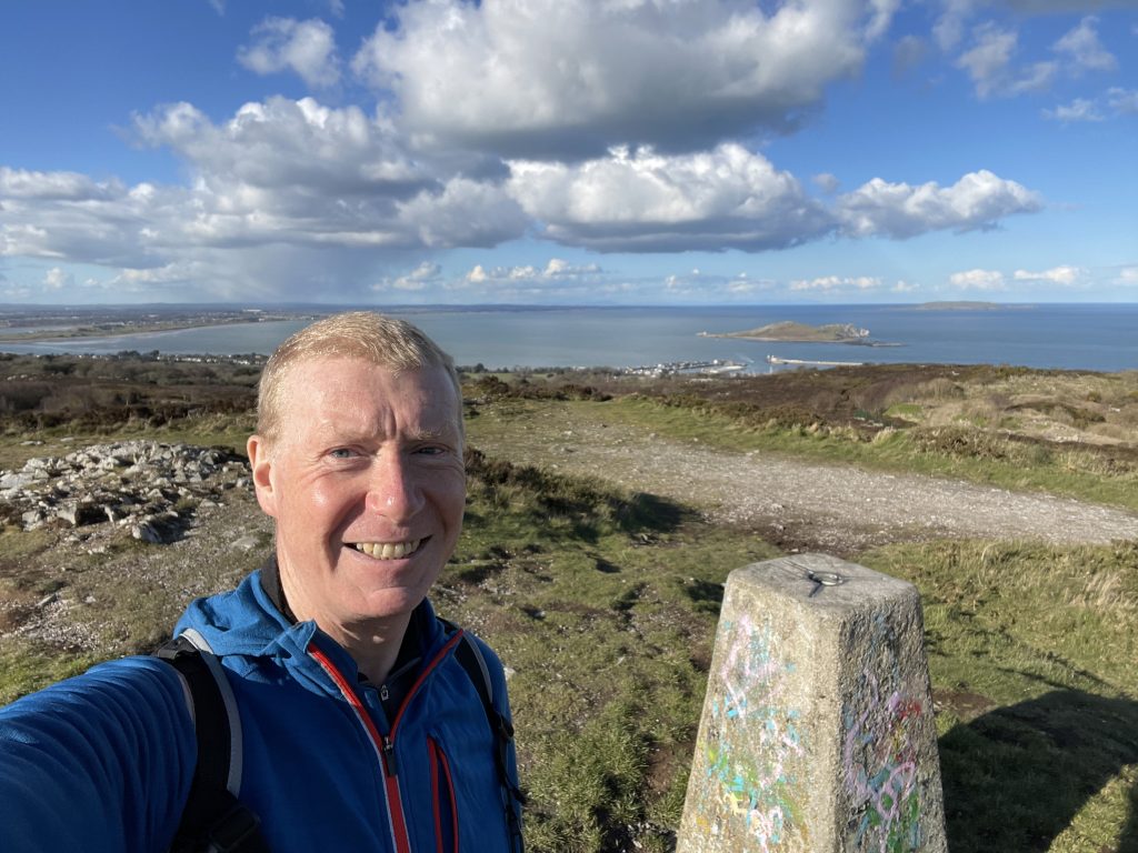
At the very top there’s a trig point and a radio antenna, but most of all there are spectacular views in all directions. You can see the trig point in the photos below, and a panorama from the top is in the banner image at the header of this blog. Best of all, because it’s a little off the beaten path, there was nobody else there apart from me. And on a glorious day like today, too,
From the top I dropped down towards Howth village itself, then regained the circular path and followed the clifftop route right round the eastern perimeter of the headland. I spotted a large grey seal blobbing around on the rocks, but as soon as I tried to take his picture, he slithered into the sea and disappeared. The one thing I was slightly surprised not to see was Wales (note – without an “h”). Holyhead Mountain, on Anglesey, is not much further away than the Mournes, but the eastern horizon remained stubbornly razor-sharp and flat. Not a pimple of land was to be seen at all despite the clarity of the air. Maybe I just wasn’t high enough up and the curvature of the earth got in the way.
I didn’t rush round the path, because the views were so exceptional and the route so uncrowded that I wanted to take it all in. But I didn’t stop either, so was back at the car in reasonable time and had a belated packed lunch (taking care not to drop any crumbs of course) in the relative comfort of the drivers seat.
The next job now that I’m back is to prepare something to eat (cold roast lamb, sweetcorn, cabbage and sweet potato, I think, followed by Christmas pudding and custard). Then I need to pull together a packed lunch for tomorrow. I’m joining the Dublin Walking Club for a hike in the Wicklow hills and as the weather forecast is looking good, I’m very much looking forward to it! Check back in this time tomorrow to see how it all went.
Today’s photos (click to enlarge)
 |
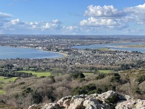 |
| Setting out from the car park near Sutton, looking due south. The Martello Tower that Val and I visited last week is just out of shot, to the left | The view from part way up the ascent of Howth head, looking north west. You can clearly see the “tombolo” (or spit of land) that connects Howth to the mainland – and on which Sutton is built. At the right hand edge of the photo is the southern end of the Portmarnock peninsula. |
 |
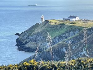 |
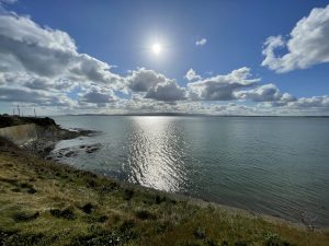
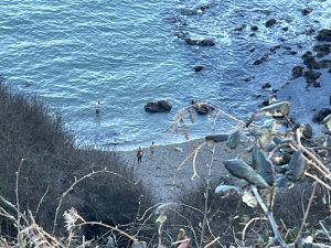
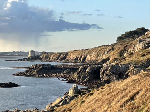
| Google maps marks this place – just below the lighthouse – as “A tiny hidden beach”. Well, perhaps not for much longer. | The Baily lighthouse. The light on this headland was built in 1814 after its predecessor – higher on the hill – was obscured by fog too frequently. It was the last lighthouse in Ireland to go fully automatic – the keeper only left in 1997. |
 |
 |
| On the path back to the car near Sutton, just catching the evening light. The sun didn’t set behind the Wicklow hills until gone 6pm. hurrah! | Here’s the Martello tower again, which is about as far as we got – coming the other way – on the stormy day last Saturday |
 |
|
| On the summit of the Ben of Howth, at about 163m. The views in all directions were nothing short of stunning. Behind me, over the trig point, you can see Ireland’s Eye and Lambay Island. Behind that, on the horizon, the Mournes were just about visible – though hard to pick out in this picture | |
Interactive map
(Elevations corrected at GPS Visualizer: Assign DEM elevation data to coordinates )
Max elevation: 163 m
Min elevation: 0 m
Total climbing: 710 m
Total descent: -710 m
Total time: 03:19:59
You can read earlier and later days’ blogs below
Previous day’s blog
Next day’s blog
Ireland home page
 Save as PDF