Ireland day 0124. Sunday 30 January 2022- Bohernabreena
| Today’s summary | Train to Connolly then long Red line LUAS trip to Tallaght. Loop walk round the two Glenasmole reservoirs with the Dublin Walking Club. Very sociable and wonderfully chaotic. Reversed the journey to come home | ||||
| Today’s weather | Quite windy. Bright with some sun to start but then showers in afternoon and heavy rain once we were back on the train. About 9C | ||||
 |
 |
||||
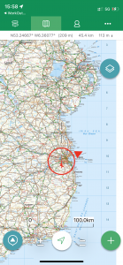
| Today’s overview location (the red cross in a circle shows where Val and I are at the moment) |
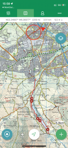
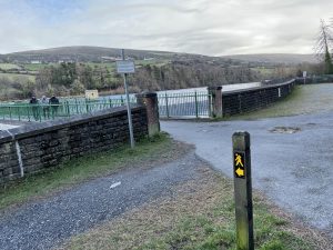
Close-up location (Click button below to download GPX of today’s walk as recorded, or see interactive map at bottom with elevations corrected): Bohernabreena DWC |
||||
Commentary
It’s always nice to go somewhere new, especially when you are with a group of people who know a bit more about the area than you do. Today was just such a day, as Val and I headed off into a completely new quarter of the Dublin hinterlands, to explore the Glenasmole Valley with the Dublin Walking Club.
I must admit though, I did know a little bit about the valley from reading Michael Fewer’s Irish coast to coast book last year, and remember trying to decipher from his complicated narrative, exactly how he crossed this particular valley. But what I hadn’t appreciated actually was how close it is to the city, and how relatively easy it is to get to by public transport.
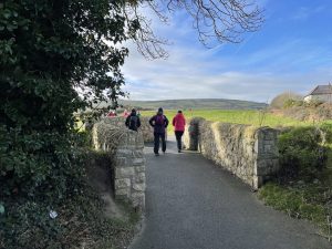
Most of us thought the starting point was the terminus of the LUAS tram at Tallaght (it’s at the end of the red line, and about 40 minutes from Connolly). So the group duly pitched up there at the allocated time of 11 am and and discovered that the walk leader had laid on car transport from the tram to a more remote carpark deep in the heart of the Kiltipper housing estate. Actually it’s only a 5 minute drive, but I guess it saved us half an hour’s walking. There was at this point quite a lot of confusion about who was going where and how, so in a manner akin to herding cats, it took the best part of an hour to get the assembled team the couple of kilometres to the actual start point in the car park of a care home just down the road.
Anyway, by that miraculous process that only really happens in Ireland, order emerged out of the disarray and as if by magic everyone suddenly was there, at the real start, and so we set off just an hour late. But the confusion was actually quite fun – nobody seemed stressed by it, and we all had a good laugh. That’s Ireland – nobody takes anything too seriously.
The walk itself was a short loop round the two Bohernabreena reservoirs in the Glenasmole valley. They were constructed between 1883 and 1887 and are interesting because the two lakes between them serve three different purposes. The first, which they jointly serve, is to control flooding in the Dodder river, which has its head-waters in the valley. The Dodder is (or was) a “flashy” river, believe it or not, rising and falling in level quickly as a result of the rapid runoff from the surrounding Dublin Mountains after heavy rain. There had been several drownings in flash floods, and by modulating the flow, the reservoirs prevented them.
But the other reasons are perhaps not quite so obvious and have their origins in the nature of the water itself in the valley. It was discovered that water running off the lower slopes was clearer – and more suitable for drinking – than the water from the upper slopes, which was peaty. So a clever catchment system was devised to collect the lower slope water in the upper reservoir and upper slope water in the lower reservoir (I admit this is a bit counterintuitive to me – I would have expected it to be the other way round). The peaty water from the upper reaches of the Dodder River bypasses the upper reservoir, and flows down to the lower reservoir via a complicated series of channels and stone-lined goyts. At the point where we had lunch, we were right by the bypass channel and you could see immediately how brown it was.
So the second two reasons were to provide clear drinking water to Dublin from the upper dam, and to use the less visually appealing (but probably equally potable) water from the lower dam to power the various mills in the Dodder Valley. As it happened, today both the reservoirs were pretty low, reflecting the dry weather we have had over the last few months and confirming what the waterworks man at Vartry reservoir had said when we walked there just before Christmas.
The walk itself was extremely interesting – and the chatting along the way made the whole outing into a very enjoyable experience (though I must say I find the chatting quite hard work and a glass of nice wine when we get back feels especially well deserved). I was definitely struck by how quickly you move from being in a busy but fairly nondescript suburb of Dublin into relatively remote mountain countryside, seemingly just by crossing a road. And for much of the route, we continued to enjoy the same mostly good weather we have had on almost all the walks we’ve done here in Ireland, though there was a spot of rain at lunchtime. I decided to put my waterproof over-trousers and jacket on just for the heck of it at this point – after all I have carried them around with me for so long, I thought it was about time they got a bit of use.
We quickly completed the rest of the circular loop walk and were back at the car park by about 4pm. I’m pleased to report that the journey back to the LUAS at Tallaght was a lot less random than the journey the other way. It turned out that the man who gave us the lift was a recently retired TD (Teachta Dála – equivalent to an MP in the UK) and we had an interesting but brief chat about rights of way access in Ireland. He had a good go at trying to persuade me to go along to the “Keep Ireland Open” AGM next Saturday (I had already heard about it at the Walking Club AGM) and at the moment I am minded to attend, though it will rather sadly mean missing what looks like being an excellent walk with the Club around Djouce – a well known hill to the south of Dublin. Still – I’ve got a week to make my mind up.
Well that’s quite enough for now. I still haven’t had that glass of red wine that I promised myself, and Val has cooked up a delicious looking pizza which we are going to have with sprouts this evening. That’s not a combination you are likely to come across in Pizza Express and I’m definitely looking forward to giving it a go.
Today’s photos (click to enlarge)
 |
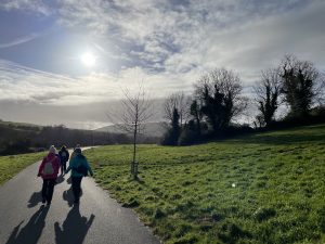 |
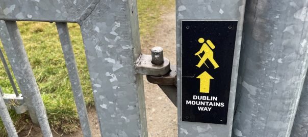
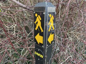
| Setting out. This is the beginning of the 43 km Dublin Mountains Way and it actually starts inauspiciously on a well-hidden path in the corner of an senior citizens’ care centre Kiltipper. It runs from here to the coast at Shankill | The first section is new – well paved (but hard on the feet) and un-marked on the Ordnance Survey map (but showing up on OpenStreetmap which is presumably updated more or less in real-time) |
 |
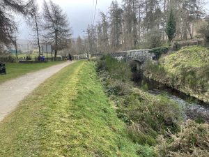 |
| There are two reservoirs in the Glenasmole valley – this is by the dam of the Upper Bohernabreena reservoir, which you can cross to walk the path on the opposite bank. | On the path between the Lower and Upper reservoirs. The goyt on the right directs the peaty water from the higher mountain slopes to the lower reservoir, bypassing the upper one. The upper one collects clearer water from the lower slopes and is used for some of Dublin’s drinking water. The darker water in the lower reservoir is used for industrial purposes |
 |
 |
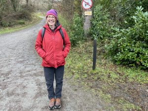
| Val looking chipper on the way back down | The “DMW” (Dublin Mountains Way) would certainly merit some more exploration, but I heard from some of the walking club members that parts of it were unfortunately closed, as farmers had decided they didn’t want people walking on their land. A real shame. |
 |
|
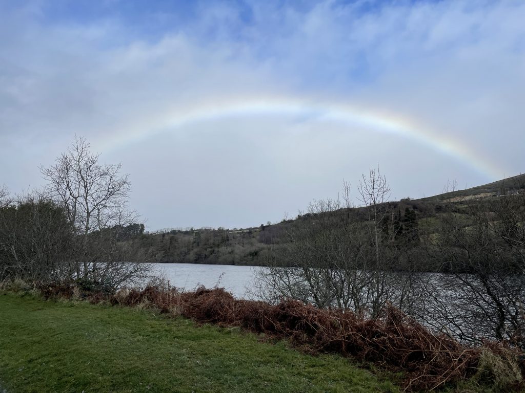
| A misty rainbow appeared out of nowhere while we were having lunch by the upper lake. A bit odd, really, as it was neither sunny nor raining at this point | |
Interactive map
(Elevations corrected at GPS Visualizer: Assign DEM elevation data to coordinates )
Max elevation: 188 m
Min elevation: 111 m
Total climbing: 279 m
Total descent: -278 m
Total time: 03:22:40
You can read earlier and later days’ blogs below
Previous day’s blog
Next day’s blog
Ireland home page
 Save as PDF