Ireland day 0107. Thursday 13 January 2022- Swannery
| Today’s summary | Walked round the western perimeter of the Broadmeadow Estary to visit the swannery and to see if the coast road was still under water (it was) | ||||
| Today’s weather | Dry and sunny in the morning, overcast in the afternoon. Dry and very light westerly wind. About 7C | ||||
 |
 |
||||
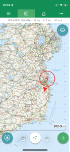
| Today’s overview location (the red cross in a circle shows where Val and I are at the moment) |
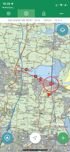
Close-up location (Click on the button below to download a GPX of today’s walk, or see the interactive map at the bottom): Swannery |
||||
Commentary
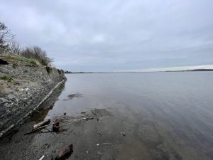
Last November, I had ridden my bike around the western perimeter of the Broadmeadow estuary, on my way to Donabate. I had been slightly surprised to discover that on the north side of the lagoon, the road simply disappeared under water. I had assumed that this was perhaps because there was an exceptionally high tide that morning – and in any case I had managed to negotiate the flooded section (about 1km long) by clambering up the banking and carrying my bike through the brambly bits.
When I had reported my mishap with the road to Val, I thought at the time she seemed a bit incredulous (probably thinking “what on earth is he on about – roads don’t just disappear under water – he must be just making it up for dramatic effect”). Anyway, when you make sweeping and expansive assertions like this, they are relatively easy to disprove, so the onus is on you prove that they are right.
So I hit upon the idea of dragging (not literally I hope you understand) Val round the estuary on foot, to see for herself. I actually thought it was a bit of a win-win. I had noticed that the tide is well out in the afternoons at the moment, so I thought that either she would see that the road really did go under water, and I would be vindicated, or if the low tide did indeed expose it, then we would at least be able to add an interesting extra leg to our walk.
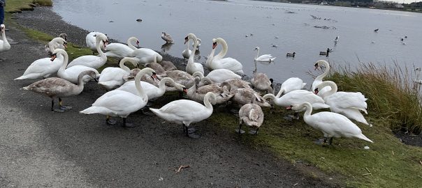
I had also done a bit of research about the area and discovered that the whole of the Broadmeadow estuary is a Special Protection Area under an EU Directive, on account of its extensive and diverse population of wildfowl. It is particularly well known for its swans – which are of the Whooper, Bewick and Mute varieties (though I have to be honest I don’t think I could tell them apart). At one spot on the north shore, the swans seem to congregate and so the area is known locally as the Malahide Swannery. Though that’s rather a grandiose title for what is essentially a car park where they like to hang out because they get fed. Anyway, I thought we could check it out as we walked past en route to the submarine road.
I had spent the morning finishing off my Ascension Island article while Val had been going through her exercise routine. So we didn’t set off until after lunch, but that didn’t matter because the walk was on easy to follow roads and tracks, so we couldn’t get lost even if darkness fell. We would make our way on foot right round the estuary and eventually pitch up at the swannery. When we actually got there, it was quite interesting to see so many swans en masse – even though at the time they were engaged in an unseemly squabble amongst themselves over who got the best bits of birdfood recently deposited by passing motorist.
We bypassed the squabble before they started pecking at us (I reckon they could be pretty vicious if they wanted to be) and made it to the submarine roadhead. I did have slightly mixed feelings when we got there. The road was indeed still under water, so my November assertions were proved right (thank goodness I hadn’t said I was at Pizza Express), but I was slightly sorry that it wasn’t exposed as I would have quite liked to have walked along it a bit further towards Donabate. I have to say I am not sure why anyone would have built a road that was more or less permanently under water, so I can only assume that when the railway embankment was re-ballasted in the 1930s, the water in the upstream lagoon was impounded behind it so it never properly drains even at low tide, leaving the shore road flooded.
We paused at the end of the road for a quick sandwich and coffee from the Thermos (ooooh lovely) then retraced our steps right round the lagoon as darkness began to fall. So now we are back on terra firma and about to enjoy dinner. Val has pulled together a delicious-looking aubergine bake which I think will go rather nicely I think with the bottle of Malbec we picked up in Supervalu at the start of our walk. We certainly do know how to live here in Malahide.
(By the way – if you would like to read about Ascension Island, you can download a copy of the article by pressing the button below):
Ascension
Today’s photos (click to enlarge)
 |
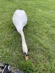 |
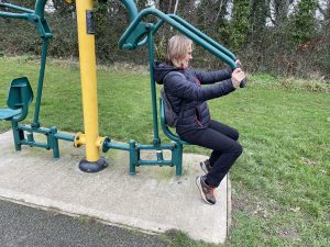
| Fingal council has taken it upon itself to provide these instruments of torture in one of the playing fields near Seabury Park. Val enthusiastically gave it a go while I enthusiastically gave it a wide berth | I am fascinated by the rate at which swans eat grass. I thought you had to be a ruminant mammal in order to be able to digest it properly, but evidently not. |
 |
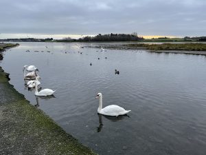 |
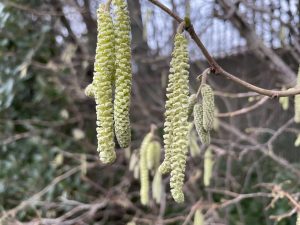
| Hazel catkins down by the Broadmeadow bridge. I like the idea that “Spring is just around the corner” – but there’s many a slip before we get there, as they say | Swans serenely gliding in the brackish waters of the lagoon…Then someone turns up with a bag of birdfood and suddenly it becomes a frenzied mass of swans kicking each other out of the way to get at the tasty morsels on offer. You can see the result in the banner picture at the top of the blog |
 |
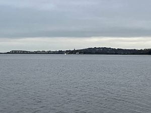 |
| I’d got this far on my bike a few weeks ago and discovered that at this point the road disappeared under water. I had hoped that today, being low tide when we arrived, it might be navigable. But evidently not | Looking over the estuary to Malahide |
 |
|
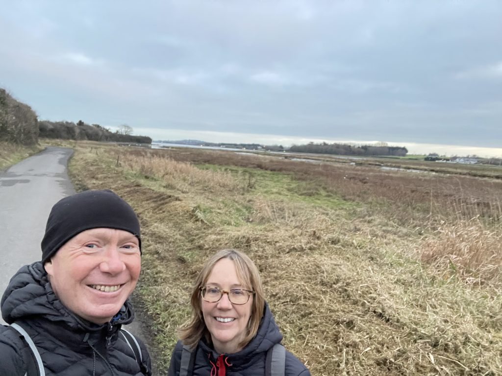
| On the north shore of the lagoon, just before the “swannery”. Most of our walking lately in Ireland has been a bit like this – i.e. on roads. At least most of the ones we walk on are pretty quiet. | |
Interactive map:
Max elevation: 19 m
Min elevation: -2 m
Total climbing: 112 m
Total descent: -102 m
Total time: 05:16:06
You can read earlier and later days’ blogs below
Previous day’s blog
Next day’s blog
Ireland home page
 Save as PDF