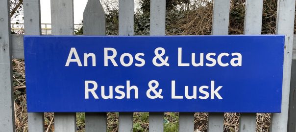
Ireland day 0083. Monday 20 December 2021- Rush&Lusk
| Today’s summary | Quick train ride north to Rush & Lusk station then a circular walk out east to the coast and a visit to the Martello Tower | ||||
| Today’s weather | Dry and overcast all day. Light easterly wind. About 7C | ||||
 |
 |
||||
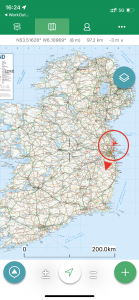
| Today’s overview location (the red cross in a circle shows where Val and I are at the moment) |
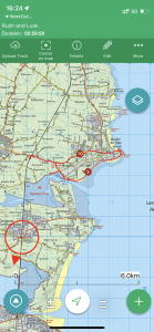
Close-up location (Click button below to download a GPX of today’s walk): Rush & Lusk |
||||
Commentary
With Val safely back in the UK and most domestic tasks here safely under control or put on hold until the New Year, the day was my own. So after a couple of cups of tea while I listened to a BBC podcast on Seamus Heaney and ate my weetabix (very interesting, actually, if a little maudlin), I started thinking about the day.
Rush and Lusk beckoned on my map because it sounds a bit like an instruction – or possibly even a breakfast cereal. But it is none of things – in fact it is a railway station serving the towns of Rush and Lusk and has the peculiar distinction of not actually being anywhere near either of them. So this was a place just crying out to be explored, especially as, just like Donabate, it’s only a short train ride north from Malahide (it’s the next station beyond Donabate, actually).
A quick packed lunch was prepared, and armed with my LEAP card, I jumped on the train and headed north. I had initially planned to get the bus from the station out east to the coast at Rush, but bizarrely the bus and train timetables didn’t coincide so I would have had a long and cold wait outside the station if I chose this option. I realised it wouldn’t take much longer, end to end, if I walked it. So I got my map out and planned a suitable route, deciding a circular walk out from the station towards Rush and then back was possible if I turned off the main road after about 1 km and headed off down the rather poetic Spout Rd to the coast.
(There is actually a nicer alternative route which follows the coast all the way, but after my experience with the Broadmeadow coast road a few weeks ago, I steered clear of it. When I got to the point where the coast road would have joined my own, my suspicions were confirmed – it was indeed under water, though there were some hints it might be passable at low tide).
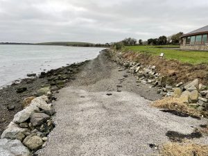
The area near the coast at the southern end of the Rush peninsula is known as Rogerstown, and it sits opposite the Burrow peninsula which you access from Donabate on the other side of the estuary lagoon. When I got there, the tide was ebbing rapidly and you could almost feel the power of the water outflow as it oozed its walk silkily through the narrow gap between Rogerstown and Burrow. Given the tidal forces on display, I wasn’t surprised to see that the area is subject to serious erosion – you can read a bit more about it in the photo captions below.
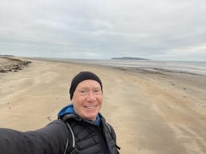
I scrambled round the southern headland – which isn’t actually private land but it’s clearly somewhere that walkers aren’t really welcome and don’t normally frequent – and made it safely through to the expansive sands at the other side. Rush beach is huge – especially when the tide goes out – and affords walkers great views south to Howth and even to the Sugarloaf mountains beyond, and due west to Lambay Island. Readers may remember that Lambay is privately owned by the Baring family (of Barings Bank notoriety) and I believe that part of the landing jetty at Rush – which is the closest mainland point to Lambay, is owned by Baron Revelstoke, the titular head of the Baring family.
By the way, Canadian readers might be interested to know that the town of Revelstoke in the Rocky mountains is also named after an earlier Baron from the same family, in recognition of the part he played in securing the funds to finish the Canadian Pacific railway.
One beach is very much like another, and Rush was similar to those at Bull Island, Laytown, Skerries and Termonfeckin – but I like them all. The going is easy underfoot, the skyscapes are always uplifting whatever the weather, and, rarely for Ireland, you feel like you can walk wherever you want. So I headed briskly up the beach, aiming to reach the Martello Tower for lunch (although by this time it was already 2:30 pm) before turning round and heading for the station down the main road.
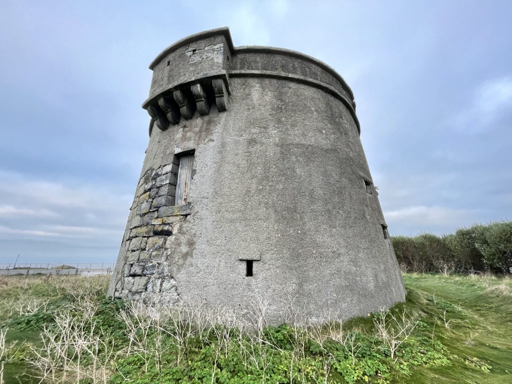
The Tower itself is unceremoniously situated in the middle of a housing estate, and isn’t easy to access. I found a narrow path leading through the houses down to the rocky shoreline, from where it was possible to loop back and scramble up a slippery slope to get to the tower itself. It stands in splendid isolation in a rough field which actually just looks like the extension of someone’s back garden. It is in reasonable shape, despite being left completely untouched presumably for 200 years. I wasn’t really sure if I was suppose to be there, so I didn’t linger for lunch but made my way back round the coast to the small harbour at Rush, where I paused for something to eat.
At that point I thought I had better take a look at the train timetable so I could make sure my walk back coincided with the arrival of a southbound train. I discovered slightly to my alarm that there were two trains departing within 8 minutes of each of each other – the first leaving in 45 minutes. Then, unaccountably, there was a gap of over an hour until the next one. So I checked my watch and reckoned if I finished my lunch straight away and hot-footed it down the main road, I would have just enough time to get to the station with a couple of minutes to spare. I really didn’t want a long cold wait on a railway platform to be the concluding chapter of an otherwise excellent day out.
So I hastily followed the main R128 road straight back to the station – completing the northern part of my loop walk. It’s a busy, fumy, road so not particularly pleasant but at least there’s a decent pavement all the way. Midway I was overtaken by a tractor pulling a giant trailer full to the top with leeks, and the smell of traffic fumes was drowned out with a rich onion scent for a good five minutes after its passage.
In the end, I arrived at the station with 4 minutes to spare – and had even managed to learn from a sign as I hurried along, that the town name “Rush” comes from the Irish “Ros Eó“, meaning “headland of the yew trees” (although I didn’t see any today) A brief flit across the Rogerstown and Broadmeadow estuaries saw me back in the flat just 15 minutes later, and now I have a completely free evening – except that I still have another half pumpkin left to prepare, cook – and eat. Val has observed that I will probably be orange by Christmas at this rate – and I think she may well be right.
Today’s photos (click to enlarge)
 |
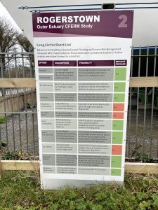 |
| This looks awfully familiar – a coast road which disappears into the sea (like the one on the north side of the Broadmeadow lagoon). But this section of the Rogerstown lagoon is downstream of the railway embankment so fully tidal. I visited at high tide and the sea still had 3m left to fall. So there is every chance that at low tide this road might actually be passable. A more pleasant alternative than the trek along the busy R128 from the station to the coast | The whole of the eastern shoreline of Ireland from Drogheda to Sandymount seems to be affected by constantly drifting sands – compounded at the moment by rising sea levels. The Rogerstown estuary seems to be particularly badly affected with erosion occurring at both the north (Rogerstown) and south (Burrow) side. There are various proposals for dealing with it but because the estuary is designated under the Habitats Directive, most of them are impossible to implement – unless “IROPI” (Imperative Reasons of Overriding Public Interest) can be demonstrated. This has only been possible once in the past across the whole of Ireland, so the chances don’t seem high. |
 |
 |
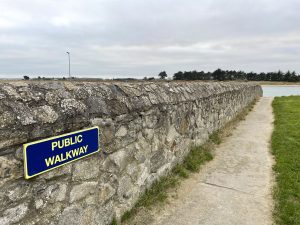
| A welcome – but rare – sight. the walkway was actually all of 20 metres long | Eventually I managed to get to the beach proper at Rush – but not until I’d first clambered over a jumble of broken concrete blocks and other debris which formed a rudimentary coastal defence round the southern end of the Rush peninsula |
 |
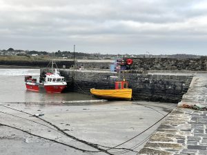 |
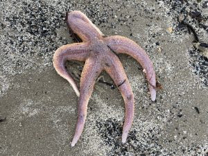
| First time I’ve come across one of these echinoid visitors since arriving here in Ireland | An attractive small harbour in Rush |
 |
|
| The Rush Martello tower. It’s completely abandoned and actually quite hard to find unless you clamber up from the beach (which I did) or sneak through somebody’s back garden. It’s completely abandoned and would make a fabulous home conversion opportunity. Though I suspect the attractions of the various nearby new housing estates, with warm, dry readymade accommodation – probably prove too seductive for most prospective buyers. A bit of a shame really. | |
You can read earlier and later days’ blogs below
Previous day’s blog
Next day’s blog
Ireland home page
 Save as PDF