Ireland day 0337. Wednesday 31 August 2022- Canada2202
| Today’s summary | Drove up the Sea to Sky highway to Whistler-Blackcombe. Never been before and wanted to see what it was like. Really interesting and enjoyable. Visited a First Nations museum and then a loop walk round Lost Lake. Excellent | ||||
| Today’s weather | Warm, dry and sunny all day. Very little wind. About 30C | ||||
 |
 |
||||
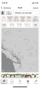
| Today’s overview location (The blue mark shows the location of our route) |
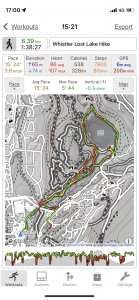
Close-up location (The green line shows where we walked) (Click button below to download GPX of today’s walk as recorded, or see interactive map at bottom with elevations corrected): Lost Lake loop walk Whistler |
||||
Commentary
Whistler is a mountain resort in British Columbia, about 120km / 75mi north east of Vancouver. I’ve heard people talk at length about “Going skiing [winter] / mountain-biking [summer] at Whistler”. But neither Val nor I had ever been so when the opportunity presented itself to travel up the sea-to-sky highway today to pay the town a visit, we seized it with both hands.
As readers will know, we are not morning people so ordinarily an 8am start would be purgatory. But with the benefit of a body clock that is still eight hours ahead of the sun, we have been waking up about 5am so not leaving till 8 actually felt like we were having a bit of a lie-in.
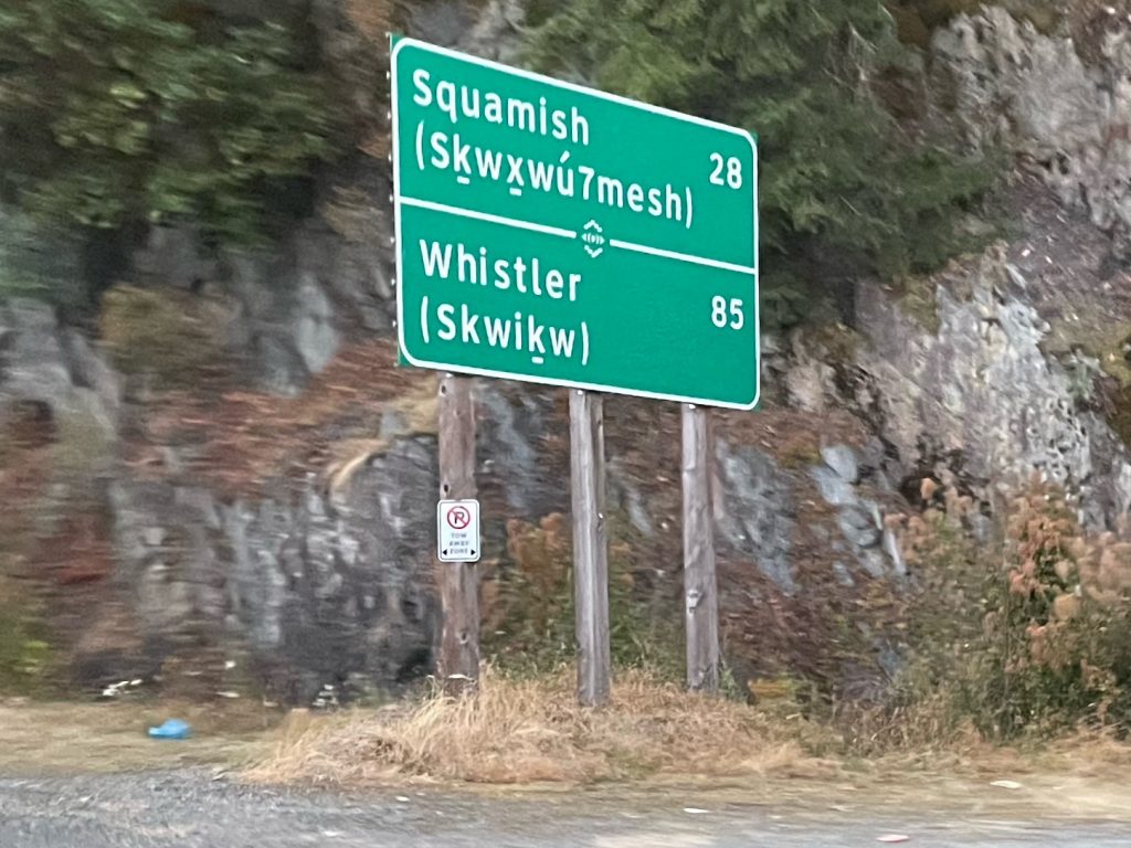
Anyway, we travelled swiftly up the highway, pausing in Squamish (a town as well as the name of a First Nation) for a delicious but entirely unnecessary Tim Hortons breakfast on the way. Whistler, and the neighbouring resort of Blackcombe were comfortably busy this lunchtime when we arrived, but, being midweek, weren’t over-run.
Our first stop was the First Nation (Squamish and Lil’wat) museum which offered a fascinating insight into the history of these groups. I could write a bit of a treatise on the history of these peoples, and the effect that colonialism had on them. But it has too many sad echoes of the colonial impact in Ireland, which I have written about many times before. And in any case it’s getting late now and my body is telling me it’s really six o’clock tomorrow morning, so I am running out of energy to write a detailed monologue .
But I did learn that petroglyphs in the area have been dated back about 7000 years (shortly before the Brú na Bóinne tombs were built in Ireland). It’s thought that humans first arrived in North America abound 10000 years ago. This was after the last Ice Age but before sea levels had full risen to today’s levels, so the Bering Straits were dry land. This meant that people could walk into the Americas from north east Asia. Interestingly, as far as I know, unlike most of Europe, including the UK, there were no humans in the Americas in earlier interglacial periods
Once we had satisfied our cultural interests, we had some lunch then found a trail leading out through the woods to the Lost Lake. It was a thoroughly enjoyable short hike, along a path which, as so many in North America are, was well waymarked and carefully graded. The lake itself was busy with day trippers relaxing on its shores and taking a dip in its waters – which presumably weren’t icy cold today.
By the time we had finished culturalising, dining and walking, it was about 5pm so we decided to call it a day and head back down to Squamish (the town, not the First nation). Squamish is about halfway to Vancouver, so it’s an ideal spot to break the 2 hour journey. We dropped in at a bar on the banks of the broad and fast-flowing Squamish River and I attempted enjoy to a peach flavoured beer (which actually tasted worse than it sounds) at the excellent and laid back Watershed Grill. We supplemented the drinks with chicken wings and fries, which were tasty and more than made up for the peach beer.
From there it was just an hour back to town, a journey which was enjoyable in its own right but made doubly so by the spectacularly beautiful sunset over Howe Sound. We made it back to our accommodation just as it was getting fully dark, and now my eyelids are feeling so heavy that I am in need of matchsticks to prop them open. So I’m going to call it a day and sign off for now. Goodbye / Au revoir (as they say in Canadian)!
Today’s photos (click to enlarge)
 |
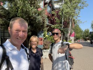 |
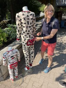
| One of the first things you don’t expect to see in a ski resort is a mannequin modelling one-piece pyjamas. For reasons that I don’t fully understand, Val seemed to be especially fascinated by the posterior trapdoor mechanism | About to set off into town |
 |
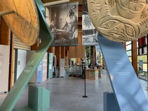 |
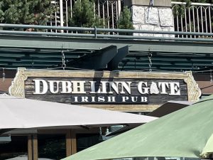
| You can take the Irish out of Ireland, it seems, but you can’t take Ireland out of the Irish | Inside the First Nations museum at Whistler. It was built in time for the winter Olympics at Whistler in 2010, and is nicely done. |
 |
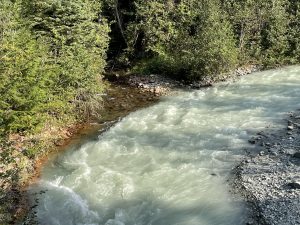 |
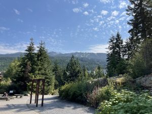
| Beautiful mountain scenery. Though even here, at well over 600m, the temperature touched 31C this afternoon | Interesting to see the rainwater creek on the left joining the glacial meltwater Fitzsimmons Creek on the right. The clear water is soon lost into the cloudy torrent of suspended clay |
 |
|
| In my travels around the British Isles I have been overwhelmed by the complexity of the local languages – Welsh, Gaelic and Irish. To the newcomer, they are dauntingly difficult to learn – though eventually, through repeated exposure, I have managed to pick out a few words and phrases that I recognise in all these languages. But First Nation Squamish takes things to an altogether different level of complexity. It’s the only language I know that uses numbers as letters, for example. Squamish isn’t a written language but was transcribed into text in the 1970s by a Dutch researcher, apparently. She introduced the use of the number 7 to indicate a glottle-stop |
|
Interactive map
(Elevations corrected at GPS Visualizer: Assign DEM elevation data to coordinates )
Max elevation: 710 m
Min elevation: 663 m
Total climbing: 192 m
Total descent: -197 m
Total time: 01:38:24
You can read earlier and later days’ blogs below
Previous day’s blog
Next day’s blog
Ireland home page
 Save as PDF