Ireland day 0326. Saturday 20 August 2022- DonardDWC
| Today’s summary | Led a Dublin Walking Club ascent of Slieve Donard, in Co. Down. Early start to meet at the Carrickdale Hotel at 9am then car-shared over to Newcastle to start the walk. Rained every step of the way, quite windy on the top. Lots of people out despite the weather. Safe return and then dinner at Carrickdale on the way back. A very enjoyable and invigorating day out | ||||
| Today’s weather | Rained all day and strong to gale force south westerly wind on the top. 17C at sea level, much cooler on the top. Only a few minutes sun | ||||
 |
 |
||||
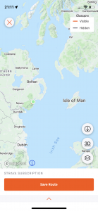
| Today’s overview location (The green mark shows the location of our route) |
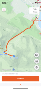
Close-up location (The orange line shows where we walked) (Click button below to download GPX of today’s walk as recorded, or see interactive map at bottom with elevations corrected): Donard DWC leading |
||||
Commentary
I’m going to try and keep this blog brief – mainly because I’m tired after a week of gym-ing and climbing mountains.
Today was the big day – leading an ascent of Slieve Donard for the Dublin Walking Club. It’s the second time Val and I have been up it in a week – we also made the ascent last Monday as part of our recce. It’s quite a long drive – almost 2 hours – from Dublin to the start point in Newcastle, so the club decided to meet at the Carrickdale Hotel – about halfway – to grab a cup of coffee and consolidate the cars for the final drive round behind the Mournes to Newcastle.
Because it takes quite a while to get to the start, it meant an early departure from Malahide – so we dragged ourselves out of bed at the unfeasibly early time of 6:45 am and were away soon after 7:30. But it was still nearly 10:45 before we all eventually plodded off out of the Donard car park ready to tackle the ascent via the Glen River. We did have to faff around a bit at the start, it has to be said, because the car park was full and we had to drive around to find an alternative spot. And then, pretty much as soon as we stepped out of the cars, it started to rain. So we had to pause a little longer to enrobe ourselves in head-to-toe waterproofs.
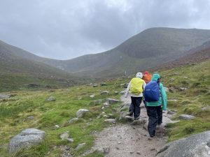
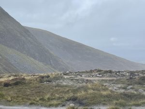
The route was the same as Val and I followed on Monday – up the Glen river then left at the Mourne Wall. The main difference today was the busy-ness of the path. Despite the gloomy weather, there were literally hundreds of people out and about. A number of them looked rather ill-equipped for the weather – basically clad in just T-shirts and shorts, with what appeared to be baggy blue bin-liner-like ponchos as their sole concession to waterproofing. But I saw some of the better clad walkers were carrying walkie-talkies and we later learned that we had stumbled across a sponsored hike being run by Tesco. Apparently these sort of events are a fairly frequent occurrence up on Donard, so today’s crowds weren’t altogether unusual. In fact if the weather had been better, there would probably have been even more.
There were seven of us in our small but perfectly formed group. We didn’t dawdle on the way up – it was so wet and cool that it wasn’t conducive to hanging around. But I have definitively concluded that I need a new waterproof jacket. The one I wore today is made of Goretex and it’s a bit long in the tooth now – it’s almost 10 years old – and it leaked like a sieve. I’ve never been a huge fan of Goretex and I looked enviously at Val who wears Paramo and stayed as dry as a bone. Maybe I’ll make a swap at Christmas, perhaps?
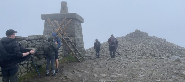
Anyway we all successfully made it up to the top – along with all the T-shirts and shorts brigade who looked distinctly shell-shocked by the conditions up there. We paused briefly to put more clothes on and get something to eat, then hot-footed it back down again, barely pausing for breath until we were well into the forestry alongside the Glen River.
It took us a full five and a half hours to get up and then back again to the car park, despite it being quite a short walk and despite the fact that we hardly stopped. But after we had all changed into some drier clothes we unanimously agreed that we deserved a slap-up meal so we jumped back in the cars and made our way back to Carrickdale to enjoy what felt to be a very well earned dinner of burgers and chips (and Guinness 0.0% which wasn’t too bad actually).
After dinner, we bade our farewells and pottered down the M1 back to Dublin.
Now, I know the question on everyone’s lips is “so what has happened to his watch? Well, I can report some progress. This evening, after I had charged it, all the numbers worked (you may recall that yesterday on the “7” worked), so I was able to unlock it. Admittedly, it made a bit of a funny noise when I was unlocking it, but things seem a lot more hopeful than they did a couple of days ago. So I think I will probably leave it a couple more days to dry out then see if it still works. I shall be keeping my fingers firmly crossed in the meantime. 🤞
Today’s photos (click to enlarge)
 |
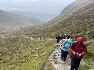 |
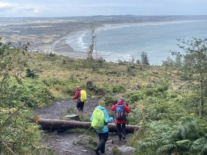
| At the point where the path leaves the forestry that runs alongside the Glen River and enters the open moorland managed by the National Trust | Long slog up to the Bealach between Sleives Donard and Commedagh. Literally hundreds of people out today, despite the weather |
 |
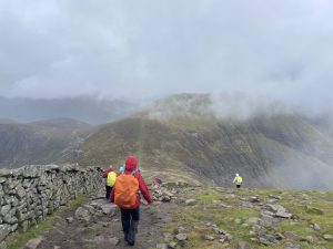 |
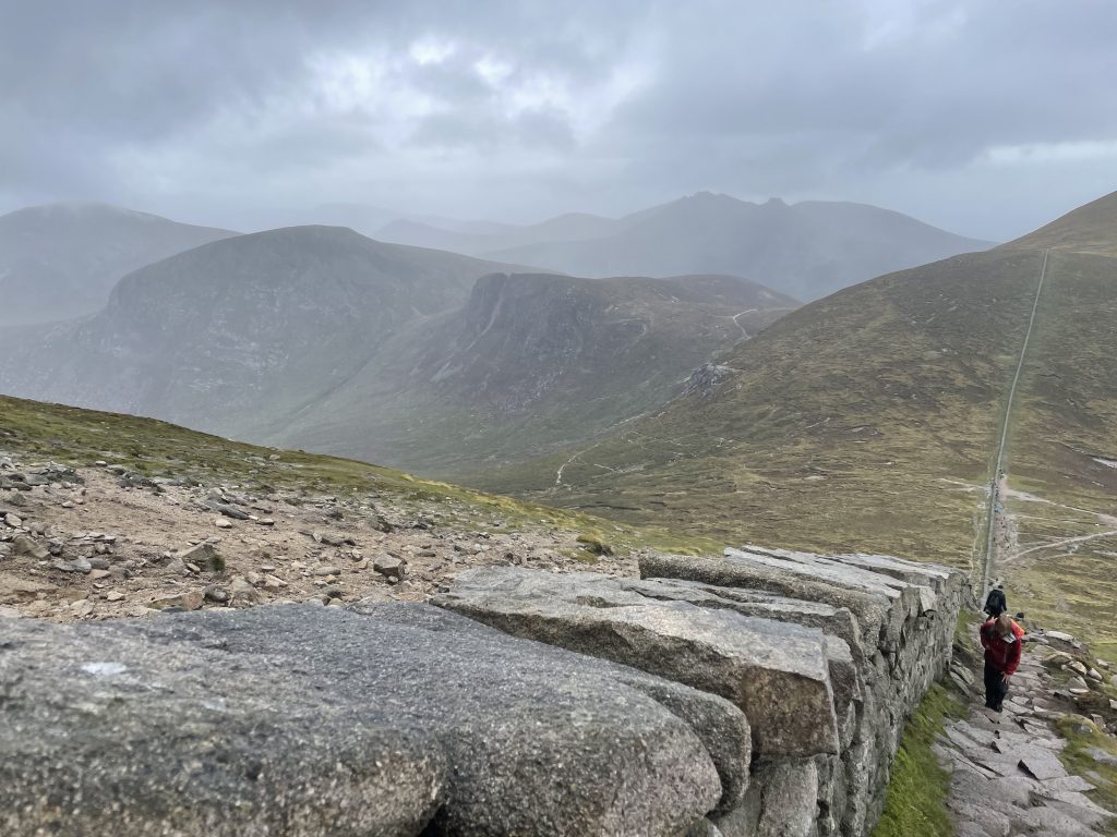
| On the bealach, looking north | Heading back down alongside the Mourne Wall after a brief pause on the wet and windy summit for a hurried lunch |
 |
 |
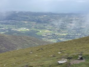
| Out in the distance, on the plains north of Newcastle and heading towards Downpatrick, there were tantalising glimpses of what appeared to be sunshine. Or at least, less wet weather | Nearing the end – weather clearing to reveal the broad sweep of Dundrum bay |
 |
|
| Peeking over the Mourne Wall towards Slievelamagan. The Mournes really are the jewel in the crown of Northern Ireland | |
Interactive map
(Elevations corrected at GPS Visualizer: Assign DEM elevation data to coordinates )
Max elevation: 846 m
Min elevation: 4 m
Total climbing: 904 m
Total descent: -904 m
Total time: 05:26:34
Previous day’s blog
Next day’s blog
Ireland home page
 Save as PDF