Ireland day 0256. Saturday 11 June 2022- Lug2
| Today’s summary | A return trip to Lugnaquilla, laid on by the Dublin Walking Club, so that members who couldn’t make the trip last April because of Covid, were able to have a second chance. I went again anyway today, as I enjoyed it so much last time. Filled the day perfectly while Val was out at work | ||||
| Today’s weather | Cool and rainy first thing but brightened up as soon as we started walking. Strong westerly wind. About 15C in the valleys, colder on top | ||||
 |
 |
||||
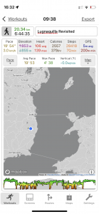
| Today’s overview location (The blue mark shows the location of our route) |
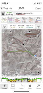
Close-up location (The green line shows where we walked) (Click button below to download GPX of today’s walk as recorded, or see interactive map at bottom with elevations corrected): Lugnaquilla DWC again |
||||
Commentary
Back in the mists of time – i.e. at the beginning of April – the Dublin Walking Club organised a hike up Lugnaquilla – the highest mountain (at 925m / 3035ft) in the Wicklow Hills. Unfortunately, hardly anyone came on that occasion as virtually everyone else had Covid (and Val and I ourselves had only just recovered). So today, the April leaders volunteered to run it again, for the benefit of everyone who couldn’t go last time.
Although I didn’t fall into the category of previous absentees, I had really enjoyed the walk. And as Val was gainfully occupied in the museum today, I thought I’d pay a return visit now that the opportunity had presented itself. Particularly, as last time I found it hard going I think because I’d only just shaken off the virus.
Today, the mountain was completely different. In April, it had been clothed in a white blanket of late spring snow, whereas today. like much of Ireland it seems, it was resplendent in a cloak of bright green. But although we’re approaching midsummer and the temperature was supposedly about 15C, it felt very much colder than that. There was a gale force westerly wind blowing pretty much the whole way, and which only really abated once we were back down in the valley.
I think I remarked last time how deceptive the ascent of “Lug” (as it seems to be affectionately known) is. You feel like you are moving quickly, and that you have reached the top in record time. Whereas in actual fact, last time it took us three and a half hours to get up and today was only ten minutes quicker. Though to be fair on ourselves, although the ground was snow-covered last time, it was also either much drier than today, or frozen. So today, we spent time and effort side-stepping bogs, which slowed us down quite a lot, I think.
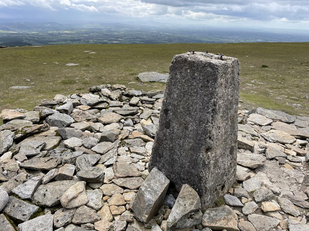
The views were outstanding from the top – assuming you could stand up long enough to admire them. The wind was indeed intense, but we managed to hunker down behind the substantial summit cairn to have our lunch, and provided you were out of the wind it was actually not too bad.
Like last time, once we’d had lunch we simply retraced our steps back down again, using the zigzag path that we had taken on the way up. The round trip time was surprisingly consistent with our last ascent. 6h44m today versus 6h52m back in April. I think in ideal (i.e. non-windy and drier underfoot) conditions, and with only a brief stop for lunch, you could probably do it in 5hrs, but to do it any quicker I think you would need to be a fell runner.
Once back at the car park, we dropped in to the Glenmalure Lodge for a quick drink (though as we were all driving, it was a sadly abstemious affair). A few of the others stayed on a while longer to get something to eat, while I took my leave and sped back to Malahide to get Val’s and my dinner ready. It’s more of the same as last night, actually – jacket potatoes with tuna and sweetcorn, but as a dessert this time we’re having some of that delicious Oxford Slab lunch fruitcake that I picked up half price in SuperValu a couple of weeks ago (don’t worry – it’s been in the freezer).
At this stage I would say I’m going to sign off, clear up after dinner and get an early night. But Iarnród Éireann have decided to do some more bridge repair work this weekend so right now we are enjoying a not-very-sleep-inducing symphony of pneumatic drills accompanied by an angle grinder solo. Hopefully this will be the last of their nocturnal activities for a while, but even if it is I suspect we may both be looking a bit bleary-eyed in the morning. Wish us luck and effective earplugs!
Today’s photos (click to enlarge)
 |
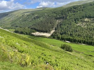 |
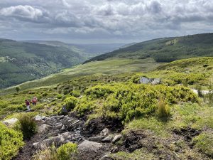
| Looking back southeast, down into Glenmalure, with the coast near Wicklow on the horizon. | Looking in the other direction up the Glenmalure valley, with what look the scars of old lead workings on the hillside |
 |
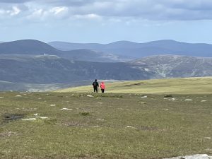 |
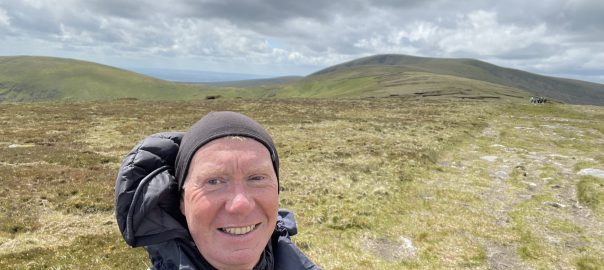
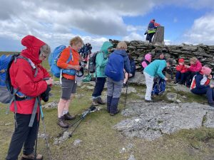
| On the top. There was a party of sponsored-walkers when we arrived, so it was quite busy. But they departed soon after we arrived, and we had the whole place pretty much to ourselves | Looking northeast from the summit, towards Tonelagee (which I think is the high summit on the left of the picture) |
 |
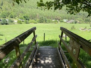 |
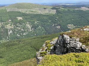
| Lugnaquilla is basically a massive blob of a mountain, so there aren’t really many rocky outcrops. This is just about the closest it comes to a cliff | Bridge over the beautifully named Carrawaystick brook, by the farm at the bottom of the zig-zags. It was built by the Mountain Meitheal volunteers in 2007 |
 |
|
| On the top of Lugnaquilla, looking southwest into the far distant haze of Co. Wicklow and, beyond, Co. Carlow | |
Interactive map
(Elevations corrected at GPS Visualizer: Assign DEM elevation data to coordinates )
Max elevation: 923 m
Min elevation: 131 m
Total climbing: 1118 m
Total descent: -1117 m
Total time: 06:44:08
You can read earlier and later days’ blogs below
Previous day’s blog
Next day’s blog
Ireland home page
 Save as PDF