PW day 16: Tue 08 Mar 2016; Greenlee to Bellingham
| Walk descriptor | Pennine Way | Day | 16 | ||
| Date | Tue 08 Mar 2016 | Start to end time | 06h 28m | ||
| Start point | Greenlee | End point | Bellingham | ||
| Miles today | 14.87 | Cu miles | 246.08 | ||
| Ft today | 1,730 | Cu ft | 39,720 | ||
| Route miles left | 44.43 | Route ft left | 6,908 | ||
| Today’s weather | Continuous heavy cloud, no sun. Drizzle all morning, drier later. Very light westerly breeze. Temp appx zero at start, 8C later | ||||
 |
 |
||||
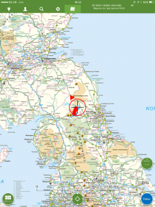
| Today’s location (the red cross in a circle shows where I am at the moment) |
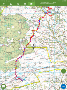
GPX based track of today’s walk (click button to download file) GPX |
||||
Commentary
Tom Stephenson (not you Tom – the one with the “ph”), the Pennine Pioneer, would have been justified in thinking, when he arrived at Alston in the early 1960s: “Yes, that’s a good piece of work. I have created a continuous right of way all the way from the southernmost Pennines, to the very northernmost. Here would be a good place to stop”. And who knows, if he had, the extra trade from visitors that a Way starting and ending at Alston would have created might even have been sufficient to persuade Dr Beeching go and wield his axe elsewhere.
Mr Stephenson would also have been justified in thinking, if he were a Pennine Purist: “Alston isn’t quite the most northerly point of the Pennines. I will press on a bit further to include the hills of Croglin Fell, which might more justifiably lay claim to this title. Then I will head over a few miles to Carlisle, a splendid city and a fitting end to the walk”.
But he didn’t do either of these things. Instead, he decided to include the pleasant but unremarkable western flanks of the South Tyne valley in his walk, and then to reach Hadrian’s Wall. This might have been a logical course to follow, as Hadrian’s Wall is indeed an excellent destination, and Housesteads fort would have been a suitable climax to the walk.
So it seems more than a little odd that the Pennine Way doesn’t finish at Hadrian’s Wall. Indeed, technically, it doesn’t even visit Housesteads, the most interesting part. Rather, it plunges north again, for a further fifty miles to its final destination. Many suppose that the motivation for this extension was to reach the Cheviots – the most northerly Hills in England. But their link to the Pennines is tenuous, and to reach them entails two days of walking through countryside which is at best unexciting and at worst downright dull.
As a result, today I found myself embarking on the first day of a two day hike to reach the more interesting Cheviot Hills at the end. In every sense, this was a day without excitement. The weather was nondescript – overcast, cold, and drizzly. The scenery was wet, muddy and neither upland nor pastoral. Completely unmemorable. And there were no incidents along the way to bring life to the day. My over-riding memory was one of a landscape in humid brown, grey and green. A pastel vision, washed out by gloom and drizzle.
The walk did offer one or two novelties – the first cows of the Pennine Way (luckily, just out of hibernation, they were much more interested in their silage than in me); the first extended forest; and the first fly-by of RAF Tornado jets. The latter, by the way, was accompanied by an intensification of the explosive earth indigestion that I’d first heard two days ago. On further inquiry, I have been told it most likely isn’t testing at Spadeadam at all, but rather the sound of military exercises at nearby Otterburn army camp. At times the explosions were so loud they felt like they would make my brain rattle. Quite a sobering reminder, with the low flying jets, of quite how terrifying living in a conflict zone would be.
Wargames aside, the walk was largely peaceful and quiet. Once I left the Wall, I saw absolutely nobody at all until I reached the B&B this evening. With the lack of sensory inputs of any sort, I drifted into a bit of a reverie – at one point to such an extent that I forgot to check my GPS for a few moments and found myself heading enthusiastically but misguidedly up a valley which was going at ninety degrees away from the right direction. A detour which probably added quarter of a mile to my journey.
So at the end of the day, I wondered if this was why Mr Stevenson had added these miles onto his route. It wasn’t to provide scenic spectacle, or even the achievement of some elevated northerly goal. Rather it was to allow for a period of reflection, an escape from the day to day pressures of life that most of us digest every day, a rare opportunity for quiet calm and contemplation.
Oh and by the way, I never saw the Northern Lights 🙁
Today’s photos (click to enlarge)
 |
 |
| Leaving Hadrian’s Wall near Cuddy’s Crags. Sorry to part company with the Wall – it was interesting – and dry! | Interesting – if murky – old kilns (I think) just to the north of the Wall |
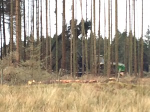 |
 |
| Tree gobbling machine busy at work digesting Kielder forest | This is the sheep equivalent of millionaire’s shortbread |
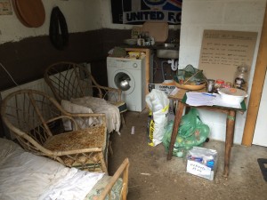 |
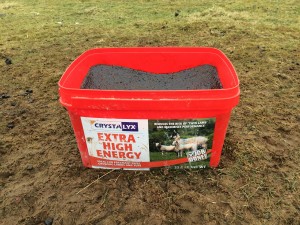
 |
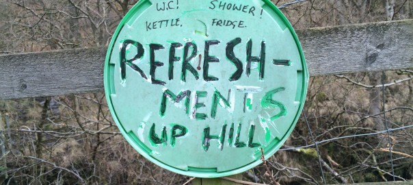
| The “refreshments up hill” advertised in the banner photo for this blog were actually in here. Tempting… | Even more tempting when I discovered what the place offering them was called |
 |
|
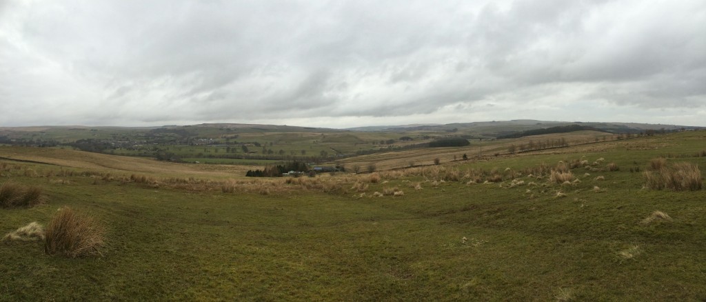
| This was a typical scene today. A study in dull. | |
The previous day’s blog follows below the blue line
 Save as PDF