PW day 06: Sat 27 Feb 2016; Gargrave to Horton
| Walk descriptor | Pennine Way | Day | 06 | ||
| Date | Sat 27 Feb 2016 | Start to end time | 09h 48m | ||
| Start point | Gargrave | End point | Horton | ||
| Miles today | 22.24 | Cu miles | 104.32 | ||
| Ft today | 3,978 | Cu ft | 18,449 | ||
| Route miles left | 179.66 | Route ft left | 25,847 | ||
| Today’s weather | High cloud, little sun except early afternoon, no rain, light easterly wind, strong on hilltops. Appx 2 C | ||||
 |
 |
||||
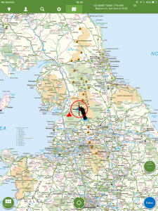
| Today’s location (the red cross in a circle shows where I am at the moment) |
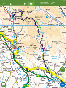
GPX based track of today’s walk (click button to download file) GPX |
||||
Commentary
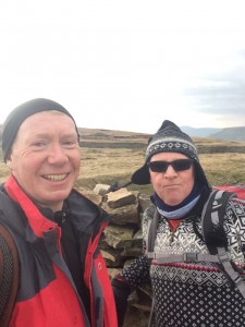
Today’s walk, in terms of both miles to be walked and feet to be ascended, would be a bit of trial, as it is the second-hardest day on the Pennine Way. I wasn’t absolutely certain whether my current fitness levels would be up to it. So I was quite glad when another old schoolfriend, Mike, got in touch and asked to join today’s walk. It would mean I would have some moral support, and also gave me welcome reassurance that I wouldn’t be alone on these moors which were not just windy and wiley, but remote.
So we made an early start this morning, and after a quick breakfast, were away from Gargrave by just after 8:30. Weather-wise, it was almost a carbon copy of yesterday. Cold and cloudy, but only light wind and no rain.
Like the weather, the first part of today’s walk mirrored the last part of yesterday’s. Six miles of rolling pasture land and mud until we reached the village of Malham. In fact I think of the stretch from Thornton in Craven to Malham as a bit of a rural “filler” between the hills of the Peak District to the south, and the Yorkshire Dales to the north.
So I was glad to reach Malham and to start to climb once more out of the farmland and into the hills. And it was an amazing, spectacular climb up the side of Malham Cove, up onto the fabulous limestone (or Karst) pavement at the top, complete with clints (blocks of limestone) and grykes (crevasses between them). It was a slightly hazardous crossing of the pavement, as the grykes afford numerous leg-breaking opportunities and only a few yards to the right, the Cove itself plunged vertically 300 feet to the valley below.
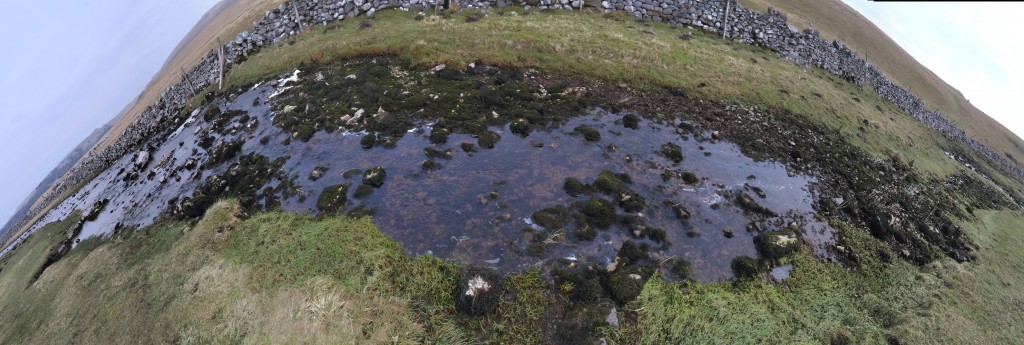
From the Cove, we followed the dry valley up to Malham Tarn. The “dry” valley hit the headlines late last year, as on 6 December, in the wake of storm Desmond, water flowed down the valley and cascaded 260 ft over Malham Cove, making it for a few hours the highest waterfall in England. Nobody knows when the last time this happened was, but it may well have been as long ago as the end of the last Ice Age, 15,000 years ago. There is an amazing video here, if interested.
From Malham Tarn, also an absolutely fascinating glacial feature in its own right, the path took us higher and higher, eventually after some 15 miles reaching the summit of Fountains Fell. En route, we paused to watch a helicopter busily ferrying hoppers of ballast up and down the mountain, where it was being used to effect repairs to the Pennine Way. We had to choose our timing carefully to cross the area under repair, to avoid being caught in the downdraft of the helicopter as it made one of its frequent return visits. But it did mean we had an absolutely pristine new path to help speed our journey to the top.
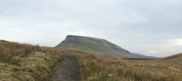
The sting in the tail of this walk as that as you descend Fountains Fell and start thinking about the nice pint in the pub which you now feel definitely ready for, the looming monolith of Penyghent starts to appear on your right. So after descending some thousand feet of painfully gained height, we crossed the valley and did it all again, to reach the top of Penyghent – at 2,277 ft the point of the PW so far – just as dusk was beginning to close in.
The final descent to Horton – a mecca for “Three peakers” (I think there will have to be a separate blog about that) was straightforward and quick, despite the gathering gloom. We eventually made it back to the village at about 6:30, just as the last light faded and it became fully dark.
So tonight’s pint and steak felt particularly well earned, and having completed the walk with relative ease, though not without considerable exertion, I also feel as well prepared as I can be for the rest of the walk. Perhaps most importantly, I now feel slightly more confident about my chances of being able to complete the notorious last day successfully.
Today’s photos (click to enlarge)
 |
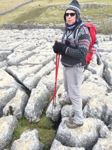 |
| With today’s travelling party, Mike. Great to have company but a bit of a shame about the hat | Checking out the clints and grykes of Malham Cove |
 |
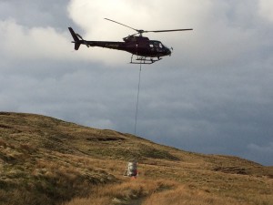 |
| The upper valley of Malhamdale. Dry for 15,000 years. Until Desmond struck | Jolly nice of them to drop in and get the path ready for us |
 |
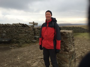 |
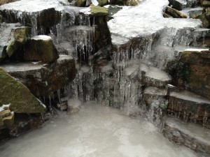
| Gigantic(ish) frozen waterfall on Fountains Fell | Looking a bit shell-shocked on summit of Penyghent |
 |
|
| Now you see it (on the left) and now you don’t (on the right). The whole of the outflow river from Malham Tarn disappears into nothing at the top of the dry valley. Except for one day in 2015, that is. | |
The previous day’s blog follows below the blue line
 Save as PDF