Ireland day 1398. Sunday 27 July 2025- Barnavave Again
| Today’s summary | Val was working at the Museum and I got a lift from a friend to Carlingford for a Club walk in the Cooleys. Good weather for the walk and excellent views. By the time I got in from the drive back, Val had made a delicious chicken stir fry from Kerrigans, and some rice pudding. Watched a James Bond film later in the evening. | ||||
| Today’s weather | Mild and mostly dry with some sun. A brief shower at the end of the walk. Light westerly wind. Appx 18c | ||||
 |
 |
||||
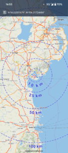
| Today’s overview location (The blue mark shows the location of our route) |
Close-up location (The blue line shows where we walked) (Click button below to download GPX of today’s walk as recorded, or see interactive map at bottom with elevations corrected): Barnavave from Carlingford |
||||
Commentary
The Cooleys are a range of hills about 100km north of where we live. They are one of my favourite groups of Irish mountains. Not just because they are intrinsically attractive, but also because it’s an easy drive up the M1 to get there, and because they are quieter than the Wicklow hills. The downside is that it rains a lot.
So when a Club walk appeared in the agenda for today, I obviously leapt at the chance to go. Especially as a friend from Portmarnock offered to pick me up on the way so I didn’t even have to drive. The only negative was that Val was working so wasn’t able to join us.
We were at the Carlingford hotel well in advance of the 11 am start time. So there was plenty of time for a cup of coffee and a scone before we set off.
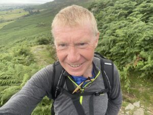
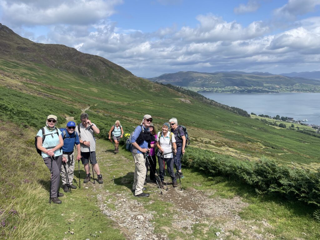
It was a fairly short circular walk today – coming in at around 10km. But if it’s small, it’s perfectly formed. A pleasant walk up the slopes of Slieve Foye as far as Queen Maeve’s Gap, where we stopped for lunch. Then a short further ascent to the top of Barnavave, with the iconic cross on the summit. We enjoyed stunning views in all directions and for once the Curse of the Cooleys – in the form of wind rain and cold – didn’t strike. Well at least not until right at the end when we had a few drops of rain.
On the way back down, we passed by the deserted village – thought to have been abandoned around the time of the Famine, and had a look at the Long Woman’s tomb – an ancient burial chamber.
From there it was a quick trot back down to Carlingford. We immediately retired to the hotel for post- walk refreshments and to catch up on the latest with the Gaelic football finals from Croke Park (Kerry beat Donegal 0-25 to 0-19).
The drive back to Malahide was straightforward though I did notice the northbound carriageway of the M1 was unusually busy. Presumably with disconsolate Donegal supporters heading back home.
Once back at the flat, Val had already returned from work and was busy cooking up the most delicious and much-needed chicken stir fry (courtesy of Kerrigans) followed by equally mouth watering rice pudding made from the fresh whole milk we had bought at the farmers’ market yesterday. She really is a treasure!
Now it’s time to wind down for a bit, after our respective activities. Perhaps another James Bond beckons. We watched “Never Say Never Again” last night which was truly crass in many ways, but enormously watchable. 100% escapism.
Today’s photos (click to enlarge)
 |
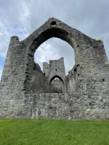 |
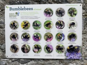
| Who knew there were so many varieties of bumblebees? Well, evidently there are! | In the ruins of the Dominican Friary in Carlingford – originally founded in 1305 and dissolved by Henry VIII in 1539, after which it was used as a base for fishermen |
 |
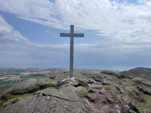 |
| On the slopes | The lonely cross on the top of Barnavane. Curiously, there is a trig point on the top of the hill on the opposite side of the valley, only a couple of hundred meters away. Yet Barnavave is definitely the higher of the two summits. Maybe the Ordnance Survey of Ireland decided that as it already had a cross, it didn’t need a trig point as well |
 |
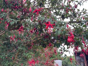 |
| On the top of Barnavave – Slieve Foye is on the skyline behind | Fabulous Fuchsias lined the pathside for large parts of the route |
 |
|
| On the slope leading up to Queen Maeve’s Gap – with Carlingford Lough behind | |
Interactive map
(Elevations corrected at GPS Visualizer: Assign DEM elevation data to coordinates )
Max elevation: 339 m
Min elevation: 3 m
Total climbing: 422 m
Total descent: -422 m
Total time: 04:48:06
You can read earlier and later days’ blogs below
Previous day’s blog
Next day’s blog
Ireland home page
 Save as PDF