Ireland day 1040. Saturday 03 August 2024- Fermanagh Day 1
| Today’s summary | Drove up to Co Fermanagh for a short break exploring one of the three remaining Irish counties we haven’t been to before. Climbed up the Stairway to Heaven (aka Cuilcagh boardwalk) along with many other visitors and some icy rain. Very enjoyable and stunning views. Staying at Crom National Trust overnight. | ||||
| Today’s weather | Sunshine and showers, some quite heavy and cold. Some mist on the top. Light south westerly wind. Appx 17c | ||||
 |
 |
||||
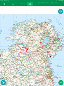
| Today’s overview location (The red mark shows the location of our route) |
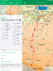
Close-up location (The red line shows where we walked) (Click button below to download GPX of today’s walk as recorded, or see interactive map at bottom with elevations corrected): Stairway to Heaven Fermanagh |
||||
Commentary
(Summary blog only. Last full blog was Day 0368).
We’ve been keeping a tally of the Irish counties we have visited and so far, of the thirty two on the Island of Ireland, we have visited all but three. The gaps are (or were this morning) Leitrim (in the Republic), Tyrone and Fermanagh (in the North). So this morning we set off up the M3, in the general direction of County Fermanagh.
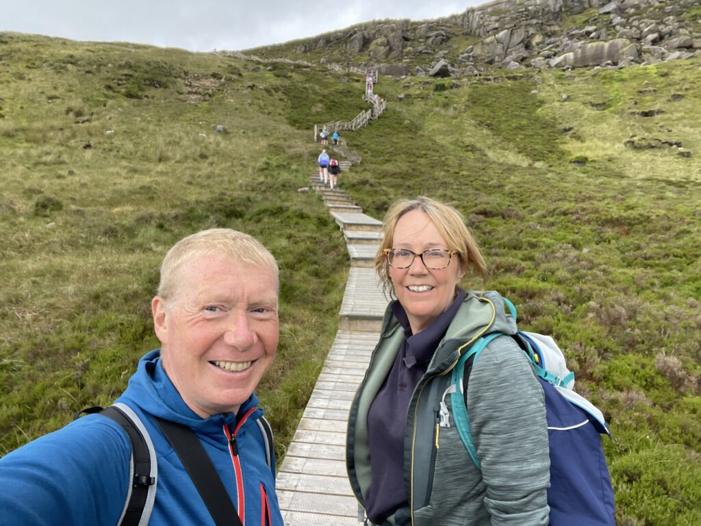
Our destination today was the Cuilcagh Mountains, and the “Stairway to Heaven” boardwalk. The boardwalk was originally built to protect the fragile peat ecosystem from the thousands of feet heading up the mountains every year. But it has since become an attraction in its own right.
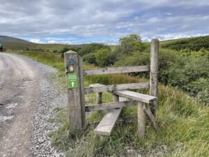
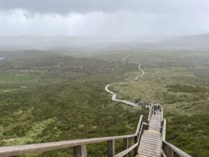
In keeping with the “destination” status that the walkway has acquired, it was quite busy today and we parked in an overflow carpark a couple of hundred meters down the road from the start of the walk itself. The route is about 6km long to the top from the road, and you have to come back down the same way you went up. The first 3km is a “normal” path and the second half is a wooden boardwalk (a bit slippery in the rain, despite the wire netting grips) with steps at the very top.
Once you get up there, there is a wooden viewing platform and you aren’t really supposed to climb off it to venture further along the mountaintop, in view of the extensive erosion that persists up there. In any case, by the time we got to the platform the clouds had descended, the wind had got up and it was raining. So we briefly peered at the view, before heading back down the slippery boards.
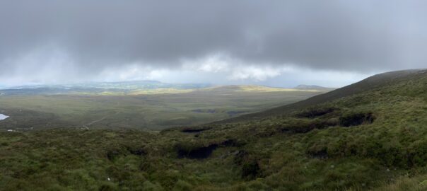
We got to the bottom without mishap and when the clouds lifted, the views looking to the north over the Loughs Erne were spectacular. Fermanagh really is a beautiful county. Not at all what I had expected.
The end of the walk is close to the Marble Arch caves. So we picked up the car and drove down to the visitor centre to get a cup of tea (and – yes – a cake).
Suitably refreshed, we headed over to the other side of Lough Erne and our accommodation for the next three nights. It’s a cottage on the National Trust estate at Crom. We’re just settling in now at so far it seems extremely well done. Clean, tidy and fresh smelling. Time to get the dinner on and the beers opened!
Today’s photos (click to enlarge)
 |
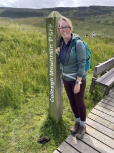 |
| At the start of the path to the top | Midway decorations! |
 |
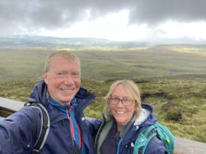 |
| Looking back through the mist, down the boardwalk from close to the top | On the summit platform |
 |
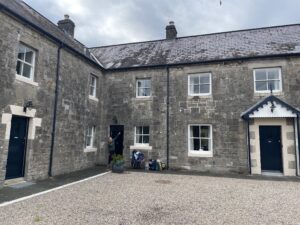 |
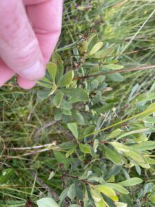
| Bog Myrtle (Myrica gale) on the slopes. The leaves have a strong, herbal, scent when crushed. It’s the first time I’ve seen it in Ireland | Bluebell Cottage (in the corner). Compact and bijou, as they say. |
 |
|
| Along with the multitude of hikers – some in t-shorts and shorts despite the freezing rain – on the boardwalk section | |
Interactive map
(Elevations corrected at GPS Visualizer: Assign DEM elevation data to coordinates )
Max elevation: 610 m
Min elevation: 183 m
Total climbing: 504 m
Total descent: -504 m
Total time: 03:23:21
You can read earlier and later days’ blogs below
Previous day’s blog
Next day’s blog
Ireland home page
 Save as PDF