Ireland day 1342. Sunday 01 June 2025- Rafting?
| Today’s summary | We got up at a reasonably normal hour, had porridge breakfast and then drove down to Portmarnock to pick up a friend for an onward drive to Drogheda. Joined a Walking Club hike in Drogheda St Dominic’s Park which went as far as Oldbridge for picnic lunch then retraced steps back. The Boyne raft race was in full swing when we reached St Dominic’s park. Looked fun but wet. Drove to Malahide via Portmarnock then beans in toast for tea with more Mad Men | ||||
| Today’s weather | Bright and breezy with occasional showers which we mostly missed. Strong north westerly wind. Appx 17c | ||||
 |
 |
||||
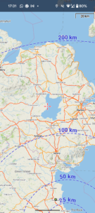
| Today’s overview location (The blue mark shows the location of our route) |
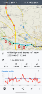
Close-up location (The blue line shows where we walked) (Click button below to download GPX of today’s walk as recorded, or see interactive map at bottom with elevations corrected): Boyne Ramparts Oldbridge and Raft Race DWC |
||||
Commentary
We’ve had long enough now to recover from jet lag, we decided. So it was time to reassume a more normal routine and to get out again with the Walking Club. There was a short walk today up at Drogheda today, so that was the ideal opportunity.
Once we’d had the usual tea and porridge etcetera, we pulled together packed lunches, packed our waterproofs, and jumped in the Trusty Yaris.
Our first stop was Portmarnock, where we collected a friend who was also going on the walk. Then we drove together up the M1 and were parked up in Drogheda by 11:15. Well early for the noon start to the walk, but plenty of time to get a coffee before setting out.
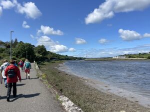
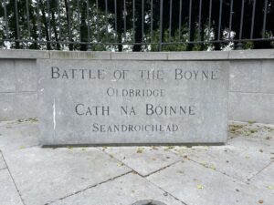
After coffee, we joined a good-sized group of sixteen fellow Club members, strolling up the banks of the Boyne . Everyone seemed interested in our recent travels, so there was lots to talk about. The walk along the Boyne Ramparts seemed to go quickly, and we got to the Battle of the Boyne visitor centre at Oldbridge in seemingly next to no time.
Despite the swift journey, the group was ready for lunch by the time we arrived at the visitor centre. But, having been reprimanded on past visits for eating our sandwiches too close to the café, this time the group dispersed itself to various hidden corners of the (rather lovely) garden to dine clandestinely, out of the gaze of the food police.
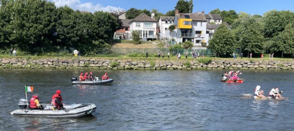
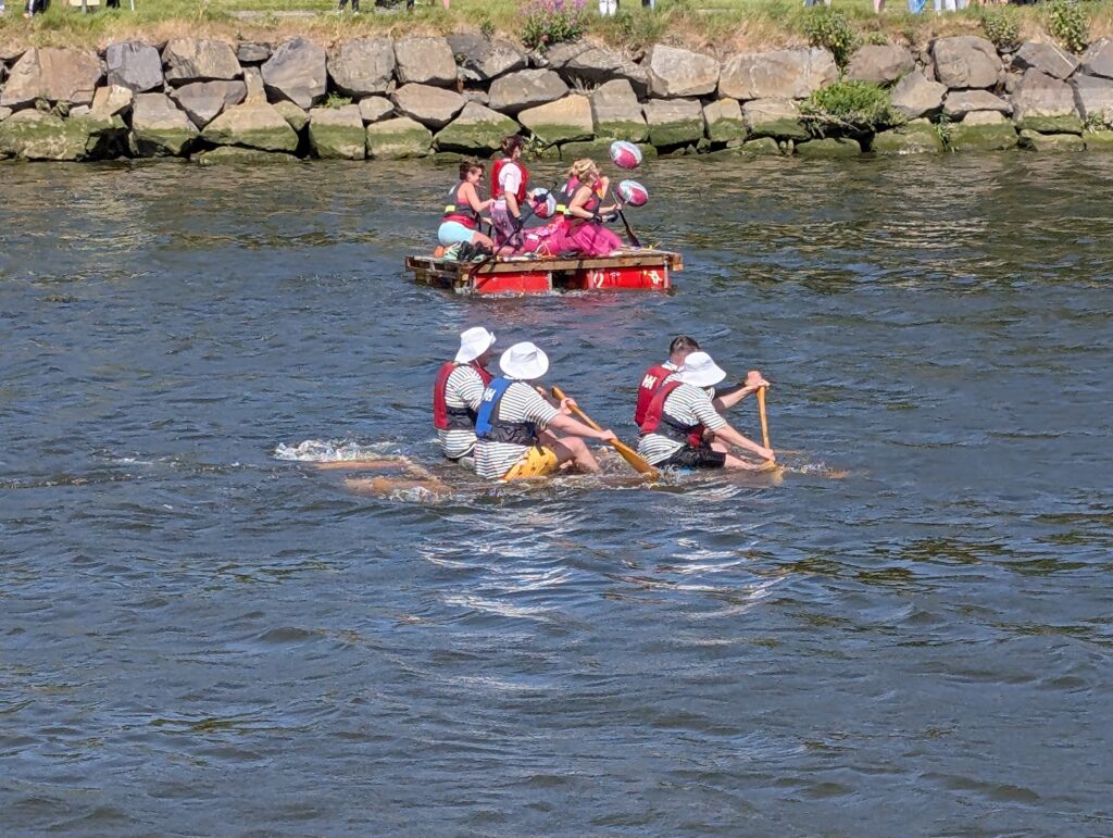
We reconvened after about half an hour, and walked back down the riverbank, retracing our outward route. It was pleasant to be out, especially when the brilliant June sun broke through the clouds. And as we approached St Dominic’s park, where we had left the car, the scene was enlivened by Boyne Raft Race, which was going on just upstream from the George’s Street Bridge of Peace.
We followed three of the waterborne competitors as they floated haphazardly downstream, relieved that all of them safely made it to the finishing line. Though it was a bit touch and go as at least one of them was more submarine than boat by the time it got there.
It was a quick drive back to Malahide, via Portmarnock, and we were in the flat again by about 5pm. The rest of the evening was spent enjoying beans in toast, a glass of Canadian vermouth, and a couple of episodes of Mad Men. (Which, I should note, is getting increasingly weird as series six progresses).
Overall, a good day out and I’m sure the bright sunshine will have worked wonders in terms of finally resetting our body clocks back. It would be nice if our circadian rhythms could actually match the time zone that we living in.
Today’s photos (click to enlarge)
 |
 |
| Setting off from St Dominic’s Park. The weather was good at this particular moment, but very variable. We got hit by a couple of showers, but mostly not heavy, and fortuitously at points where we could take shelter | Under the Mary MacAleese bridge on the M1. her presidency was all about building bridges, so this is symbolic |
 |
 |
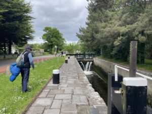
| Alongside the Oldbridge Sealock on the Boyne navigation. So called, I’m guessing, because at this point the canal enters the river, which is tidal. It’s also known as Tiernan’s Lock, or just Lock 1 | Entering the Oldbridge Demesne |
 |
 |
| Oldbridge House, with the Battle of the Boyne field in front (where the walkers are hanging out) | Skulking about in the Oldbridge gardens – trying to eat our packed lunches without the OPW noticing! |
 |
|
| Raft Race – although the one in the foreground looks more like a submersible. Despite sometimes sketchy appearances, they all safely crossed the finishing line, I’m pleased to report | |
Interactive map
(Elevations corrected at GPS Visualizer: Assign DEM elevation data to coordinates )
Max elevation: 15 m
Min elevation: 0 m
Total climbing: 141 m
Total descent: -140 m
Total time: 03:41:35
You can read earlier and later days’ blogs below
Previous day’s blog
Next day’s blog
Ireland home page
 Save as PDF