Ireland day 1475. Sunday 12 October 2025- Dingle Day 1
| Today’s summary | After a very leisurely morning in the cottage, we eventually left at about noon and drove over the spectacular Conor pass to Dingle Town. Had a look round and got a cup of tea. Then drove out to Slea Head and did a 9k loop walk round the hillside. Fabulous views and good weather. Drove back the same way and had gnocchi for dinner with red wine round the real fire. | ||||
| Today’s weather | Dry and bright with plenty of sun. Very light easterly wind. Appx 13c | ||||
 |
 |
||||
| Today’s overview location (The blue mark shows the location of our route) |
Close-up location (The blue line shows where we walked) (Click button below to download GPX of today’s walk as recorded, or see interactive map at bottom with elevations corrected): Slea Head loop walk |
||||
Commentary
I think all four of us on this holiday, for various reasons, were in need of a bit of down-time, so this morning we didn’t really rush to get going. In fact we had a fairly leisurely start to the day, during which we made breakfast and some simple packed lunches, but didn’t leave the cottage until around noon.
Once we did eventually make it out of the front door, we were confronted with a beautiful quiet day – hardly any wind, no rain(!!) and even a hint of sun. So we decided to set off in the cars and drive over from where we are staying in Brandon village, over to Dingle town on the other side of the peninsula.
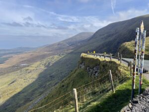
This meant driving over the Conor pass, which surely must be one of Ireland’s most spectacular routes. The road carves its way almost up a cliff face on the eastern side of a giant glacial valley. There’s a small car park at the bealach at the top, where today we stopped to admire the amazing views in both directions. The Brandon massif itself, to the west, looked particularly impressive as the mist swirled around its summit.
We wound our way down the far side of the pass, and finished up in Dingle town, a bustling hub on the southern side of the peninsula. Today it was looking especially attractive in the sun, and it was thronging with visitors and locals. We spent a couple of hours there and used the time to investigate boat trips, and to get some coffee.
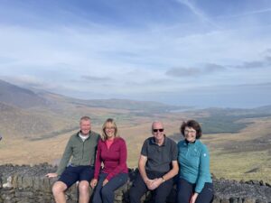
By about 2:30 we decided that it really was time to take some exercise so we continued our four wheeled sojourn, following the road out to Slea Head. We parked up at one of the numerous roadside car parks, then set out on our loop walk of the day.
Like so many in Ireland, it featured quite a lot of road-walking, but more than half of it followed the Dingle Way, which took us higher up the hillside, running parallel to the road but about 100 meters above it. A lovely walk and the coffee and biscuits we brought and which we enjoyed half way round, were particularly appreciated.
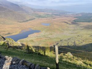
With the weather being so clear, we had excellent views across the bay to the Iveagh peninsula. Then, as we headed back on the westerly leg of the loop and rounded the headland, we had excellent views over the Blasket Islands too. Finally, as we walked back in the road to the cars, we spotted the Skelligs – Michael and Beag – faintly puncturing the misty horizon to the south.
Finally our 9km loop was complete so we got in the cars and retraced our steps, through Dingle town and over the Conor Pass, to the cottage.
Once back in the cottage, I lit a real fire in the sitting room and for dinner we had some delicious gnocchi which Bev rustled up out of seemingly nowhere.
Now it’s time to relax by the fire, finish off the wine, and reflect on another very fulfilling day.
Today’s photos (click to enlarge)
 |
 |
| Looking back from the top of the Conor Pass, at the precipitous winding route leading to the top | The northerly view to the coast, with the Brandon massif on the left in this photo |
 |
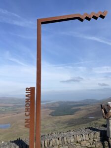 |
| At the bealach (“way through”) at the top of the Conor Pass – minus legs | Adding to my collection of rusty “Wild Atlantic Way” signs. I love them! |
 |
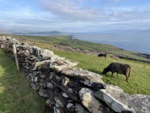 |
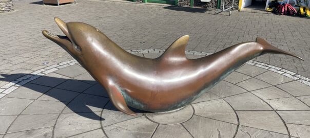
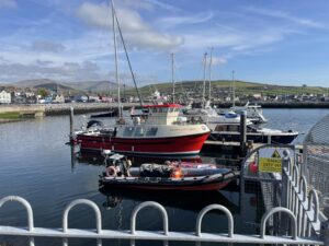
| In Dingle harbour. Sadly, Dingle Bay’s most famous inhabitant – Fungie the Dolphin – is no longer in residence. Although his bronze statue decorates the town plaza, pictured in the banner image at the top of this blog | Along the Slea Head path – part of the Dingle Way. Looking back east towards Dingle and the Iveagh peninsula (aka “Ring of Kerry”) at the far side of the bay |
 |
|
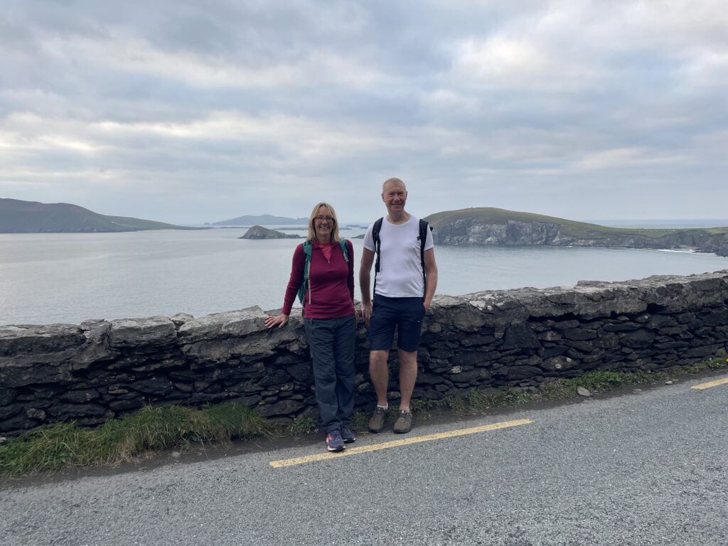
| Heading back to the cars at the end of the loop walk. Blasket island is on the horizon, at the left-hand side. I was last on this road in 1979, when I cycled it with some friends from University | |
Interactive map
(Elevations corrected at GPS Visualizer: Assign DEM elevation data to coordinates )
Max elevation: 178 m
Min elevation: 8 m
Total climbing: 525 m
Total descent: -525 m
Total time: 03:02:15
You can read earlier and later days’ blogs below
Previous day’s blog
Next day’s blog
Ireland home page
 Save as PDF