Ireland day 1307. Sunday 27 April 2025- Waterstown Park
| Today’s summary | Val was doing a shift at the museum today and while she was working I joined a Club walk round Waterstown Park. Enjoyable chat and lots of friendly faces. Drinks in the Palmerstown House pub at the end then C3 bus and Connolly diesel back. Walked round the demesne, finished off the curry and watched some TV once Val returned. | ||||
| Today’s weather | Dry with light cloudy and some sun. Light south westerly wind. Appx 16c | ||||
 |
 |
||||
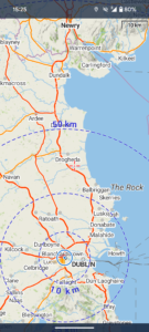
| Today’s overview location (The blue mark shows the location of our route) |
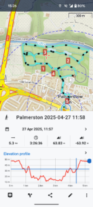
Close-up location (The blue line shows where we walked) (Click button below to download GPX of today’s walk as recorded, or see interactive map at bottom with elevations corrected): Waterstown Park DWC 2025 |
||||
Commentary
Ever the glutton for punishment(!), Val was working at the museum again today, so I was left to my own devices. Actually it worked out quite well, as there was a Club walk out at Palmerstown (west Dublin) that I wanted to go on and which I knew would fill the day nicely.
So once Val was away for her 9:30 shift start, I started to get my things together for my day out. Packed lunch, trusty thermos, waterproofs (well you never know) and spare battery for my phone were all shoved into my rucksack, and then I scuttled over to the railway station to catch the 11 o’clock DART.
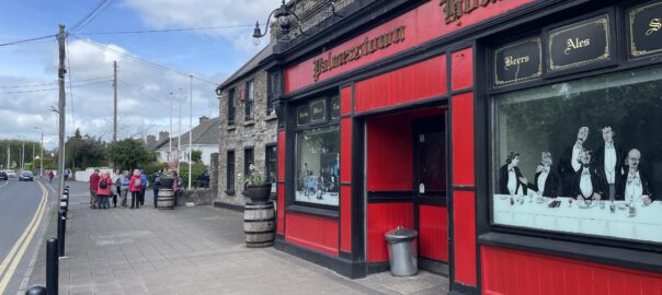
A quick change onto the C3 bus at Tara Street saw me speedily on my way to Palmerstown House (a pub, not a stately home) and I got there just as the clock was striking twelve. In perfect time for our noon start. I was pretty much the last to arrive so without further ado we set off for our walk around nearby Waterstown Park.
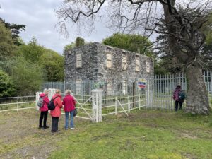
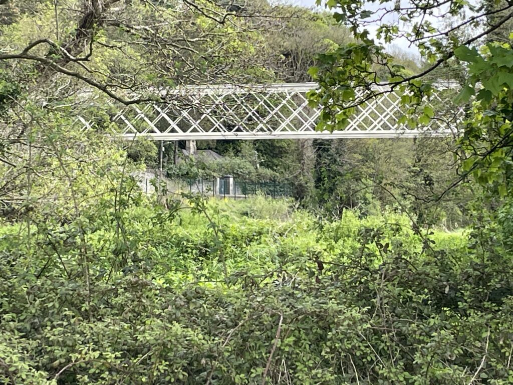
We’ve done this walk several times before and it has to be said that while it’s not the most spectacular of all the walks in Ireland, it’s relaxing, semi-rural and generally fairly quiet. We explored the whole of the pack, from end to and and top to bottom, then stopped for lunch at the picnic tables near the M50 Liffey flyover. En route, I was pleased to see that the Silver Bridge, built by the Guinness family in the 1870s to bring electricity and water supplies to their Farmleigh estate, had been repainted. But there’s still no word on a full restoration.
The weather was mild and pleasant, and there was no particular time pressure. So we lingered over lunch and spent a long time at the picnic tables generally chatting and putting the world to rights.
After lunch, we continued our wanderings and then somehow – perhaps not surprisingly – we all ended up in the pub, where we called it a day. After suitable refreshments (all the more enjoyable as I wasn’t driving) I said my goodbyes and retraced my steps to Malahide courtesy of a convenient C3 bus and waiting diesel at Connolly station.
I was back in the flat by 4:30, which just gave me time to finish the coffee which I hadn’t drunk at lunchtime, and to put a load of washing on. Then, once Val was back, we quickly headed out for a brisk walk round the demesne, after which we finished off the curry for dinner and enjoyed our beers to the accompaniment of “Mad Men”.
A nice, easy, day.
Today’s photos (click to enlarge)
 |
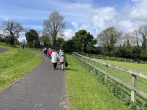 |
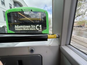
| On the bus heading to the Kennelsfort Road stop | In Waterstown Park |
 |
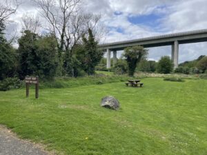 |
| The old semi-derelict “Harris” house at the eastern end of the park. There has been talk of fully restoring it and turning it into a café which would be linked in with a project to reopen the silver bridge. Sounds expensive and a bit fanciful to me, but nice to dream about | The M50 Liffey viaduct. We’ve driven over it so many times, and rarely given thought to what’s underneath it |
 |
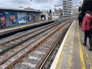 |
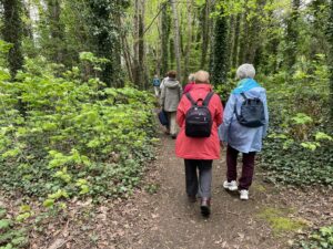
| There’s even a short section of woodland in the park which actually contains a proper footpath! | As a footnote – I was impressed with the new track laid a few weeks ago between Connolly and Tara Street – a massive improvement on the rather rickety lines that preceded it |
 |
|
| The Silver Bridge linking Waterstown to the Strawberry beds and Farmleigh. Recently repainted, so it looks a lot less dilapidated than it used to, but apparently no funding to restore it and open it to the public. Much less so the tunnel at the northern end, which goes to somewhere (unknown!) in the Farmleigh estate | |
Interactive map
(Elevations corrected at GPS Visualizer: Assign DEM elevation data to coordinates )
Max elevation: 47 m
Min elevation: 10 m
Total climbing: 79 m
Total descent: -79 m
Total time: 03:26:36
You can read earlier and later days’ blogs below
Previous day’s blog
Next day’s blog
Ireland home page
 Save as PDF