Ireland day 1362. Saturday 21 June 2025- Midsummer Tonelagee
| Today’s summary | Drove down to Glendasan to join a Walking Club group walk up the Brockaghs and Tonelagee. We had intended to go on to Turlough and Camaderry, as per the recce we did last, but nobody seemed much inclined. So we cut back from the Wicklow Gap to our cars parked at the Hero mine. A quick drive back via Blessington then pop pop curry for dinner. Picked up Val from the airport later on. | ||||
| Today’s weather | Warm dry and sunny. Occasional light southerly breeze, otherwise calm. Appx 22c | ||||
 |
 |
||||
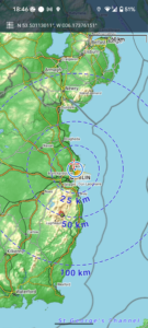
| Today’s overview location (The blue mark shows the location of our route) |
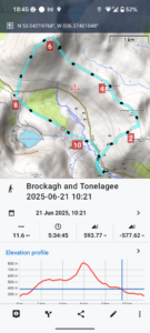
Close-up location (The blue line shows where we walked) (Click button below to download GPX of today’s walk as recorded, or see interactive map at bottom with elevations corrected): Midsummer Tonelagee |
||||
Commentary
I must admit I was in two minds as to whether or not to join today’s Club walk in the Wicklow mountains. It featured an ascent of Tonelagee and as I’d climbed it seven times recently, and as it’s not my favourite mountain anyway (on account of the generally-awful weather) I really wasn’t sure that I wanted to go. Not to mention that my back has been quite painful until only a couple of days ago, and I didn’t want to risk reigniting it again.
Anyway, when I woke up the sky was blue and the sun was shining – and it was midsummer – so I decided what the heck and I grabbed the packed lunch I’d bought yesterday and jumped in the car. Plus the fact that Val was still away and wasn’t there to point out the error of my ways.
In the end, I was quite glad I made the decision to go. The drives – both there and back – were not as busy as I had feared, and I used the time to catch up on a couple of news podcasts. The walk itself was of course very familiar – having done it only a week ago on the recce. But the ground was reasonably dry, which was nice, and the views were superb.
Once we got to the top of Tonelagee, after the steep pull up from the Brockagh whaleback, to my surprise there were several other people up there as well. On none of the previous seven visits do I think I have ever seen anyone else at all up there. Best of all, there was no wind, rain or fog and we were able to sit on the rocks and enjoy the view while eating our lunch by the trig point. A rare treat.
There was even a youngish chap who had just run up Tonelagee three times carrying 30 litres of water in his backpack. He told us he was training for a climb up Pik Lenina, a 7000m summit in Kyrgyzstan. It was to be his honeymoon, he told us. What an amazing experience.
Once back down at the Wicklow Gap there didn’t seem to be much enthusiasm for carrying on up Turlough and Camaderry, so we dropped back to the Hero mine car park, where we had left the cars, directly along St Kevin’s way.
As we had cut the walk short, I was back at the flat well before 6pm, which gave me plenty of time to reheat a pop pop curry for dinner and generally make myself look presentable. Then I tidied the flat a little, to remove any traces of bachelor squalor, and popped off to the airport to pick up Val from her return flight from London which landed at about 8:45pm.
It’s lovely to be back together again, and to start planning our next adventures !
Today’s photos (click to enlarge)
 |
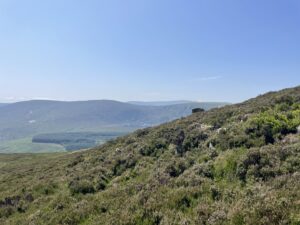 |
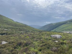
| Looking back down Glendasan from the climb up to the Brockaghs through the pathless heathery slope above the Hero mine | Starting the steep pull up from Brockagh to Tonelagee – looking south towards Lugnaquilla |
 |
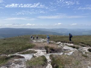 |
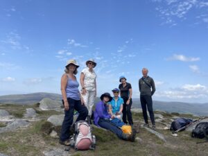
| On the top – all women in the Saturday group now, except me | Heading back down again to the Wicklow Gap – quite a few folk out today |
 |
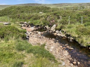 |
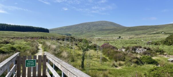
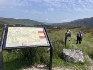
| At the start of St Kevin’s Way, near the Wicklow Gap car park | Looking for fish from the footbridge over the Glendasan River. Didn’t spot any! |
 |
|
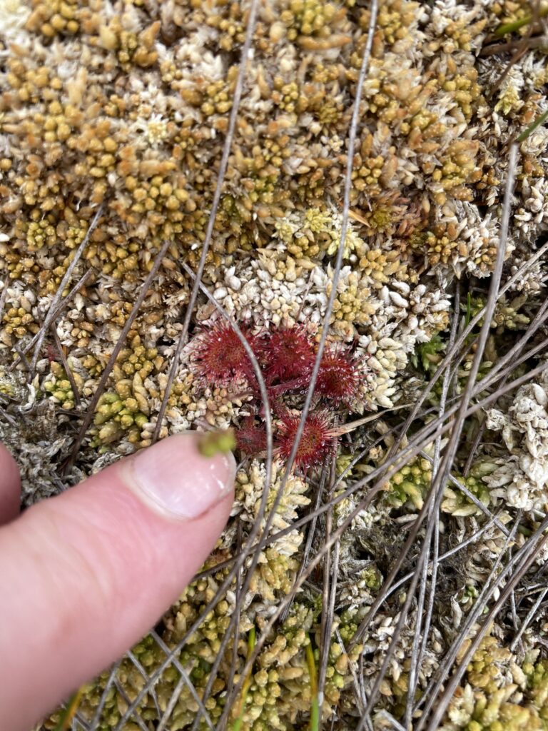
| Insects watch out! Sundews in abundance on the slopes of Brockagh | |
Interactive map
(Elevations corrected at GPS Visualizer: Assign DEM elevation data to coordinates )
Max elevation: 812 m
Min elevation: 276 m
Total climbing: 617 m
Total descent: -617 m
Total time: 05:34:45
You can read earlier and later days’ blogs below
Previous day’s blog
Next day’s blog
Ireland home page
 Save as PDF