Ireland day 1503. Sunday 09 November 2025- Port DWC
| Today’s summary | A decent sunny day so went to Clontarf Rd with Val to join the Walking Club for a noon stroll along the new Dublin Port Greenway. Walked out to then end and then back to the Applegreen service area for lunch. Caught the Dart back afterwards and we were in the flat again by 5pm. More Kerrigans beer and Netflix in the evening. | ||||
| Today’s weather | Mostly dry and sunny after overnight rain. Almost no wind. Appx 12c | ||||
 |
 |
||||
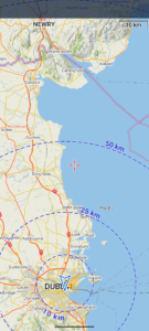
| Today’s overview location (The blue mark shows the location of our route) |
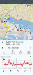
Close-up location (The blue line shows where we walked) (Click button below to download GPX of today’s walk as recorded, or see interactive map at bottom with elevations corrected): Dublin Port Greenway DWC |
||||
Commentary
After yet more rain overnight, the morning dawned bright and sunny, much like yesterday. As there was a Club walk going on just down the line from here, at Clontarf, joining the group seemed like an obvious way of making best use of the break in the weather.
We went through our usual morning routine, then caught a Dart at just after 11 am. The walk didn’t start till noon, so we had time to walk along the Clontarf promenade to Lott’s beforehand, to ogle at the exotic fruits and other delicacies on sale (if you can afford them).
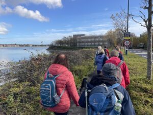
We met up with everyone else at the appointed time, close to the car park entrance on the “Down” line side of the station. There were fifteen of us in total, so a good sized group. The route today was a simple stroll on the new Dublin Port Greenway, which runs from Clontarf to the heart of the Dublin docks, along the south bank of the Dodder estuary.
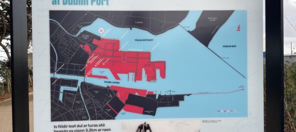
We’ve done this walk a couple of times in the past, but in both occasions it was raining, so it was nice to be able to enjoy the route in much better conditions today. It’s a very easy walk – completely flat and not very long – but there’s lots of interest to see along the way. Also, it’s an out-and-back pathway and at present there is no way of making it a loop without returning along the main port access road. Though I was interested to read on a sign at the end that the next stage of the greenway will be opening in 2026. We could see some diggers in operation on the shoreline, seemingly extending the route east from the current terminus, but quite how far the extension will go I don’t know.
So we made our way to the end then did a metaphorical back-flip to retrace our steps. We stopped halfway back, by the nearby Applegreen services, for refreshments and facilities for those that needed them. The rest of us had our sandwiches on the harbour wall. We even spotted a murmuration of starlings over towards Howth as we ate. Not seen one of those for many years, and it was a real treat (albeit too distant and too fleeting to photograph).
After lunch we completed the short last remaining stretch of the walk and said our goodbyes on the Clontarf Road. Val and I headed to the station and after a 20 minute wait, caught a Dart to Malahide. We were back in the flat by about 5pm.
Nobody reading this will be terribly surprised to learn that the evening was spent in similar fashion to many others in the recent past. There are only so many permutations of beer, Kerrigans and Netflix that you can make and today we enjoyed all three in equal measure. A good way to end a good day.
Today’s photos (click to enlarge)
 |
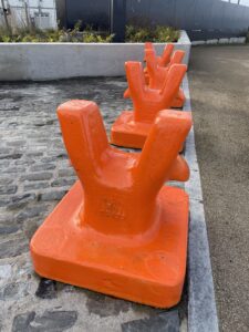 |
| At the start of the greenway, near the Alfie Byrne Road | There are lots of items of interest like this along the route. These huge cast iron bits of metalwork were presumably mooring bollards from somewhere along the former harbourside |
 |
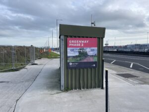 |
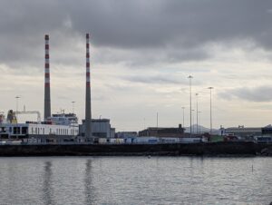
| Yes its those iconic chimneys again, on the other side of the Liffey | Optimistic sign at the end of the current greenway. I don’t know how far the extension will go, though |
 |
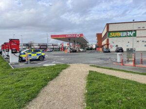 |
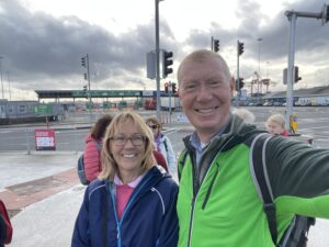
| Looking chipper, with the ferry terminal behind us | Lovely Applegreen service station – but they do do a decent cup of coffee, I remember from the last time we were here |
 |
|
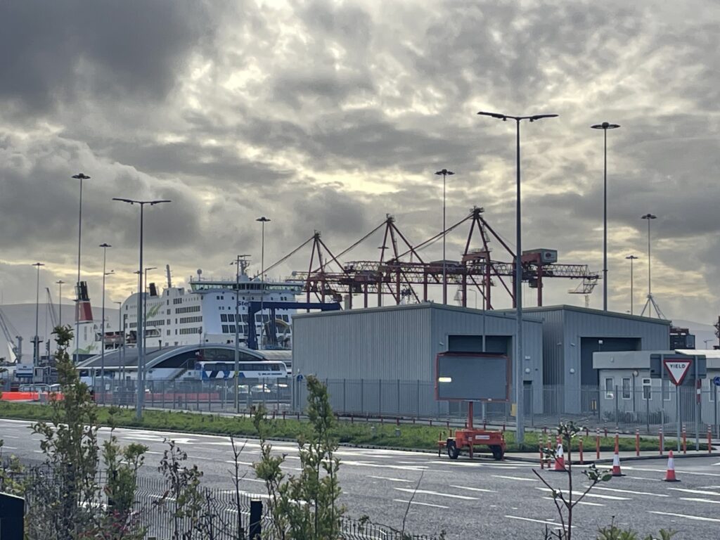
| Stena Adventurer loading up prior to a hopefully not-too-adventurous voyage across the Irish Sea | |
Interactive map
(Elevations corrected at GPS Visualizer: Assign DEM elevation data to coordinates )
Max elevation: 10 m
Min elevation: 0 m
Total climbing: 108 m
Total descent: -108 m
Total time: 04:36:09
You can read earlier and later days’ blogs below
Previous day’s blog
Next day’s blog
Ireland home page
 Save as PDF