
Ireland day 1404. Saturday 02 August 2025- Doolin DWC Day 1
| Today’s summary | After a night in Doolin, drove to Fanore and the group of us did a good long loop walk round Black Head and up Gleninagh Mountain. Fabulous karstic limestone scenery and amazing plants. A plant lover’s paradise. Started to rain at the end but we didn’t get too wet. Dinner in O’Donohue’s pub as it poured down outside | ||||
| Today’s weather | Cloudy but dry and bright most of the day, with moderate rain in the evening. Strong south westerly wind. Appx 18c | ||||
 |
 |
||||
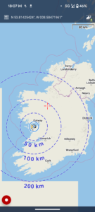
| Today’s overview location (The blue mark shows the location of our route) |
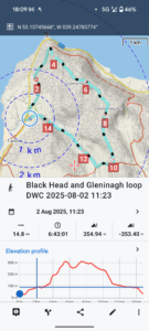
Close-up location (The blue line shows where we walked) (Click button below to download GPX of today’s walk as recorded, or see interactive map at bottom with elevations corrected): Black Head and Gleninagh Mountain loop DWC |
||||
Commentary
Today we went on a fantastic walk. One of Ireland’s Best – and certainly one I’d been wanting to do for some time.
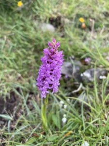
As soon as we were all up and breakfasted, we set off in a couple of cars towards Fanore, where we parked up near the church. From there, we went on a decent-length clockwise circular walk round Black Head, then directly up to the two summit(s) of Gleninagh Mountain. It’s a fabulous hill. A solid limestone edifice, composed of tiered layers of karstic limestone, with great slabs of limestone pavement inbetween. And the flora is diverse and unique. Mountain Avens (Dryas octapetala), fragrant orchids, harebells, yellow rattle, and a myriad more. Fantastic.
We had lunch in the lee of the west summit, Doughbranneen (314m) before skirting the giant sink hole (you have to examine the concentric contour lines on the map to realise that it is a hole not a hill) and on to the east summit of Gleninagh itself (316m). The contrast with the boggy Wicklow hills couldn’t be greater. Here, all is iron-hard limestone which is almost concrete-like in parts. The biggest hazard is twisting a limb in one of the clints and grikes. Fortunately we all escaped unscathed though we did have to walk very slowly to avoid mishaps.
We eventually made it over to intercept the Burren Way near a large cashel (stone-walled enclosure) and dropped down to the road at the so-called Khyber Pass. Apparently it was named by the policeman who used to live in the big white house at the end of the road, who thought the area resembled the real-life Khyber, where he had served in the military. From the point where we met the road back to the parked cars was only about 3km, and we completed this last stage of the loop walk quite quickly. Which was fortunate as by that point it had started to rain – and it continued to come down enthusiastically for most of the rest of the evening.
Once out of our wet things, we drove the short distance back into Fanore-proper, and had dinner at O’Donohue’s pub (one of our group had cunningly booked a table in advance – essential as it is pretty busy here at the moment on account of the Bank Holiday on Monday). In view of the weather, we sought the warm comforts of the pub, rather than going swimming, as had been our original plan.
We were back in the cottage by about 9pm, ready for a relaxing cup of tea, reflecting on an excellent day, and giving ourselves a few moments to start planning for tomorrow. What a day!
Today’s photos (click to enlarge)
 |
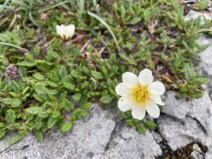 |
| Common Fragrant Orchid (Gymnadenia conoposea) | Mountain Avens (Dryas octapetala) – a sure sign of harsh growing conditions |
 |
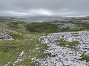 |
| Rugged mountain explorer negotiating the clints and grikes | Sink hol (about 30 m deep) between the two summits |
 |
 |
| Wild goats eyeing us up suspiciously from afar, on the way back down to the Khyber Pass road | O’Donohue’s, enjoying a traditional Irish evening |
 |
|
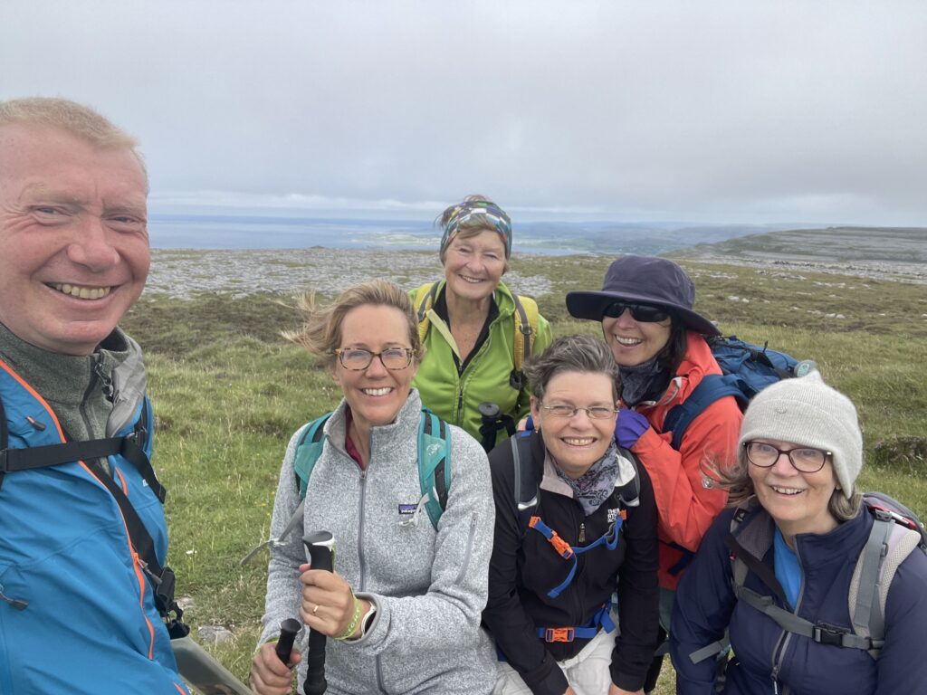
| Happy faces on the top of Gleninagh Mountain | |
Interactive map
(Elevations corrected at GPS Visualizer: Assign DEM elevation data to coordinates )
Max elevation: 311 m
Min elevation: 23 m
Total climbing: 417 m
Total descent: -417 m
Total time: 06:43:01
You can read earlier and later days’ blogs below
Previous day’s blog
Next day’s blog
Ireland home page
 Save as PDF