Ireland day 1390. Saturday 19 July 2025- Conavalla Leading
| Today’s summary | An early start to be at Barravore car park by 10am, to lead today’s Club walk round Glenmalure. There were just four of us on the walk and we made good progress round the circular route. We took in Table Mountain, the air crash site, and Conavalla. Enjoyed it much more than when I did the recce. Finished just before 5pm and drove straight back to Malahide. Pop pop Chinese meal for dinner then drove to the airport to collect Val from her return flight from London | ||||
| Today’s weather | Overcast with occasional light drizzle and some sun. Light south easterly wind. Appx 16c | ||||
 |
 |
||||
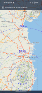
| Today’s overview location (The blue mark shows the location of our route) |
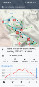
Close-up location (The blue line shows where we walked) (Click button below to download GPX of today’s walk as recorded, or see interactive map at bottom with elevations corrected): Table Mountain Air Crash and Conavalla leading |
||||
Commentary
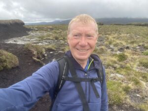
Today was, in essence, a re-run of last Saturday. I had agreed to lead a circular Club walk in Glenmalure and whereas last weekend it was just me walking it on the recce, today it was the real thing and I was responsible for getting the party safely round.
As the agreed meeting time was 10am, in the Barravore car park, an early start was called for as it’s quite a long drive. So I was away from Malahide by 8am.
In the end, there were only four of us on the walk – which is actually a good size as it’s sociable without being unmanageable. We followed exactly the same route as I’d recced, except that I avoided the shortcut into the Avonbeg valley at the end, as I deemed it too hazardous. The route ended up being 1.5km longer than last time, but the extra distance was worth it to reduce the risk.
The walk was straightforward, despite it being quite a lot wetter underfoot than last time, as a result of the last few days’ rain. I also enjoyed it very much more today than the previous Saturday. I’m not quite sure why, but it’s probably to do with the illness I’d had just before doing the recce – I feel like I’m over than now and energy levels are more or less back to normal.
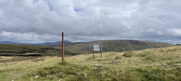
We had lunch at the top of the Table track before heading off into the wilderness of Table mountain itself. We dropped down from the “summit” (such as it is) and managed to locate the air crash site without difficulty.
From there we traversed round the head of the valley then picked a fairly peat hag-free route to the top of Conavalla. We paused there for the second instalment of lunch before pressing on, keen to move before the cloud and rain which was slowly enveloping Lugnaquilla reached us with it’s soaking tentacles.
On the way down, we saw numerous deer (which barked and whistled quite vocally as we approached) and passed quite close to a large herd of wild goats. Some of which were sporting alarmingly impressive horns.
Despite missing the shortcut, we made good progress down the valley and were soon at the Youth Hostel. There were far fewer people about than last time, which meant Glenmalure was pleasantly quiet. The disappointing piles of rubbish left behind by last week’s campers were sadly in evidence. I wish people didn’t have to be so messy.
We were back at the cars by about 5pm. So we said our goodbyes and I was soon speeding on my way back to Malahide, with a couple of podcasts to accompany me. Once in the flat again, it was a fairly quick turnaround to get my hiking gear unpacked and out to dry, and to heat up a pop-pop Chinese meal for dinner (I was hungry!), all before setting out again at 8:30pm to collect Val from the airport.
A great day all round, and I was so relieved that I’d recovered my strength compared to last Saturday’s rather grim nadir.
Today’s photos (click to enlarge)
 |
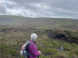 |
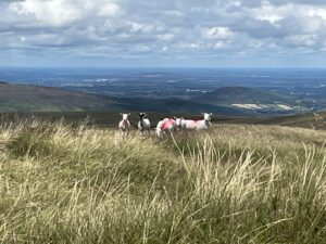
| A few sheep wandered over to take a look at us as we were having our lunch. They disappeared as soon as we set off again | Surveying the wilderness between us on the slopes of Conavalla and Lugnaquilla, on the far horizon |
 |
 |
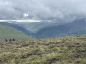
| A lofty view down into Glenmalure from the final descent | Sheltering behind one of the many peat hags that litter the tops |
 |
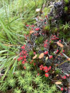 |
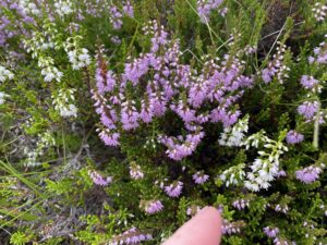
| I’m not sure I’ve ever seen white heather growing in the wild before. There was a small clone of it just in this one spot, and it was quite striking | A colourful clump of Cladonia (Devil’s Matchsticks) growing in one of the marshy areas on the lower slopes above Glenmalure |
 |
|
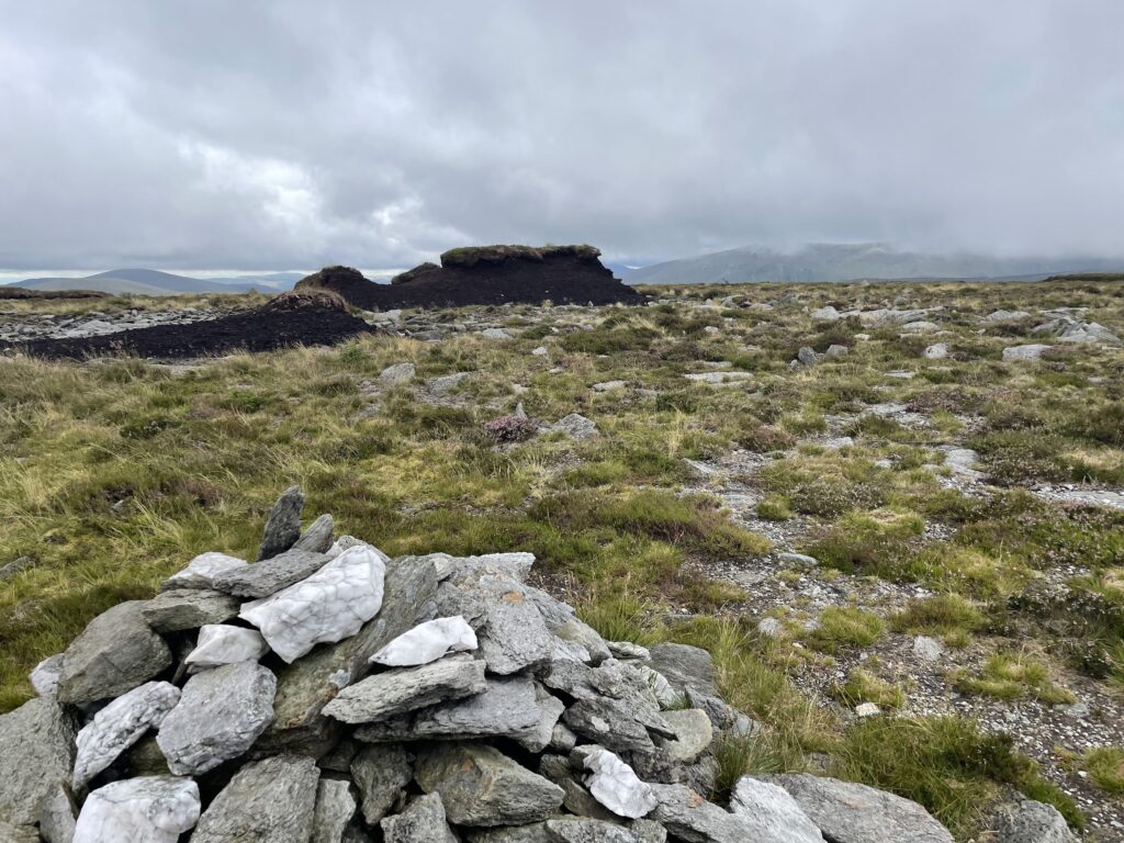
| The summit of Conavalla. A modest cairn and a few peat hags – and not a lot else. It’s not one of Wicklow’s most visited mountains but I really like it because it’s so bleak and deserted | |
Interactive map
(Elevations corrected at GPS Visualizer: Assign DEM elevation data to coordinates )
Max elevation: 734 m
Min elevation: 163 m
Total climbing: 829 m
Total descent: -829 m
Total time: 06:36:02
You can read earlier and later days’ blogs below
Previous day’s blog
Next day’s blog
Ireland home page
 Save as PDF