Ireland day 0998. Saturday 22 June 2024- Lugnaquilla 5
| Today’s summary | Made an early start to drive down to Glenmalure to hike up Lugnaquilla (for the fifth time in three years) but this time up via the Fraughan Rock Glen and back down via Arts Lough (since the zigzag route closed). A good long hike and a superb day out. | ||||
| Today’s weather | Sunny and bright until mid afternoon, then clouded over. Moderate southerly wind. Appx 17c (but much colder and windier on top, requiring fleeces, hats and gloves). | ||||
 |
 |
||||
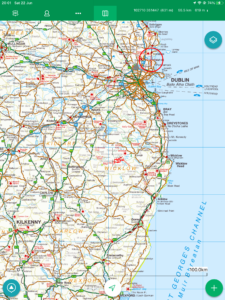
| Today’s overview location (The red mark shows the location of our route) |
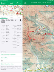
Close-up location (The red line shows where we walked) (Click button below to download GPX of today’s walk as recorded, or see interactive map at bottom with elevations corrected): Lugnaquilla 5 Fraughan DWC |
||||
Commentary
(Summary blog only. Last full blog was Day 0368).
Well in a nutshell, today was superb.
After an early reveille, we packed our bags, gathered our sandwiches and were on the road by 8:15, heading south in the car to Glenmalure for this week’s “long” Club walk.
Our destination today was Lugnaquilla, Leinster’s highest peak (and if it were in Scotland it would just qualify as a “Munro”). It was our fifth ascent in three years, though today we had to make use of an new, alternative, route, up the Fraughan Rock Glen and back down via Arts Lough. This was needed because “normal” route up from Glenmalure, via the zigzag path, has been closed.
As it turned out, it was a brilliant choice of route. The Fraughan Rock Glen was superb, with excellent examples of recent glaciation. And the way back via Arts Lough afforded fantastic views over Glenmalure from a perspective that I’d never seen before.
Because it was a one way walk and not a full loop, a bit of car shuttling was required at the start and end, but it was well worthwhile. The weather co-operated too, with clear blue skies much of the way, not too cold, and just enough wind to keep the midges away.
So we all really enjoyed the outing today, and we rounded it off perfectly with tea and Taytos in the Glenmalure Lodge at the end. A straightforward but quite long drive back to Malahide saw us in the flat by 8pm – almost a full twelve hours since we left. Time for a cup of tea now, and an early night to rest the weary limbs!
Today’s photos (click to enlarge)
 |
 |
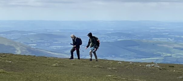
| Looking down into the Fraughan Rock Glen – a beautiful post-glacial landscape | With the group on the bleak plateau between the top of the Glen, and Lugnaquilla summit itself |
 |
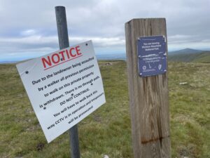 |
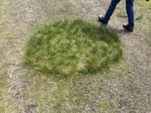
| Lots of these peculiar circular grassy features on the plateau | Slightly depressing explanation of why the Zigzag path is closed. You’ll have to enlarge it and read it for yourselves |
 |
 |
| Looking down on Arts Lough – an absolutely lovely spot and I’d never seen it before | A charming water-feature in the woods on the way back down below Arts Lough |
 |
|
| On the top! Didn’t last long in just a t-shirt – it rapidly got chilly once we stopped for lunch | |
Interactive map
(Elevations corrected at GPS Visualizer: Assign DEM elevation data to coordinates )
Max elevation: 924 m
Min elevation: 135 m
Total climbing: 942 m
Total descent: -965 m
Total time: 06:37:10
You can read earlier and later days’ blogs below
Previous day’s blog
Next day’s blog
Ireland home page
 Save as PDF