Ireland day 1376. Saturday 05 July 2025- Clonmacnoise
| Today’s summary | Drove out to mid-Offaly to visit the Clonmacnoise monastic site. Founded about 1500 years ago at the intersection of the Shannon river and the Pilgrims esker- both major communication and transport route. Had a good look round then went to nearby Shannonbridge to inspect the bridge and get a cup of tea before coming home. Marks and Spencer pop pop meal for dinner. | ||||
| Today’s weather | Cool, grey and very windy with just a few spots of rain. Strong to gale force westerly wind. Appx 19c | ||||
 |
 |
||||
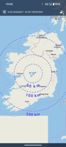
| Today’s overview location (The blue mark shows the location of our route) |
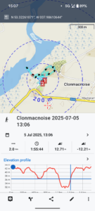
Close-up location (The blue line shows where we walked) (Click button below to download GPX of today’s walk as recorded, or see interactive map at bottom with elevations corrected): Clonmacnoise |
||||
Commentary
Ireland has numerous historic sites – some dating back thousands of years – dotted around over the whole island. We have been to a fair few of them but one particularly well known one – Clonmacnoise- had until today remained un-visited.
So, as I am having a bit of a break from major mountain-climbing until I know what is going on in my hip, I decided to skip today’s Club hike to Lugnaquilla (it would have been at least my seventh ascent) and drive out to take a look at Clonmacnoise instead.
But first thing this morning, before we had really had time to emerge from sleep it seemed, Val was up and out, doing a park run (she came second in her age category, and achieved a personal best at 29m47s, which she was pretty pleased with). Once that was done and we’d had a cup of coffee we set out on our journey west.
The monastic site is slap-bang in the middle of Ireland, just south of Athlone, in County Offaly. It is situated where the Pilgrims Road – which runs east-west across Ireland along the top of an ancient glacial esker – crosses the Shannon river, which runs north south at that point. Two major transport and communication routes – and an ideal spot for a monastery.
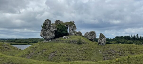
The first buildings were probably wooden and erected in the early sixth century. They were replaced by the succession of stone buildings, now mostly ruined, that are nowadays scattered over the site. The monasteries seemingly thrived for about 250 years before 800 years of successive Viking, Irish, Anglo Norman and English raiders finally damaged it irreparably.
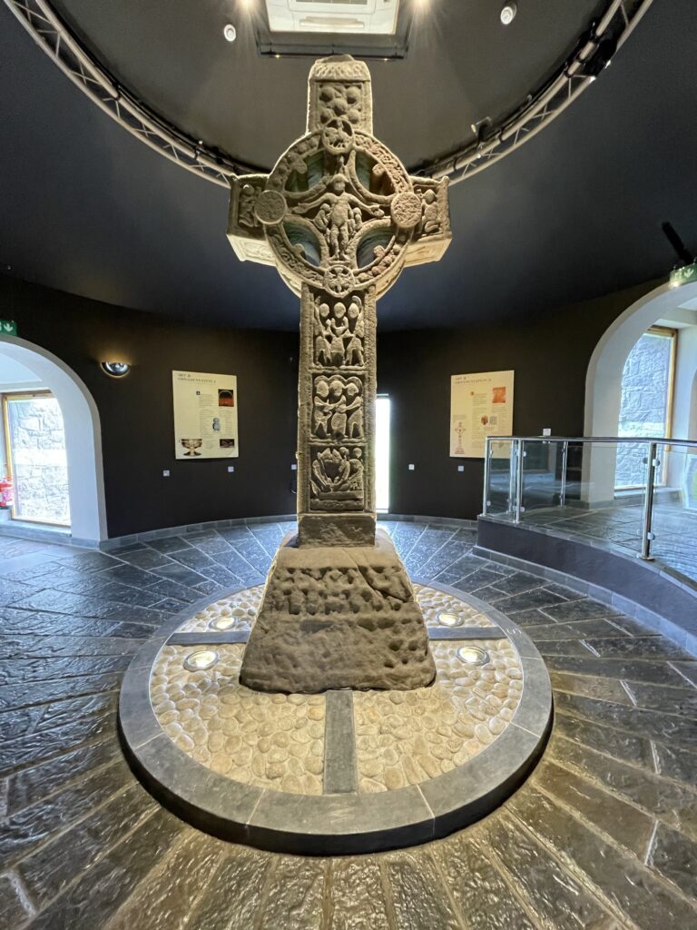
It’s managed by the OPW so of course it’s well done. There’s an interesting visitor centre (housing three Celtic crosses which have been moved indoors for protection) but the café is sadly closed this year.
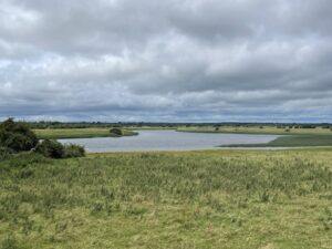
The site feels remote. When you look down to the river, you can’t really see any signs of human habitation at all. And in the other direction, the low silhouette of the esker obscures views of the distant horizon. If there was any such thing as “Ireland Profonde”, as there is in France, it would be here.
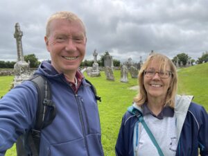
We spent a couple of hours looking around, then eventually managed to find a sheltered corner out of the wind where we could hunker down and enjoy the packed lunch we had brought with us.
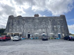
After we had eaten it felt too soon to drive back Dublin-wards, so instead we drove a few km downriver as far as the small town of Shannonbridge. We stopped here to look at the eponymous – and impressive – river crossing and to enjoy some refreshments in the café housed in the old military fort.
From there, it didn’t take long to drive back to the M6 and start the journey east. It took about an hour and three quarters of very easy driving to return, and we used the time to catch up on some of our favourite podcasts.
En route we stopped at the Swords Applegreen petrol station to fill up the tank and also to get a pop pop meal from the on-site Marks and Spencer.
We are back in Malahide now where, curiously (but perhaps actually not in view of the Irish audience) the all-Ireland hurling semi-final from Croke Park is replacing Wimbledon on the TV (Cork won, by the way, beating Dublin 7-26 to 2-21).
The pop pop dinner is in the oven, and we are relaxing with some crisps and a glass of red wine while it heats up. What a fascinating day in this land of a thousand fascinations.
Today’s photos (click to enlarge)
 |
 |
| On site – with bright green grass! | General overview of the site, with one of the two round-towers keeping watch on it all |
 |
 |
| Looking over the Shannon river cluane (water-meadows, or “callows” in English) from which Clonmacnoise gets its name. The vista stretches seemingly for ever with no signs of human habitation | Shannonbridge. It was constructed in 1757, with surrounding fortifications added around 1810, in view of the continued worry about Napoleonic invasion |
 |
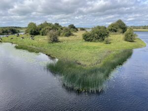 |
| The old Military Fort on the west bank of the river at Shannonbridge. Nowadays, it houses a café | Looking north, upstream, from Shannonbridge, to the Long Island |
 |
|
| Centuries-old Celtic Cross, now safely housed in the Clonmacnoise visitor centre | |
Interactive map
(Elevations corrected at GPS Visualizer: Assign DEM elevation data to coordinates )
Max elevation: 43 m
Min elevation: 31 m
Total climbing: 31 m
Total descent: -30 m
Total time: 01:55:44
You can read earlier and later days’ blogs below
Previous day’s blog
Next day’s blog
Ireland home page
 Save as PDF