Ireland day 0494. Saturday 04 February 2023- Belmont2
| Today’s summary | Walked with the DWC from Bray to the Little Sugarloaf and back via the Belmont estate. Excellent day out with fine weather except at the end. Took the DART both ways from Malahide to Bray and back | ||||
| Today’s weather | Dry and bright with high cloud and occasional glimpses of sun, until late afternoon when heavy cloud rolled in and it started to rain. Light north westerly wind. Appx 10C | ||||
 |
 |
||||
| Today’s overview location (The blue mark shows the location of our route) |
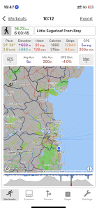
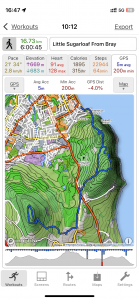
Close-up location (The blue line shows where we walked) (Click button below to download GPX of today’s walk as recorded, or see interactive map at bottom with elevations corrected): Bray Belmont Little Sugarloaf DWC |
||||
Commentary
(Summary blog only. Last full blog was Day 0368).
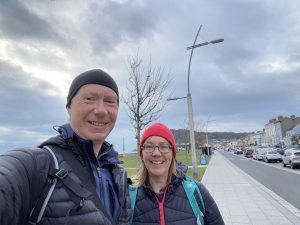
Another outing with the Dublin Walking Club today. We got up early (for us) and caught the 0818 DART from Malahide right down to Bray, where we joined the rest of the group.
Today’s route was mainly a re-run of the out-and-round walk we did across the Belmont Estate back last October, although we had to divert slightly at the start as the Bray to Greystones path has been totally closed because of a second landslide, meaning we had to divert straight up to the top of Bray Head.
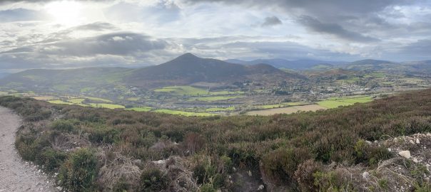
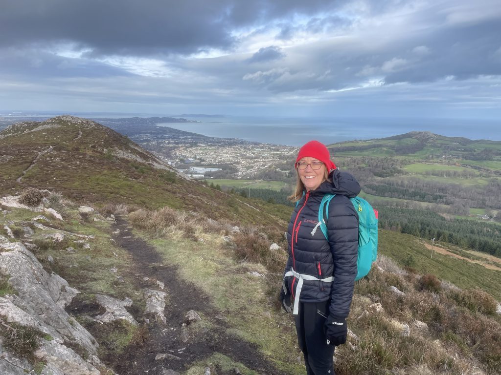
Apart from the last five minutes of the walk when it rained a bit, we had excellent weather – dry with high cloud and expansive views, and very little wind (except on the top of Little Sugarloaf, which always attracts a gale, irrespective of what the weather is like anywhere else). Great views (as seen in the featured image at the top) west over to the Great Sugarloaf and the Dublin Mountains. A thoroughly enjoyable walk as usual – and I think the Little Sugarloaf is rapidly becoming one of my favourite summits in Ireland. Though I think Val and I have concluded that the chatting is almost as exhausting as the walking.
At the end, as it was raining, we headed straight back to Bray station, where we didn’t have to wait too long for a DART to whisk us back to Malahide. What a great day out! And now it’s time for a beer.
Today’s photos (click to enlarge)
 |
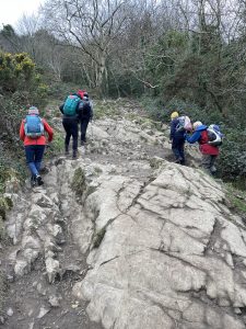 |
| Leaving Bray this morning. I’m sure it’s this hat that makes my face look fat. | Scrambling up to Bray Head. It’s steep but you do get up quickly |
 |
 |
| Crocuses spotted growing in the verge by the road to the Belmont Estate. Incredibly early | Approaching the top of Bray Head. Not many people about today, which was actually quite unusual |
 |
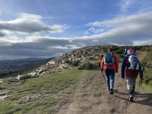 |
| Looking south towards Wicklow Head from the Bray Head ridge | Striding out on the Carriage Road |
 |
|
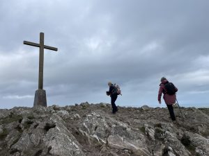
| Val on the top of the Little Sugarloaf. I love the views from up here. | |
Interactive map
(Elevations corrected at GPS Visualizer: Assign DEM elevation data to coordinates )
Max elevation: 327 m
Min elevation: 1 m
Total climbing: 739 m
Total descent: -737 m
Total time: 06:00:38
You can read earlier and later days’ blogs below
Previous day’s blog
Next day’s blog
Ireland home page
 Save as PDF