Ireland day 0477. Wednesday 18 January 2023- Glen Of The Downs
| Today’s summary | Joined a few DWC friends to recce a walk in the Glen of the Downs. Very interesting walk and the Octagon was an interesting discovery. Refreshments in the Glenview Hotel at the start and the end | ||||
| Today’s weather | Cold, dry and bright again. Moderate to strong westerly wind. Appx 3C | ||||
 |
 |
||||
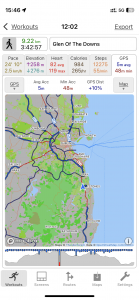
| Today’s overview location (The blue mark shows the location of our route) |
Close-up location (The blue line shows where we walked) (Click button below to download GPX of today’s walk as recorded, or see interactive map at bottom with elevations corrected): Glen of The Downs DWC recce |
||||
Commentary
(Summary blog only. Last full blog was Day 0368).
A semi-spontaneous day out today, as I was invited to join a recce walk with a few DWC friends, for a hike which is happening a week on Sunday.
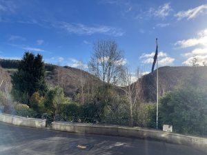
Today we visited the Glen Of The Downs, which is a striking, steep-sided valley, carved out of solid quartzite by glacial meltwater at the end of one of the ice ages. It’s less than an hour outside Dublin, and there is some good walking in its wooded slopes. But despite these attractions I’d never been before today. We started (and finished!) with refreshments in the Glenview Hotel, just off the N11 dual carriageway.
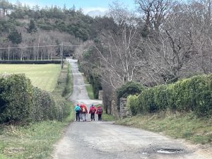
The walk itself was straightforward and interesting, though quite chilly. We searched unsuccessfully for the iron age fort which is said to be located near the top of the Kindlestown Hill – though it’s not clear if it actually exists at all. But we did manage to find The Octagon – a ruinous but still impressive 18th century folly overlooking the steepest section of the Glen itself.
From there it was a quick walk back to the cars at the hotel, and then on to Dublin to reflect on a successful and wholly enjoyable day out.
Today’s photos (click to enlarge)
 |
 |
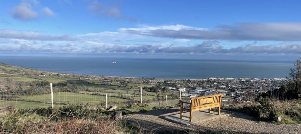
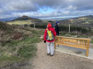
| Setting out from Glenview Hotel. the Glen Of The Downs is the obvious cleft in the hills beyond the trees | Heading over to Kindlestown Hill (Coolagad) in search of the Iron Age hill fort |
 |
 |
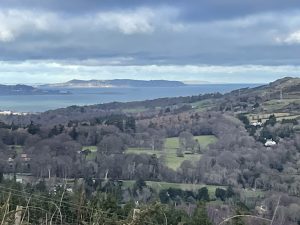
| From the top of the hill, looking north to Killiney Hill and Dalkey island (left), Howth head (centre) and Lambay island (centre right, horizon) | Searching for the hill fort – to no avail. |
 |
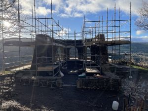 |
| Lots of bright sunshine for most of the day today. Took the edge off the bitter wind | The Octagon – an 18th century folly, and a legacy of the La Touche estate. It enjoys a commanding position overlooking the Glen of the Downs and is now having a bit of a face-lift, following decades of neglect and vandalisation |
 |
|
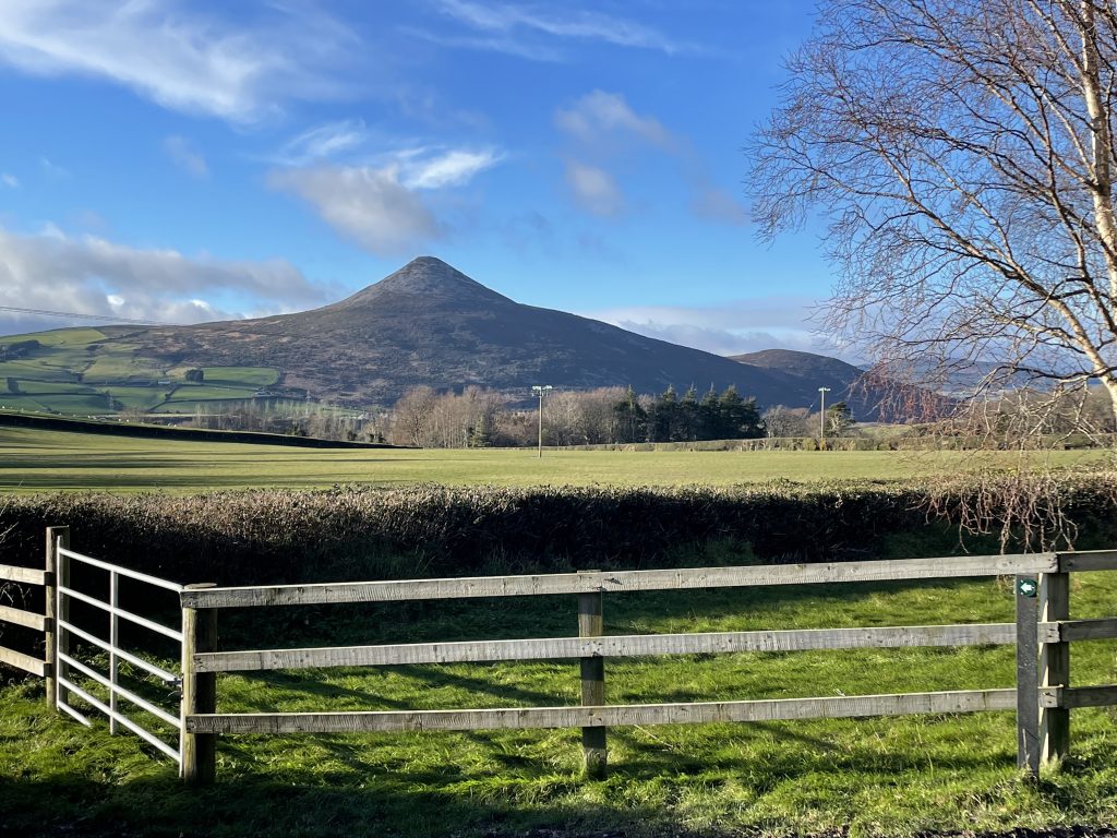
| The Great Sugarloaf from the slopes of Kindlestown Wood, looking perfect in its conical symmetry | |
Interactive map
(Elevations corrected at GPS Visualizer: Assign DEM elevation data to coordinates )
Max elevation: 219 m
Min elevation: 98 m
Total climbing: 372 m
Total descent: -371 m
Total time: 03:42:22
You can read earlier and later days’ blogs below
Previous day’s blog
Next day’s blog
Ireland home page
 Save as PDF