Ireland day 0466. Saturday 07 January 2023- Two Rock DWC
| Today’s summary | Val was working at the museum and I went for a Club walk in the Dublin Mountains from Stepaside. An excellent walk. Did some shopping at Swords Tesco on the way back and had Lough Avalla beef for dinner with Val in the evening | ||||
| Today’s weather | Mostly bright, sunny and dry, though some cloudy intervals with a few drops of rain. Heavy shower in the evening. Strong to gale force south westerly wind. Appx 8C | ||||
 |
 |
||||
| Today’s overview location (The blue mark shows the location of our route) |
Close-up location (The green line shows where we walked) (Click button below to download GPX of today’s walk as recorded, or see interactive map at bottom with elevations corrected): Two Rock DWC |
||||
Commentary
(Summary blog only. Last full blog was Day 0368).
We got up reasonably early this morning – which was a bit surprising since we were both feeling a bit thick-headed from our evenings out last night – Val at Gibneys with Wonderlights colleagues and me at the Cobblestone for the trad night.
She heroically had work today and I was out by 9 to drive down to Stepaside to join a “long” club walk in the Dublin mountains around Two Rock. I’d never been to this part of the mountains before and I thoroughly enjoyed it. Especially as the clear weather meant the views were excellent. It was my longest walk of the year and in testament to holiday season inertia and over-indulgence, I felt quite tired by the end.
Stopped in at Tesco in Swords for some shopping on the way back to Malahide then joined Val for a delicious roast beef dinner which she had magically rustled up. Using the as ever-delicious Lough Avalla beef.
Today’s photos (click to enlarge)
 |
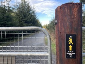 |
| At the top of Three Rock (Three Rock is actually a mini-summit on the way up to the top of Two Rock. It’s where all the TV transmitter masts are | We followed the Dublin Mountains Way for quite a lot of the walk – would like to do the whole thing one day |
 |
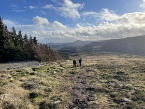 |
| he Ballyedmonduff megalithic wedge tomb. Built about 1800BC | Lonely figures on the final pull to the top of Two Rock |
 |
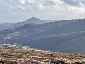 |
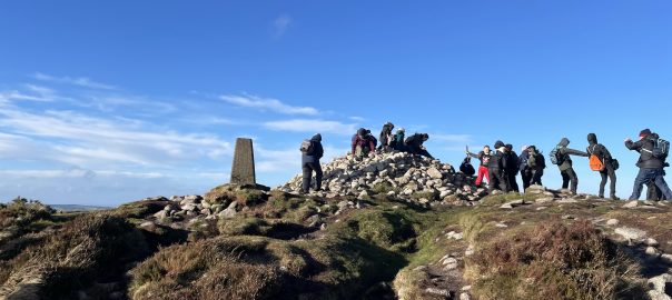
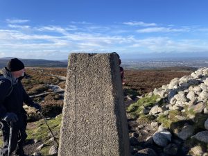
| At the top of Two Rock. It was teeming with visitors when we were there. I think the summit cairn and trig point are collectively know as “Fairy Castle” | Looking back on the Great Sugarloaf from the summit of Two Rock |
 |
|
| It looks warm and sunny – and while it was sunny it definitely wasn’t warm. Not a shred of protection from the gale force wind for miles in any direction | |
Interactive map
(Elevations corrected at GPS Visualizer: Assign DEM elevation data to coordinates )
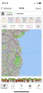
Max elevation: 533 m
Min elevation: 158 m
Total climbing: 714 m
Total descent: -714 m
Total time: 05:55:25
You can read earlier and later days’ blogs below
Previous day’s blog
Next day’s blog
Ireland home page
 Save as PDF