Ireland day 0437. Friday 09 December 2022- Snowy
| Today’s summary | Val had a double museum + castle shift today. A bit of snow last night and low temperatures made Malahide feel quite christmassy. I went to the gym while Val was at work then made Lough Avalla roast beef for dinner which we had inbetween Val’s shifts | ||||
| Today’s weather | Dry clear and sunny all day with snow and ice underfoot. Light westerly wind. Appx 2C. | ||||
 |
 |
||||
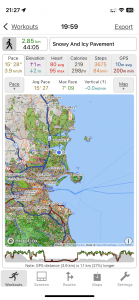
| Today’s overview location (The blue mark shows the location of my route) |
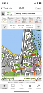
Close-up location (The green line shows where I walked) (Click button below to download GPX of today’s walk as recorded, or see interactive map at bottom with elevations corrected): Snow and ice in Malahide |
||||
Commentary
(Summary blog only. Last full blog was Day 0368).
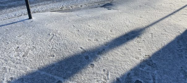
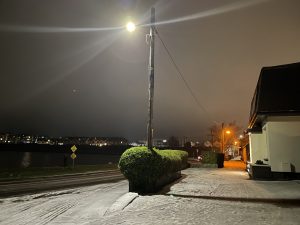
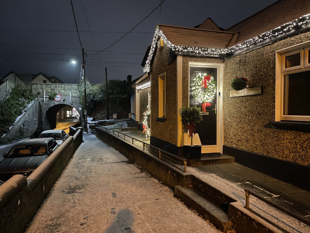
I was woken up this morning by strange flashes of light coming through the blind in the bedroom window. For I while I couldn’t work out what it was then I wondered if it was coming from the overhead power lines on the DART. I remembered from back in the UK that you sometimes get arcing to the train pantograph if the cable is iced up. So I wasn’t surprised when I looked out of the window and discovered that a thin layer of icy snow had fallen during the night, and so for a brief few hours this morning, Malahide looked quite Christmassy.
It’s obviously quite a rare thing here – being so coastal and temperate in climate it’s rarely even frosty – meaning the roads and pavements hadn’t been gritted and cars and pedestrians were sliding about all over the place. Nevertheless, while Val was at work in the museum, I first of all had another video call with a friend in the UK then pottered down to the gym for a few exercises in the torture chamber, then a swim, then a very welcome opportunity to warm up in the sauna.
I made dinner (the last of the Lough Avalla roast beef which was absolutely superb) then Val was back off to work for the evening up the castle. I hope she manages to keep warm.
Today’s photos (click to enlarge)
 |
 |
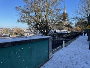
| St Sylvester’s church from the railway bridge – magnificent blue sky almost all day today | Down by the lagoon this evening. The snow barely melted at all today |
 |
|
| Looking Christmassy on the Coast Road tonight | |
Interactive map
(Elevations corrected at GPS Visualizer: Assign DEM elevation data to coordinates )
Max elevation: 16 m
Min elevation: 1 m
Total climbing: 40 m
Total descent: -40 m
Total time: 00:43:56
You can read earlier and later days’ blogs below
Previous day’s blog
Next day’s blog
Ireland home page
 Save as PDF