Ireland day 0432. Sunday 04 December 2022- Vartry2 DWC
| Today’s summary | Val had a day at the flat before working at Wonderlights in the evening. I drove down to Roundwood for a walk round the upper Vartry reservoirs. Finished up at the pub in Roundwood then drove home. A good day out and fortunately we dodged most of the showers | ||||
| Today’s weather | Cool and blustery with occasional torrential haily downpours. A few seconds of sun but mostly heavily overcast. Moderate to strong easterly wind. Appx. 7C | ||||
 |
 |
||||
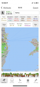
| Today’s overview location (The blue mark shows the location of our route) |
Close-up location (The green line shows where we walked) (Click button below to download GPX of today’s walk as recorded, or see interactive map at bottom with elevations corrected): Vartry upper lakes circuit |
||||
Commentary
(Summary blog only. Last full blog was Day 0368).
Val had a day off the Museum but was working in the evening so decided to have a relaxing day at home.
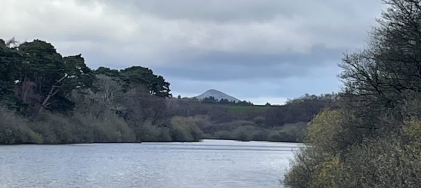
I had an outing planned with the walking club so drove down to Clongriffin to pick up two friends then we lift shared down to Roundwood for a walk around the upper Vartry reservoirs.
It was a very easy but enjoyable and interesting walk, and the lakes themselves were very much fuller than when we last did the walk, almost exactly a year ago. We got hit by one heavy hailstorm but seemed to miss the worst of the downpours, fortunately. We returned to Roundwood at the end for quick refreshments (in my case soup and tea) in the Coach House pub.
By the time we finished it was fully dark and so we beat a retreat to Dublin in the pouring rain. Hopefully Val’s not getting too wet at Wonderlights.
Today’s photos (click to enlarge)
 |
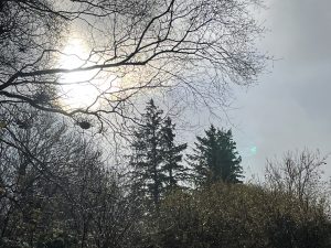 |
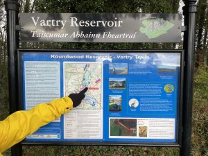
| Pointing out our route | A watery sun broke through for a few seconds this afternoon – but that was all we saw of it |
 |
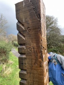 |
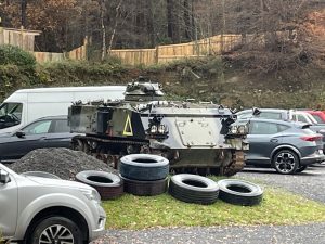
| FV432 armoured car – a relic of the British army, now used as a prop by the paintballing company | Ogham (ancient Celtic) script describing a local tree – part of the Ogham Tree Trail by the Upper Vartry Reservoir |
 |
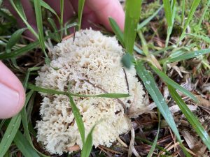 |
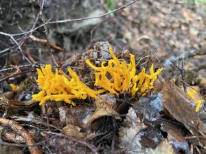
| Yellow stagshorn fungus, Calocera viscosa, flourishing in the saturated undergrowth | As far as I can tell, this is Poretooth Rosette fungus, Hydnopolyporus fimbriatus although the identification is a bit uncertain as it mainly grows in the American tropics (but has been found as far north as the Baltic) |
 |
|
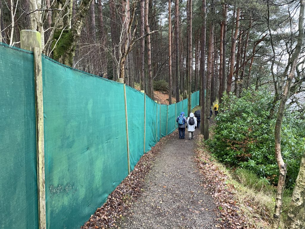
| Fence alongside the path by the paintballing site. A dispute with the paintball company had led to the path being closed until a couple of weeks ago, when it reopened after a successful campaign by the “Keep Ireland Open” group. | |
Interactive map
(Elevations corrected at GPS Visualizer: Assign DEM elevation data to coordinates )
Max elevation: 239 m
Min elevation: 206 m
Total climbing: 202 m
Total descent: -201 m
Total time: 03:38:48
You can read earlier and later days’ blogs below
Previous day’s blog
Next day’s blog
Ireland home page
 Save as PDF