Ireland day 0334. Sunday 28 August 2022- Ballinastoe
| Today’s summary | Gave a lift to a couple of friends from the Portmarnock area and we drove together down to Enniskerry to meet the rest of the walking club group prior to a circular hike through Ballinastoe woods. Only after coffee and scones to start with though. A lovely day out in a nice part of the country, with perfect, wind-free weather. Lots of mountain-bikers to dodge | ||||
| Today’s weather | Mild, dry and bright, but no sun. Almost dead calm at the start, slight easterly breeze higher up. About 18C | ||||
 |
 |
||||
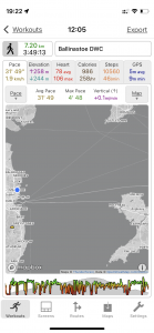
| Today’s overview location (The blue mark shows the location of our route) |
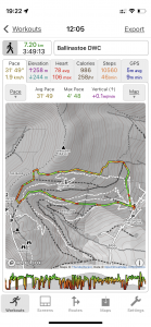
Close-up location (The green line shows where we walked) (Click button below to download GPX of today’s walk as recorded, or see interactive map at bottom with elevations corrected): Ballinastoe Woods circular DWC |
||||
Commentary
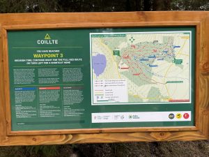
Val had to go back into work today (though it’s her last shift for a few days now), so while she was out earning a crust, I decided to join the Walking Club for a short-ish outing round Ballinastoe Woods. For those not in the know, this is an area of coniferous woodland down in Wicklow, managed by Coillte (pronounced “quilter” and which is simply the Irish for “forests”). The equivalent body in the UK would I think be the Forestry Commission. Ballinastoe is just below the ridge which carries the Wicklow Way down from Djouce to the J. B. Malone memorial, which itself overlooks Lough Tay.
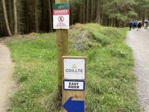
The Woods’ principal claim to fame is that it plays host to well developed network of mountain trails, though walkers are welcome too. Provided of course that they keep off the designated biking tracks- which is altogether sensible as you would probably be obliterated by cyclists downhilling and warp speed if you strayed off the relatively safer footpaths.
But although Ballinastoe was our destination today, first I drove down to Portmarnock to pick up a couple of friends, then we lift-shared down to our favourite Kingfisher café in Eniskerry to meet the rest of the group and indulge in scones and coffee before setting off on the walk proper. And I must say the Kingfisher’s scones are particularly nice (and this isn’t product placement – honestly!).
Once we were invigorated with caffeine and energised with carbs, we jumped back in the cars and drove a further 20 mins in the general direction of Roundwood to the car park in the woods. It too k a while for us all to find our way there but eventually we all safely arrived and we headed on foot uphill into the forest.
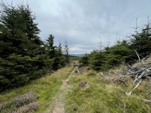
It’s pleasant walk – though you have to take care not to crash into cyclists, who were out in lycra-clad force today but generally well mannered provided they weren’t totally out of control. We ascended quite quickly and soon left the busier sections behind, emerging into the heathery lower slopes of what I suppose is, ultimately, Djouce mountain.
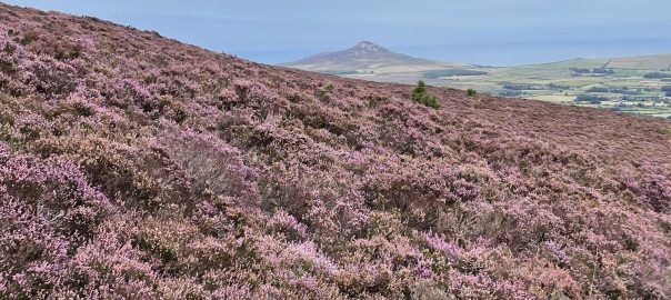
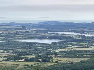
As we climbed, the views really open out and we paused in a clearing above the trees for lunch and to admire the view. Today, you could easily see the coast at Wicklow Head – with its two just-visible lighthouses – glowering beyond the Vartry reservoirs in the closer foreground. An excellent panorama, which only improved even further as we ascended a bit further and headed round slightly to the north east, when Sugarloaf came into view, towering volcanically above the purple heather.
We descended back to the cars from the north, on a slightly steeper path than the upwards route, pausing to admire the beehives with their industrious drones busily pollinating their way round the moorland and turning heather into honey. It was only a short walk today – but very enjoyable – so we were quickly in the car park but with just long enough to grab a cup of tea from the café van before saying our farewells and heading back to Dublin.
Another fine day out, exploring a new part of the countryside that I hadn’t visited before. So once again thanks go to the Club for organising such an excellent day out.
Today’s photos (click to enlarge)
 |
 |
| The woods are a labyrinth of mountain bike trails – with stern warnings for walkers to keep out (probably a wise move as you are likely to be mown down). Unfortunately the bikes tend to use the paths too, so you have to keep your wits about you | Ballinastoe seems to be a bit of Mecca for mountain bikers. The trails are very well maintained and extensive. There’s even a café at the bottom, which benefitted us walkers, too. |
 |
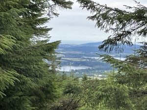 |
| If you had x-ray vision, you would be able to see Lough Tay and the Luggala valley beyond the end of the track – in the centre of the photo – that we had just walked up. From the point, we turned uphill to meet the Wicklow Way, just above the J.B. Malone monument. | Looking down towards the coast through the upper Ballinastoe Woods |
 |
 |
| Telephoto shot of the Vartry Reserviors, Upper and Lower, with Wicklow Head beyond. The apparent mountainous outcrops poking their heads above the sea are in fact illusory – they are clouds – the disappeared or moved a few moments later. | Beehives abuzz with activity towards the end of the walk. The moorlands were covered in heather which seemed to be in full bloom and looking their purple best. Ideal nectar harvesting territory, I should imagine |
 |
|
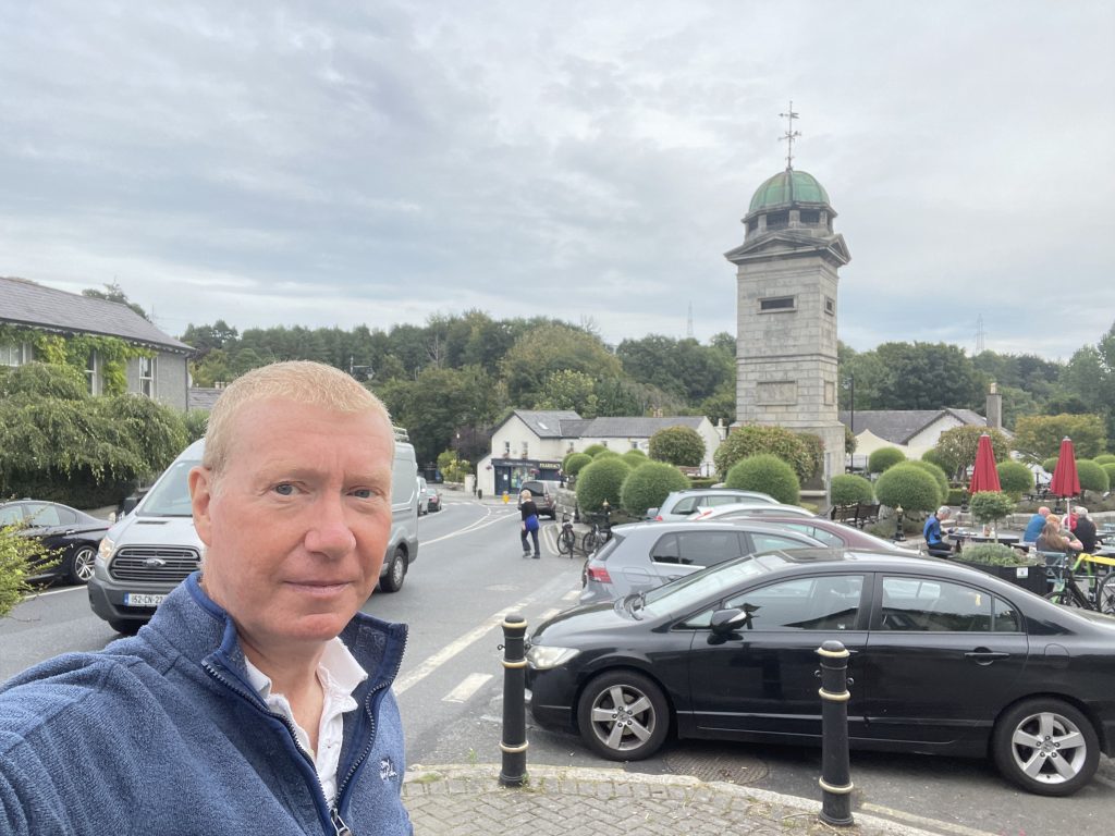
| In Enniskerry this morning – just time for a cup of coffee and a scone.. | |
Interactive map
(Elevations corrected at GPS Visualizer: Assign DEM elevation data to coordinates )
Max elevation: 567 m
Min elevation: 317 m
Total climbing: 327 m
Total descent: -318 m
Total time: 03:48:19
You can read earlier and later days’ blogs below
Previous day’s blog
Next day’s blog
Ireland home page
 Save as PDF