Ireland day 0382. Saturday 15 October 2022- Tonelagee DWC
| Today’s summary | Led a Walking Club hike up Tonelagee from Laragh then back via the Wicklow Gap and St Kevin’s Way. Unexpectedly tiring but enjoyable. Poor weather on the summit meant we had to delay lunch till we were well down St Kevin’s Way. | ||||
| Today’s weather | Sun with squally showers. Gale force westerly wind, possibly even stronger later in the afternoon. About 11C in the valley, much lower on the top. | ||||
 |
 |
||||
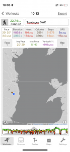
| Today’s overview location (The blue mark shows the location of our route) |
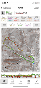
Close-up location (The green line shows where we walked) (Click button below to download GPX of today’s walk as recorded, or see interactive map at bottom with elevations corrected): Tonelagee DWC |
||||
Commentary
(Summary blog only. Last full blog was Day 0368).
Led a group of six DWC hikers round my favourite Tonelagee loop walk from Laragh.
Took much longer than I expected – 7¾ hours – but fortunately we left relatively early so didn’t run out of daylight. Weather was very windy with a very sharp shower as we approached the summit. But superb views when it wasn’t raining.
An unexpectedly tiring day for everyone, but it seemed to be well received.
Today’s photos (click to enlarge)
 |
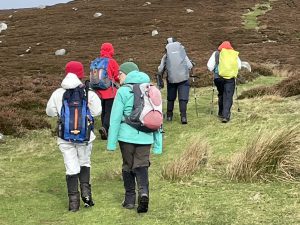 |
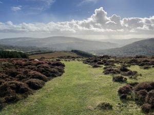
| Looking back towards Laragh from the ascent of east Brockagh summit | Heading along the Brockagh ridge |
 |
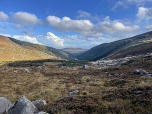 |
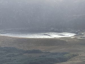
| Lough Nahanagan with the two Younger Dryas terminal moraines clearly visible | Looking down into Glendasan from above the lead mines |
 |
|
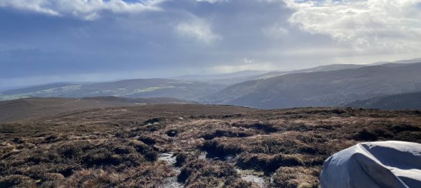
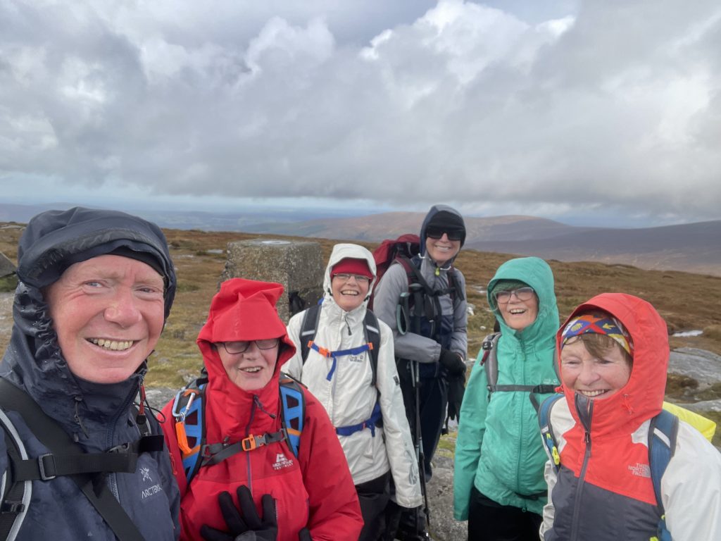
| Tonelagee summit. Very blowy up there! | |
Interactive map
(Elevations corrected at GPS Visualizer: Assign DEM elevation data to coordinates )
Total distance: 21699 m
Max elevation: 812 m
Min elevation: 126 m
Total climbing: 969 m
Total descent: -968 m
Total time: 07:41:18
Download file: Tonelagee%20DWC%20compressed%20corrected.gpx
Max elevation: 812 m
Min elevation: 126 m
Total climbing: 969 m
Total descent: -968 m
Total time: 07:41:18
You can read earlier and later days’ blogs below
Previous day’s blog
Next day’s blog
Ireland home page
 Save as PDF