Ireland day 1550. Friday 26 December 2025- Connemara St Stephens day
| Today’s summary | After salad breakfast, got up and drove down to Roundstone to walk clockwise round the T-shaped Gorteen Bay / Earawalla Point / Dogs Bay peninsula and tombolo. Sandwich lunch halfway round then afterwards drove up to Marconi Road. Parked and did the loop walk round the site of the old Marconi transatlantic telegraph station (1907-1922) -and the nearby crash landing site (1919) of Alcock and Brown’s first transatlantic flight. When we got back to the cottage, we had reheated turkey, Christmas pudding, mince pies and red wine for dinner. | ||||
| Today’s weather | Dry and bright but clouded over mid morning. Light north easterly wind. Appx 5c. | ||||
 |
 |
||||
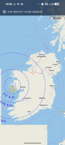
| Today’s overview location (The blue mark shows the location of our routes) |
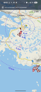
Close-up location (The red lines shows where we walked – Tombolo first to the south, then Marconi second to the north) (Click buttons below to download GPXs of today’s walks as recorded, or see interactive maps at bottom with elevations corrected): Tombolo Marconi |
||||
Commentary
After yesterday’s indulgences we felt we needed to spend a good part of today outdoors getting a bit of turkey-burning exercise.
So we started the day with good intentions. Tea, plain yogurt and salad for breakfast. Yes breakfast. I mean to say! What’s all that about? Well it’s a concession to healthy eating and a firm antidote to yesterday’s embarrassment of riches.
Once we’d cleansed our consciences and cleansed our bodies, we grabbed some hastily assembled packed lunches, and jumped in the Yaris.
Our first stop was the coastal village of Roundstone, which is about 25 min drive south from here. We got there straightforwardly- there was hardly any traffic to clog up the single track road, though it must be a nightmare in summer – and parked near the beach.
Our aim was to walk clockwise wound the strange Y-shaped headland, which is connected to the mainland by a spit of sand which has the technical but poetic name of a tombolo.
We followed the coast as closely as rocks and swamp would allow, passing through Gorteen Bay, Gorteen Point, Earawalla Point, and Dogs Bay. We stopped for lunch halfway, watching a pod of playful dolphins in the cove below us. Actually the dolphins turned out to be rocks emerging from the receding tide, but it was a nice illusion while it lasted.
It was a wonderful walk. Very few people about, bright and uplifting. The scenery was gently rolling coastal granite which resembled in many ways a hybrid between the Scilly Isles and the far north west of Scotland.
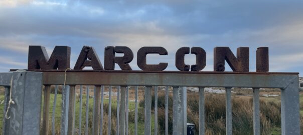
Once the loop was completed, we didn’t go straight back to the cottage. Rather, we called in at Marconi Road, which we had briefly visited yesterday, so we could do the short walk down to the old Marconi radio station, far out in the bog.
This site for the transmission station was chosen partly because Marconi was half-Irish (his great grandfather founded the Jameson distillery) but more practically because it is just about the closest point in Europe to North America – which in this case was St John’s Newfoundland. Hence the ideal site to build the first transatlantic telegraph station – which required its own one megawatt power station (fuelled by coal and turf) to provide the massive voltage needed to send the signals right across the Atlantic.
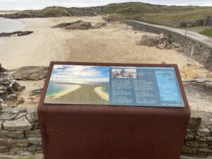
There’s not a lot left now – the station operated from 1907 until its demise in 1922 during the Civil War. But by that stage it was probably being overtaken by superior more modern technology anyway. There’s a good walkway all the way round, with lots of interesting interpretation stations along the way. I thought it was curious that the first transatlantic cable telegraph system – which came ashore at Valentia island – predated Marconi’s system by some 50 years. I have to admit I’m not sure what the benefits of radio telegraphy as opposed to cable actually were. Nowadays, most transatlantic communication seems to be via fibre optic cable. The wheel has come full circle.
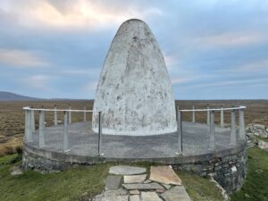
Coincidentally (or perhaps not given the geographic proximity to Newfoundland), just a couple of hundred meters away from the telegraph station is the bog where Alcock and Brown crash-landed after their 1919 epic transatlantic flight. There’s a large white marker beacon there – distinct from the memorial we visited yesterday on the top of a hill a couple of km away.
By the time we had completed the trail and were back at the car, it was 5pm and just reaching the point when you’d need a head torch if you wanted to carry on walking. So we packed our stuff in the Yaris, and drove the 5mins back to the cottage as the last light faded.
Once back, we adopted the now-familiar routine of fire-lighting, making cups of tea, eating preprandial snacks, and then finishing off a bit of the Christmas turkey.
Now it’s time to relax with a glass of red wine in front of the fire and look back on an excellent outdoorsy day. Just what we needed after yesterday’s indulgences!
Today’s photos (click to enlarge)
 |
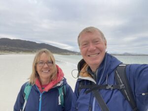 |
| At the mainland end of the tombolo, looking out over Gorteen Bay. “Tombolo”, apparently, is derived from the Latin for “mound”. Actually, in this context, it refers to the spit of sand, bounded on both sides by the sea, which connects the mainland to the distant “island”. There’s a similar, even more spectacular one, in the Shetland Islands, off the north coast of Scotland | On the beach! |
 |
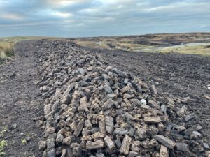 |
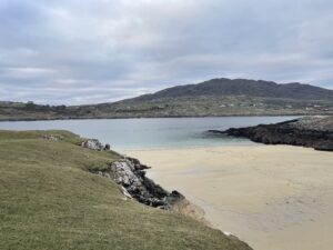
| On of the many hidden deserted and stunning (but cold!) beaches on the “island” at the end of the tombolo | Meanwhile, on the bog surrounding the Marconi telegraph station, turf is still seemingly being actively harvested. Even though this is supposed to be one of the largest surviving unspoiled areas of bogland in Ireland |
 |
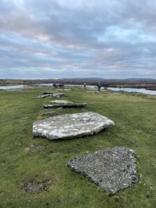 |
| The Alcock and Brown marker. It’s about 3 metres high and their aircraft crash landed in the bog a couple of hundred meters from this point (which was virtually right on top of the Marconi station) | All that remains of the giant turbine hall which powered the telegraph transmission system |
 |
|
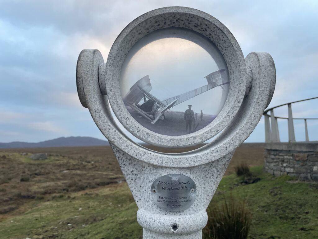
| You’re invited to peer through the looking-glass and envisage the scene shortly after Alcock and Brown completed their historic flight on 15 June, 1919. | |
Interactive map
(Elevations corrected at GPS Visualizer: Assign DEM elevation data to coordinates )
Max elevation: 16 m
Min elevation: 0 m
Total climbing: 95 m
Total descent: -94 m
Total time: 03:01:58
Max elevation: 31 m
Min elevation: 8 m
Total climbing: 65 m
Total descent: -65 m
Total time: 01:30:52
You can read earlier and later days’ blogs below
Previous day’s blog
Next day’s blog
Ireland home page
 Save as PDF