Ireland day 1490. Monday 27 October 2025- Rory Stewart
| Today’s summary | Had breakfast in the hotel and checked out. Then walked to Cathedral Close and had a look round Mompesson House (National Trust). Spent a couple of hours there exploring and having tea and cakes for lunch. Picked up our bags from the hotel and caught the 13:47 train to Waterloo. In the evening went to hear former Tory MP Rory Stewart talking about “Borders” at Friends House in Euston Road. A very interesting and enlightening day, even if the Stewart talk was disappointing. | ||||
| Today’s weather | Bright and breezy with cloud and sun but staying dry. Strong north westerly wind. Appx 13c | ||||
 |
 |
||||
| Today’s overview location (The blue mark shows the location of our route) |
Close-up location (The blue line shows where we walked) (Click button below to download GPX of today’s walk as recorded, or see interactive map at bottom with elevations corrected): Rory Stewart |
||||
Commentary
We had another night in Salisbury last night and as we weren’t travelling back to London until later this afternoon, that gave us a whole morning free to do some more exploration in Salisbury. First though we had to avail ourselves of the hotel breakfast – which was reasonably good – and despite a relatively early start we were still the last to finish.
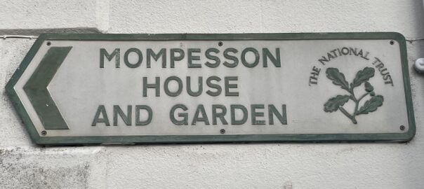
Yesterday when we were looking round Cathedral Close, we had spotted a National Trust property, Mompesson House, which we thought would be interesting to have a look at. As we ran out of time yesterday, we thought we would go back today and explore it. I always like looking round these well-preserved historic buildings – the National Trust is like the UK equivalent of the OPW and they generally do a good job. It’s especially good to visit for us as we were given joint life membership several years ago (thanks Aunty Dorothy!) so we don’t have to pay.
It was an interesting visit. The house itself was built in Queen Anne style in the 17th and 18th centuries but the ownership history is too convoluted to explain here. Anyone wanting to know more will just have to google it. Suffice it to say that the ownership of the freehold by Salisbury Cathedral has been a complicating factor which meant that tenancies were relatively short term and changed every few decades.
We spent a couple of hours there and leaned a lot from the knowledgeable guides who were in each room. The visit was rounded off with a visit to the bookshop and the tearoom. All very delicious but after a huge slice of sponge cake I now feel a bit hypercarbohydrated.
Afterwards, we walked back to the station for our train, calling at the hotel on the way to pick up our bags. Luckily we unintentionally arrived just seconds to spare before the 13:47 departure for London, so we jumped on board and were back at Waterloo before 3:30pm. Doubly lucky, as it turned out, because the earlier train, which we had originally intended to catch, was cancelled.
Once back in London, we refreshed ourselves with more tea and biscuits, then set out to walk up to Friends House in the Euston Road, to listen to a lecture by Rory Stewart (former Tory MP and well-known podcaster) on the subject of “Borders”.
Unfortunately, he came across as pompous, negative, with the same old moans and groans with no solutions. Particularly disappointing to hear him repeating misinformation about Cumbrian geology and radioactive waste. If he’s so wrong about something I know a little about, how much else of what he opines is also wrong?
Today’s photos (click to enlarge)
 |
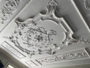 |
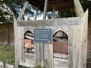
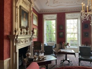
| There’s a bee hotel in the grounds of the Cathedral, styled as a miniature cathedral. The occupants all seemed to have checked out when we visited | Magnificent stucco ceilings throughout Mompesson House – produced by “Itinerant Plasterers” which serviced the properties Cathedral Close. Clearly a wealthy (and much decorated) spot |
 |
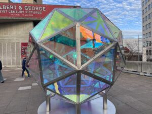 |
| In one of the drawing rooms – redecorated by the National Trust in “original” style (though I can’t quite remember which period in the house’s 300 year history was deemed to be the “original”) | Curious artwork installation on the South Bank. Besides being a polyhedron, I have no idea what it is supposed to represent |
 |
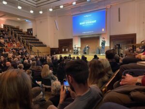 |
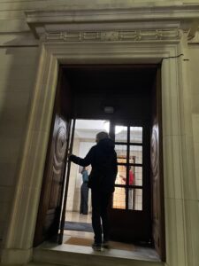
| Val silhouetted in the entrance to Friends’ House, on the Euston Road | Discussion about to start. Caroline Lucas, of the Green Party (on the left) was the host, with Rory Stewart on the right. Both were disappointing. |
 |
|
| Mompesson House (named after its first occupants) from Choristers Square | |
Interactive map
(Elevations corrected at GPS Visualizer: Assign DEM elevation data to coordinates )
Max elevation: 26 m
Min elevation: 22 m
Total climbing: 24 m
Total descent: -24 m
Total time: 02:55:01
You can read earlier and later days’ blogs below
Previous day’s blog
Next day’s blog
Ireland home page
 Save as PDF