Ireland day 1460. Saturday 27 September 2025- Gran Canaria 3
| Today’s summary | Got up reasonably early, had a couple of cups of tea, and then went down east to the beach for an early morning swim. Then after breakfast spent the time relaxing and swimming at the hotel. Had a snack lunch on our balcony enjoying the sun. After lunch in the later afternoon, walked out west along the promenade to look at the lighthouse and the start of the GR131 path. Finished at Meloneras overlooking the Canary Islands Space Tracking centre. Dinner in the hotel again then 80s disco(!!!) later. | ||||
| Today’s weather | Warm dry and sunny all day. Variable wind strongest and southerly in early afternoon. Appx 29c | ||||
 |
 |
||||
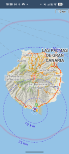
| Today’s overview location (The blue mark shows the location of our route) |
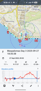
Close-up location (The blue line shows where we walked) (Click button below to download GPX of today’s walk as recorded, or see interactive map at bottom with elevations corrected): Maspalomas Day 3 |
||||
Commentary
Today was a wonderful relaxing day. Unlike the previous couple of days, it remained sunny all day and we were determined to make the most of it.
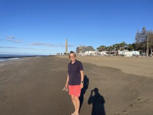
We started the day in a rather out of character way – we got up just as it was getting light (about 7:30am), had a couple of cups of tea on the balcony, then gathered our things and headed out of the hotel, down onto the beach, where we walked in an easterly direction for 20 minutes or so until we found a suitable place to go swimming.
The water was fantastic and for me at any rate a dip in the Atlantic (when the sea temperature is 23.9c as opposed to 14.2c in Portmarnock) is just about the best possible way to start the day. Breakfast, afterwards when we got back to the hotel, felt particularly well deserved.
By the time we had finished breakfast, the sun was getting quite hot (there was no shading cloud layer today) so we sought out the cool shadows of some palm trees and sat generally relaxing and enjoying swimming in the various hotel pools. Very nice, but not quite so exuberant as the sea.
After lazing about for a couple of hours, we were starting to get hungry. So I nipped out to the nearby mini supermercado and got some snacks and drinks. We retired to our room where we enjoyed our tasty morsels on the balcony watching the world go by on the beach below.
Next on our agenda was to do a bit more exploring of the local area. We particularly wanted to seek out the start point for the GR131 long distance path, which traverses the length of the island. Our various guidebooks and the internet told us it started at the lighthouse just by our hotel, so we set out to take a look.
Once we got there, we found it very busy but with no signs of the path start. No information board or friendly red and white waymarks as you might find on the other islands. Just a GPX file to download and follow, I suppose. But then again, the GR131 route has only just been designated on Gran Canaria so perhaps there hasn’t been time to signpost it properly yet.
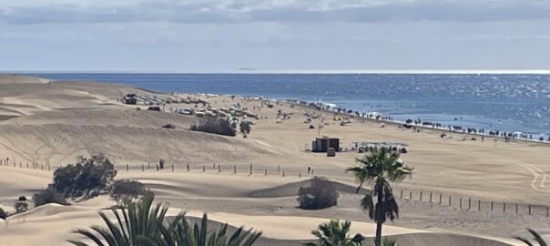
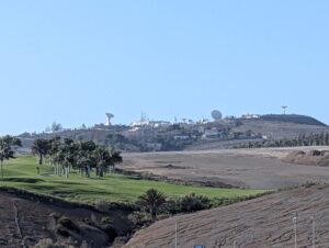
From the lighthouse we continued our westerly journey along the promenade, until we finally reached Meloneras beach. It was a pleasant walk, especially as the sun was starting to go down so it wasn’t quite so hot. And there were good views over the sea and inland to the mountains of the central massif. Perhaps most fascinatingly, at the Meloneras end there was a good if distant view of the Canary Islands Space Tracking Centre. Apparently it remotely tracks and controls satellites and rockets, though quite what that entails I am not sure.
We retraced our steps back along the promenade to the hotel after having a good look at the delights of Meloneras. Then it was was time for dinner at the hotel and then we are promised a 70s-80s-90s disco to follow afterwards. I am sure I will enjoy it after a couple of glasses of wine. It is my era, after all!
Today’s photos (click to enlarge)
 |
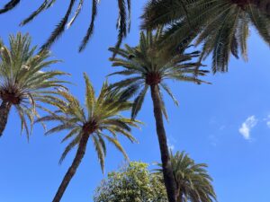 |
| On the way for our early morning dip, with the lighthouse beyond | Our view for much of the morning |
 |
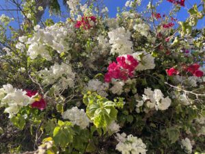 |
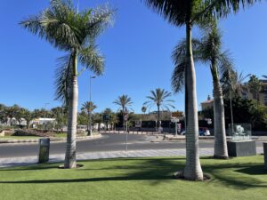
| The view from the Estacion de guaguas (Bus Station). I have seen worse! | Bougainvilleas. I know I am on holiday now! |
 |
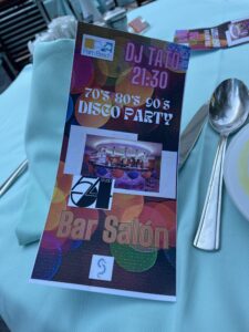 |
| A distant view of the dishes and domes of the Canary Island Space Tracking Centre. It’s said to be a civilian facility, but visits are strictly not allowed | We have got this to look forward tonight!!! |
 |
|
| The faro (lighthouse) at the very south of Gran Canaria. The GR131 path starts here – but we couldn’t see any sign of it | |
Interactive map
(Elevations corrected at GPS Visualizer: Assign DEM elevation data to coordinates )
Max elevation: 19 m
Min elevation: 0 m
Total climbing: 93 m
Total descent: -93 m
Total time: 09:17:27
You can read earlier and later days’ blogs below
Previous day’s blog
Next day’s blog
Ireland home page
 Save as PDF