Ireland day 1327. Saturday 17 May 2025- To Takayama
| Today’s summary | Had a “Western” breakfast then checked out of our ryokan. Took a taxi to Kanazawa station as it was pouring with rain. Then a short Shinkansen journey to Toyama where we changed onto the JR Hida line for a beautiful mountain train ride to Takayama. Checked into our next ryokan then had a stroll round the town and enjoyed a bento box for dinner on the river bank. Quick dip in the onsen on return, then an early night | ||||
| Today’s weather | Heavy rain in the morning but dried up in mid afternoon. Light south westerly wind. Appx 26c in Kanazawa but a little cooler in Takayama | ||||
 |
 |
||||
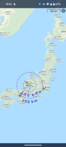
| Today’s overview location (The blue mark shows the location of our route) |
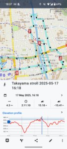
Close-up location (The blue line shows where we walked) (Click button below to download GPX of today’s walk as recorded, or see interactive map at bottom with elevations corrected): Takayama afternoon stroll |
||||
Commentary
This morning we had a “western” style breakfast in the ryokan – I’m not quite sure why they chose to serve us bacon and eggs rather than the usual Japanese fare, but I must admit I, for one, was quite glad not to be facing raw snails again, as I think I need a bit of a break from gastropods. It was also our last night in Kanazawa, so after we had breakfasted, we checked out and, because it was absolutely pouring down, we took a taxi to the station rather than walking.
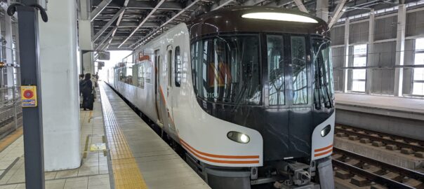
After a wait which was just long enough to work out how to get a coffee from the machine in the station Seven-Eleven, we boarded a Shinkansen for the brief journey along the coast to Toyama. Here we transferred off the standard gauge Shinkansen onto a narrow gauge regional JR Hida railway service which runs over the mountains from Toyama to Nagoya. It’s very scenic and so tends to be very popular with visitors. So it was fortunate that we had booked our seats yesterday, as the train was completely full by the time we set off.
We only took the first half of the journey today – as far as Takayama, a small town in the heart of the mountains. Indeed “Takayama” means “High Mountain” in Japanese, and it’s situated at an altitude of about 580m / 1900ft. We will complete the journey to Nagoya later next week. The section we travelled today made for a spectacular ride, with a river gorge below us and steep wooded hills towering above us. No wonder it is so popular.
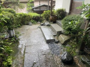
Once at Takayama, we got off the train and walked a couple of blocks to our conveniently situated ryokan (Oyado Koto No Yume) where we’re staying for the next three nights. It’s not so opulent as the Kanazawa ryokan, but feels very much like an authentic Japanese rural hotel – albeit one with mats on the floor to sleep on, and a hot spring onsen around the back.
Once we were settled in, we set out to have a look round the town. It’s quite small by Japanese standards, though it still has 87,000 inhabitants. It’s best known for its old wooden houses, narrow streets and wood carvings – which isn’t surprising as the town is surrounded by so much forest.
The hotel doesn’t serve dinners but that was fine by us as we rather fancied something a bit more ordinary to eat tonight. So we made do with a couple of bento-boxes which we bought at a local Family Mart corner store. We ate then on a seat down by the riverbank and it was actually very serene. It felt nice to relax over dinner, after three days of kimono-clad formality.
After our walk-and-dine excursion, we returned to the hotel and went down to the hot-spring onsen on the ground floor. We don’t have a shower in our room, so this was our ideal opportunity for a wash and soak before retiring to bed.
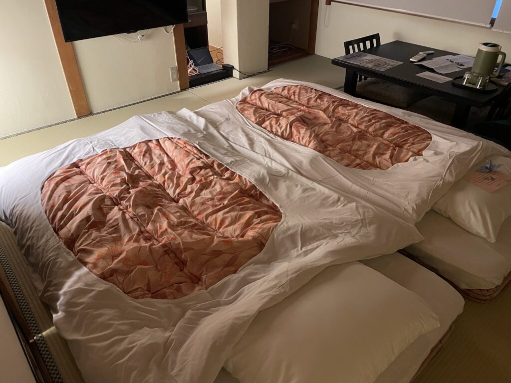
Finally, we repaired to our room, which had been laid out with sleeping mats while we were out, and enjoyed a couple of beers while lying on the floor, as there are no seats. Today really was Japan at its finest, in so many ways!
Today’s photos (click to enlarge)
 |
 |
| Absolutely bucketing with rain when we left the ryokan this morning. So glad it wasn’t like this for our on-foot explorations over the last couple of days | Looking over the rice paddy fields to the distant mountains as we sped along in the Shinkansen on our way to Toyama |
 |
 |
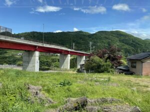
| One of the many impressive looking road bridges spanning the valley through which the JR Hida line to Takayama runs | Entrance to our ryokan, with a shadowy onlooker! |
 |
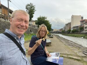 |
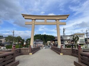
| The main gate into the old town of Takayama. It’s huge. | We certainly know how to live – bento boxes on the riverbank for dinner |
 |
|
| Our beds miraculously appeared on the floor of our room while we were out | |
Interactive map
(Elevations corrected at GPS Visualizer: Assign DEM elevation data to coordinates )
Max elevation: 578 m
Min elevation: 563 m
Total climbing: 53 m
Total descent: -53 m
Total time: 02:11:05
You can read earlier and later days’ blogs below
Previous day’s blog
Next day’s blog
Ireland home page
 Save as PDF