Ireland day 1138. Saturday 09 November 2024- Misty Maulin
| Today’s summary | Val was working at Wonderlights again today, and I went out first thing to join the Walking Club at Enniskerry. A circuit of Maulin from Curtlestown woods in the drizzle and mist. Very enjoyable despite the lack of views. Stopped off at Tesco on the way back. | ||||
| Today’s weather | Misty and drizzly all day with heavy cloud. Light south easterly wind. Appx 12c | ||||
 |
 |
||||
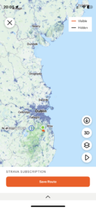
| Today’s overview location (The green mark shows the location of our route) |
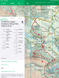
Close-up location (The red line shows where we walked) (Click button below to download GPX of today’s walk as recorded, or see interactive map at bottom with elevations corrected): Misty Maulin DWC |
||||
Commentary
If you ever felt like you’d had enough of the blue skies and sunshine of the Canaries, then today would have been the ideal antidote. Wall to wall grey, with endless drizzle. The perfect day for a trip out into the Wicklow hills with the Walking Club, in fact.
I set the alarm for 7am to allow plenty of time to get all my things together and to be ready for off at 8:30. Val, meanwhile, enjoyed a bit of a lie in before heading off herself, back up to the Castle for a Wonderlights shift this afternoon and evening.
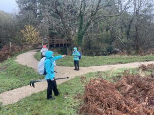
The Group met up at the Kingfisher Kitchen in Enniskerry at 10 and, thanks to my early start, I was there in good time. Long enough in fact to enjoy a quick restorative cup of coffee before setting off on the hike.
Our route took us from the Curtlestown woods car park, down the Wicklow Way to the river and then more on less straight up to the top of Maulin (570m / 1870ft), over the space of two hours. The clouds were right down, so there were no views – a complete contrast to when we did this walk three years ago and could clearly see the distant mountains of Wales, on the other side of the Irish Sea.
We didn’t stop on the top, as it was a bit miserable, but paused a little further down, by a wall, for lunch. From there we pressed on towards the Powerscourt waterfall, which was just visible as a faint white streak in the murk.
Our route looped back to Crone woods where we picked up our outward track and retraced our steps back to the cars. The sting in the tail was, of course, the steep hill up from the Glencree valley back to Curtlestown.
Once goodbyes were said, I made my way back to Malahide, stopping off at Swords Tesco on the way. We have some friends coming to stay for the next few days and I needed to stock up on some essential provisions. As soon as I got back to the flat I realised I had forgotten half the things I needed, so had to head straight back out again to fill the gaps at SuperValu.
After the shopping was finally sorted and put away, I bagged up and froze the casseroles I’d made yesterday, then reheated for dinner some of the older beef casserole and mashed potato I’d concocted a couple of days earlier.
Now there’s just time to unpack all the soaking wet stuff from my kit bag and try and make the place look semi-respectable before Val gets back!
Today’s photos (click to enlarge)
 |
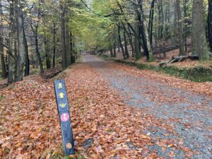 |
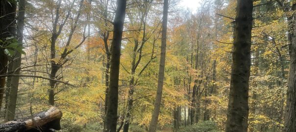
| Pointing the way – the Wicklow Way path has recently been resurfaced down by the Glencree River. We actually took a short cut to avoid this stretch of the Way, but agreed next time we were passing by here, we would try it out | Autumn seems to be at least a week late this year, as the leaf colours were just about at their best today. Normally most of the leaves have gone by now. |
 |
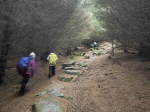 |
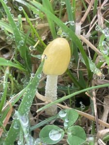
| Apparently this tiny toadstool (the top was only 1cm across) is known as “sunny side up” for obvious reasons. Its Latin name is Bo0lbitis titubans and I don’t honestly think I’d ever seen it before. According to Wikipedia, nobody knows if it is edible or not because it is so small nobody has ever bothered to try | The horrible slog back up the hill from the river to the car park at the end |
 |
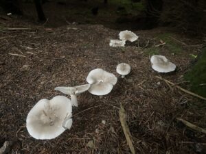 |
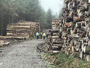
| Lots of forestry operations going on in Curtlestown woods. Every time you visit, the topography seems to have changed | Not actually sure what these toadstools were. but they were quite big (10cm or more across) and seemed to be thriving in the gloom of the spruce forest |
 |
|
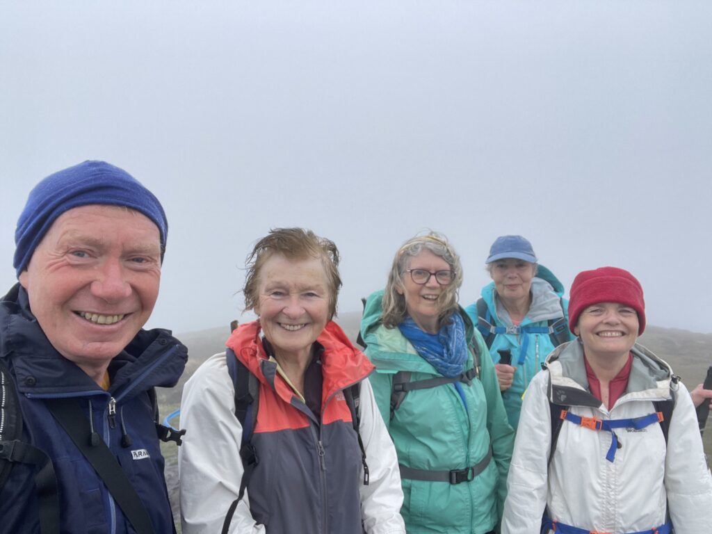
| On the top of Maulin, enjoying the moisturising effect of the fog | |
Interactive map
(Elevations corrected at GPS Visualizer: Assign DEM elevation data to coordinates )
Max elevation: 561 m
Min elevation: 103 m
Total climbing: 840 m
Total descent: -839 m
Total time: 05:21:42
You can read earlier and later days’ blogs below
Previous day’s blog
Next day’s blog
Ireland home page
 Save as PDF