
Ireland day 1069. Sunday 01 September 2024- Kerry Cliffs
| Today’s summary | Got up relatively late and checked out of our guesthouse. Drove up to the Cliffs of Kerry then on to Kilkeaveragh and walked to the RTE mast. Returned to Portmagee for lunch at the Skellig Rock café. Made a brief trip over the bridge to look at the site of the landfall of the first transatlantic telegraph cable. Then turned on our heels and drove the 5 hours back to Dublin. Very straightforward then watched an episode of “The Hour” in the evening | ||||
| Today’s weather | Overcast and dull with flecks of rain. Moderate south easterly wind. Appx 17c | ||||
 |
 |
||||
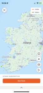
| Today’s overview location (The green mark shows the location of our route) |
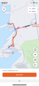
Close-up location (The orange line shows where we walked) (Click button below to download GPX of today’s walk as recorded, or see interactive map at bottom with elevations corrected): Kerry Cliffs |
||||
Commentary
(Summary blog only. Last full blog was Day 0368).
All good things have to come to an end, I suppose, and today our brilliant short break in Kerry reached its final day. After the exhilarations of the past couple of days, especially yesterday, we didn’t have anything special planned for today. But as soon as we got up and opened the blinds, we could see how lucky we had been for our sail yesterday. It was windy and grey, with rain blowing in the air. There was no sign of the sun which has filled our two days in Kerry. (I later learned that the Skellig landing tours did actually go today, but I imagine that it was a far less enjoyable outing than yesterday).
We allowed ourselves the luxury of a lie-in with cups of tea in bed, then packed, and checked out at 11 am. We inspected the porcine and caprine menagerie before finally jumping the the car and saying goodbye to Valentia View.
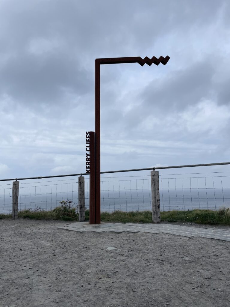
Right behind the guesthouse are the Cliffs of Kerry, and then above that, Kilkeaveragh mountain. So we decided to head that way first, before making our way back to Malahide. The cliffs have, like so many things, been transformed into an “Experience” which charges €5 to get in. But I have to say it was worth it, as the cliffs are spectacular – certainly on a par with the Cliffs of Moher, and less commercialised – and with a good viewing walkway around the best bits.
After having a look at the cliffs, we went on up the narrow road to the car park on the Kilkeaveragh ridge. We left the car there and walked out on the access road, aiming to reach the second set of RTE transmitters at the high point of the ridge. But the wind was picking up and the clouds were closing in, so we stopped at the first mast then turned back. We did pause long enough, though, enough to admire the fine views in all directions, with the Skelligs just visible in the grey haze out to the west.
From the car park we returned down to Portmagee where we did some shopping and then had lunch at the Skellig Rock café (it was “OK”). There was just time to pop over to Valentia Island to have a look at the landing-point of the first transatlantic telegraph cable link to North America before bidding farewell to Kerry for the time being, and driving to back to Malahide.
It was a straightforward journey back – the five hours passed quickly and we made it to the flat in plenty of time to have a light dinner (bananas!) and even to slot in a quick episode of “The Hour” before retiring to bed.
But what a trip! Kerry really surpassed itself for us this weekend, and with Skellig Michael as the jewel in the crown, it really couldn’t have been any better.
Today’s photos (click to enlarge)
 |
 |
| Ginger the pig is thankfully not going to be turned into bacon | Peering down warily to the Atlantic a hundred meters below, from the top of the cliffs at Foilnageragh |
 |
 |
| Really impressive cliffs and some doubtless fascinating geology | RTE mast on the Kilkeaveragh ridge |
 |
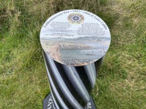 |
| Memorial commemorating the landing-spot of the first successful Transatlantic cable, connecting Valentia with Heart’s Content, Newfoundland, in 1866 | A bit more about the cable, which was laid from the back of the “Great Eastern” steamship – at the time the biggest hip in the world. |
 |
|
| I really like these Wild Atlantic Way markers. So much, in fact that Val bought me a model “Skellig” one, cast in iron, from the shop in Portmagee. What a wonderful gift, and a wonderful memory of a wonderful holiday | |
Interactive map
(Elevations corrected at GPS Visualizer: Assign DEM elevation data to coordinates )
Max elevation: 106 m
Min elevation: 53 m
Total climbing: 304 m
Total descent: -305 m
Total time: 00:58:10
You can read earlier and later days’ blogs below
Previous day’s blog
Next day’s blog
Ireland home page
 Save as PDF