Ireland day 0578. Saturday 29 April 2023- Howth Nonstop
| Today’s summary | Walked all the way to Howth – at 16km the longest post-op walk so far. A cold and clammy day so didn’t hang around. in the evening, took the bus to the airport to meet Val on her return from the UK | ||||
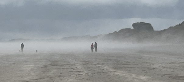
| Today’s weather | Rain at first, and another light shower in the later afternoon. Most of the rest of the day was dry but heavily overcast and with sea mist over Howth. Light south easterly wind, stronger on the shore. Appx 14C but feeling much colder in the wind and in the mist | ||||
 |
 |
||||
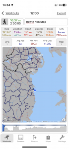
| Today’s overview location (The blue mark shows the location of our route) |
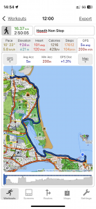
Close-up location (The blue line shows where we walked) (Click button below to download GPX of today’s walk as recorded, or see interactive map at bottom with elevations corrected): Howth Nonstop |
||||
Commentary
(Summary blog only. Last full blog was Day 0368).
Val was in the UK for most of the day and I decided to use the time to try increasing my walking distance a little. This time, I walked round the coast to Howth – always an enjoyable outing and especially good as a hip-recovery route, as it’s flat and mostly on sand, which is easy on the joints.
The walk went very well – very comfortable walking (the hip performed well!) and the rain held off. The forecast said the temperature would reach 14C but it felt much colder than this down on the shore – with a cold headwind and drifting clammy mist. I doubt it was actually much more than 7 or 8 C. In fact it was so cold that I abandoned my plan to stop for lunch midway, and just kept on going instead.
So I got to the end in Howth without stopping at all, and covered the 16.4km / 10.2mi in under 3 hr. Which I was pretty pleased about, especially as it was my longest post-operation walk to date, and broke through the “psychological” 16km / 10mi barrier.
Now I’m just contemplating what to have for tea, then preparing to head back to the airport to meet Val as she returns from London. A good day.
Today’s photos (click to enlarge)
 |
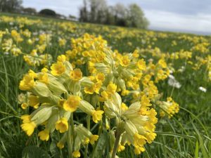 |
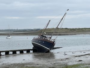
| The beached boat is still hanging about in the Malahide estuary | Beautiful, abundant, cowslips in the meadow alongside Strand Road in Portmarnock |
 |
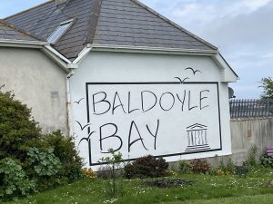 |
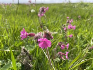
| Red campions seem to be thriving alongside the greenway in Baldoyle | This sign was actually painted while I was sheltering by the wall, having lunch, a couple of weeks ago |
 |
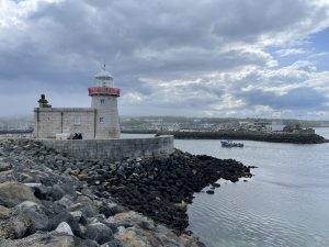 |
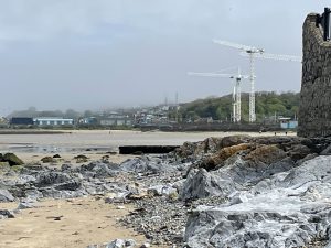
| Approaching Howth – there’s lots of building work going on at the moment | At the end of the breakwater in Howth, looking back into the harbour |
 |
|
| On the Howth breakwater – end of the journey! | |
Interactive map
(Elevations corrected at GPS Visualizer: Assign DEM elevation data to coordinates )
Max elevation: 14 m
Min elevation: -1 m
Total climbing: 129 m
Total descent: -140 m
Total time: 02:49:30
You can read earlier and later days’ blogs below
Previous day’s blog
Next day’s blog
Ireland home page
 Save as PDF