Ireland day 0558. Sunday 09 April 2023- Lucan and Catherine
| Today’s summary | Val and I went to Lucan to explore the town and walk round St Catherine’s Park. Dropped in to see the Wonderful Barn on the way back | ||||
| Today’s weather | Overcast with occasional drizzly spells most of the day, then more persistent rain in the evening. Moderate south easterly wind. Appx 11C | ||||
 |
 |
||||
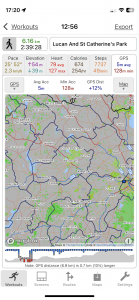
| Today’s overview location (The blue mark shows the location of our route) |
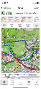
Close-up location (The blue line shows where we walked) (Click button below to download GPX of today’s walk as recorded, or see interactive map at bottom with elevations corrected): Download |
||||
Commentary
(Summary blog only. Last full blog was Day 0368).
Easter Sunday – and we decided to spend it just up the Liffey valley, having a look round the town of Lucan. I’d been there a couple of times before, but Val had never been, so once we’d had breakfast, we thought we would head off upstream and see what we could find.
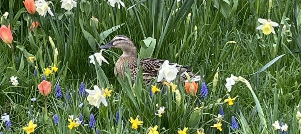
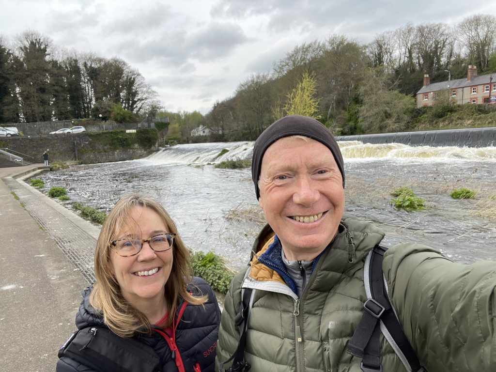
Lucan is a pleasant town with a nice high street – plenty of interesting shops and cafés. And the Liffey runs through the town, with a massive weir and lock system to admire – as well as the main road bridge, built by George Knowles in 1814 and still to this day the longest single span masonry arch bridge in Ireland. And, of course various mallard ducks scuttling about and photogenically settling themselves in the flowerbeds on the riverbank.
Once we’d had a good look round the town, we walked a bit further upstream, past the Italian Ambassador’s house, into the Lucan Demesne. We found a suitable picnic table for lunch – but didn’t linger as it was drizzly and cold. Then we went further upstream, and crossed over into St Catherine’s park via the sewage-pipe bridge.
We made our way back to Lucan through the park and then the residential back streets of the town, but before returning to Malahide, decided to fit in a short detour to see the Wonderful barn. Once again, I’d been a couple of times but Val hadn’t so it did have its usual shine of novelty for her. I still think it’s a real shame that it hasn’t been properly restored and opened up as a visitor amenity. It would be a fantastic asset to the area. Anyway that’s enough for now.
Time for an Easter beer I think!
Today’s photos (click to enlarge)
 |
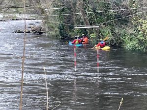 |
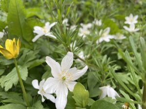
| Wood anemones at the entrance to the Lucan Demesne, just opposite McDonalds | Canoeists negotiating the Slalom course just downstream of the Lucan sluice |
 |
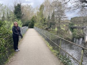 |
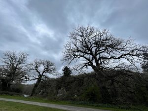
| Trees in the parklands still looking pretty wintry | On the bridge between the sewage pipes, crossing from the Lucan Demesne on the south bank of the river, to St Catherine’s Park on the north |
 |
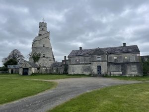 |
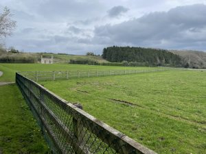
| St Catherine’s Park – it looks suspiciously like English countryside! | We paid an impromptu call on the Wonderful Barn on the way back to Malahide. Still as weird – and as sadly neglected – as ever |
 |
|
| By the Liffey weir in Lucan. I suppose we don’t look too bad for a combined age of 126 | |
Interactive map
(Elevations corrected at GPS Visualizer: Assign DEM elevation data to coordinates )
Max elevation: 52 m
Min elevation: 18 m
Total climbing: 114 m
Total descent: -114 m
Total time: 02:39:09
You can read earlier and later days’ blogs below
Previous day’s blog
Next day’s blog
Ireland home page
 Save as PDF