Ireland day 0543. Saturday 25 March 2023- On The Sand
| Today’s summary | Val returned to work at the museum after a month off, so i was left to my own devices. I walk right down the coast to Portmarnock via the Velvet Strand, the caught the 102 back. Feeling pretty good and recovery so far going well | ||||
| Today’s weather | Bright sunshine interspersed with heavy showers. Light south easterly wind. Appx 10C | ||||
 |
 |
||||
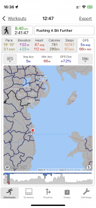
| Today’s overview location (The blue mark shows the location of my route) |
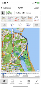
Close-up location (The blue line shows where I walked) (Click button below to download GPX of today’s walk as recorded, or see interactive map at bottom with elevations corrected): Portmarnock down the coast on crutches |
||||
Commentary
(Summary blog only. Last full blog was Day 0368).
After nearly a month off work – first with a bad back and then nursing me, Val returned to work at the museum today. So I was left to my own devices and actually didn’t have any plans for the day. I quite like days without commitments – you can just make things up as you go along.
So, once I’d made breakfast and packed lunches, and Val was safely despatched, I spent the first part of the morning doing a bit of Spanish practice. Once that was out of the way, I packed my things and decided to head off down the coast in the direction of Portmarnock, and just see how far I could get. In the end, as the weather was brilliantly spring-like (despite the occasional shower of rain), I made it all the way to the Velvet Strand, and part of the way beyond. I cut off across the dunes at the mid-point, and headed over to Portmarnock where I caught the 102 back from just outside Lidl. Once I checked my GPS, I realised that I’d walked over 8km, making it my longest walk since the operation.
Once back in the flat I actually felt quite tired so (to my horror) I decided to have a little lie down and fell asleep. Awful! Anyway now I’m refreshed and going to help Val to make dinner for us both.
This evening, I think it’s chili con carne and I must admit, after the exertions of the day, I’m actually feeling quite hungry. Onwards and upwards
Today’s photos (click to enlarge)
 |
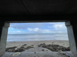 |
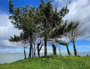
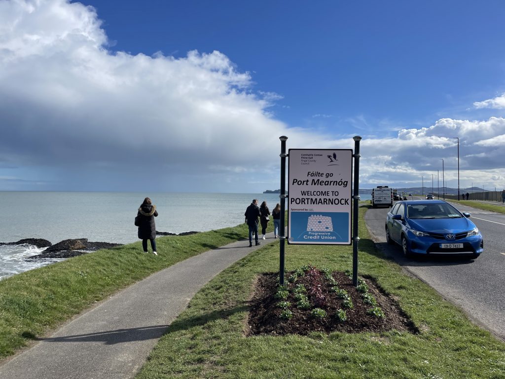
| Trees on the coastal dunes at Malahide | I was hit by a heavy downpour just as I arrived at Portmarnock. Fortunately the bathing pavilion was within easy reach so I stopped there and had my lunch while the shower passed |
 |
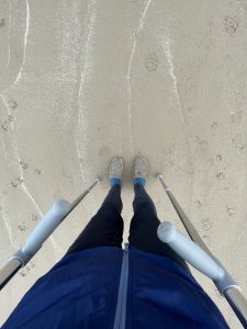 |
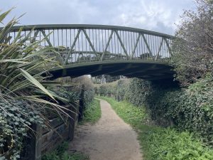
| Bridge from the Portmarnock hotel to the golf course, over the new path to the coast from Portmarnock, that I explored today | The crutches actually worked well on the sand – it was quite firm, as the tide had just gone out, so they didn’t sink in too far |
 |
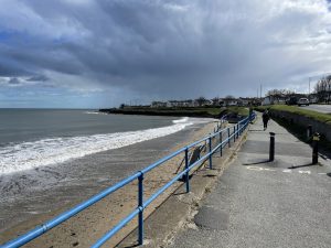 |
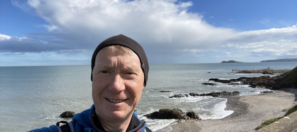
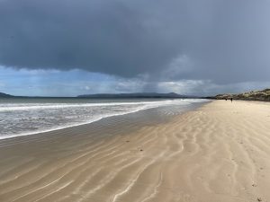
| On the Velvet Strand. I love the feeling of space | Leaving Malahide on the coast path – I ignored the impressive and threatening storm clouds on the horizon. |
 |
|
| Making haste down the coast. The sky – when it wasn’t raining – was brilliantly clear. Springtime at last, perhaps! | |
Interactive map
(Elevations corrected at GPS Visualizer: Assign DEM elevation data to coordinates )
Max elevation: 14 m
Min elevation: -1 m
Total climbing: 105 m
Total descent: -112 m
Total time: 02:41:32
You can read earlier and later days’ blogs below
Previous day’s blog
Next day’s blog
Ireland home page
 Save as PDF