Ireland day 0439. Sunday 11 December 2022- Clontarf Bull
| Today’s summary | Val working again in the evening and had a warm day in the flat beforehand. I went out for a short club walk from Clontarf Road and was treated to an impromptu birthday party at Dollymount. Very touching! Finished off by walking all the way round Bull Island. | ||||
| Today’s weather | Continuing cold, sunny and mostly dry, but with a few snow showers visible in the distance from Bull Island. Moderate north westerly wind. About 4C during the day but well below freezing by evening | ||||
 |
 |
||||
| Today’s overview location (The blue mark shows the location of our route) |
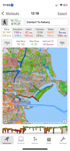
Close-up location (The green line shows where we walked) (Click button below to download GPX of today’s walk as recorded, or see interactive map at bottom with elevations corrected): Clontarf to Raheny via Dollymount and Bull Island DWC |
||||
Commentary
(Summary blog only. Last full blog was Day 0368).
Val was working in the evening so decided to have a relaxing day in Malahide while I joined the walking club for what was billed as a short outing from Clontarf to Dollymount.
The first problem was that my train was cancelled so I had to dash to the bus stop and catch the H2 instead, which meant I was 15 minutes late. The walk was very enjoyable, despite the early mishaps and the low temperatures. The low sun and wintry shadows made the whole thing very atmospheric.
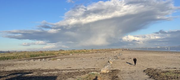
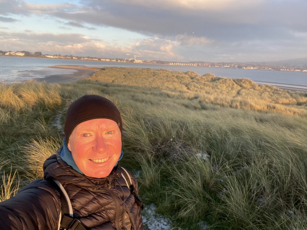
But the best part was the impromptu (early) birthday party the group laid on for me at Dollymount – a very thoughtful and much appreciated touch. After walking out to the monument at the end of the North Bull wall, I branched off and walked right round Bull Island hoping to see the seals at the end. Sadly they didn’t put in an appearance but it extended the walk by a good 10km so all in all it turned out to be a pretty decent length, as well as a generally happy and excellent day out.
Today’s photos (click to enlarge)
 |
 |
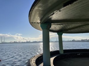
| From one of the crumbling art deco pavilions along the Clontarf Road promenade | Its those iconic Poolbeg chimneys again, with the snowy Dublin Mountains beyond |
 |
 |
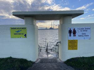
| Women’s bathing shelter on the Bull Wall. incredibly there were people in the sea today. According to the sea temperature website: “Today water temperature in Dublin is 11.6°C. In general, this water temperature is unacceptable for swimming. But hardened people can afford to be in such water for 5-10 minutes. In any case, the general weather is also important. So, the air temperature at the same time will reach 5°C.“ |
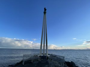
Stella Maris – Star of the Sea – at the end of the Bull Wall |
 |
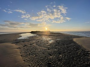 |
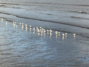
| There are lots of these small wading birds on the shorelines around here at the moment. They are either turnstones or black-bellied plovers I think | Looking back from the very north east end of Bull Island. This is where the seals hang out, but none were to be seen today |
 |
|
| Basking in the dying embers of the afternoon. | |
Interactive map
(Elevations corrected at GPS Visualizer: Assign DEM elevation data to coordinates )
Max elevation: 23 m
Min elevation: -0 m
Total climbing: 153 m
Total descent: -133 m
Total time: 04:11:12
You can read earlier and later days’ blogs below
Previous day’s blog
Next day’s blog
Ireland home page
 Save as PDF