Ireland day 1548. Wednesday 24 December 2025- Connemara Christmas Eve
| Today’s summary | Tea and toast breakfast in bed then drove up to Letterfrack for a look round the Connemara National Park visitor centre. Then walked from there up Diamond Hill. A fabulous loop walk with stunning views over Kylemore Abbey and the Twelve Bens from the top. Had packed lunches in a sunny spot on the way down then drove to Cleggan Harbour afterwards. Back at the cottage about 4pm then roast ham and red wine for dinner. | ||||
| Today’s weather | Brilliant sun and blue skies almost the whole day. Moderate easterly wind. Appx 6c | ||||
 |
 |
||||
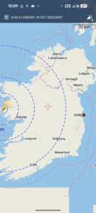
| Today’s overview location (The blue mark shows the location of our route) |
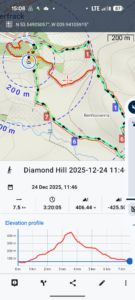
Close-up location (The blue line shows where we walked) (Click button below to download GPX of today’s walk as recorded, or see interactive map at bottom with elevations corrected): Diamond Hill |
||||
Commentary
Miracle of miracles! We have come on holiday and the sun has started to shine! It was an altogether brilliant day here in Connemara today and we determined to make the most of it.
We started in a more leisurely fashion, though, with a tea and toast breakfast in bed. By the time we’d got up and got ready for the day, the last vestiges of overnight cloud had burned off and it had all the promise of being a superb day.
Without further ado, then, we jumped in the car and drove about half an hour north to the coastal village of Letterfrack (it’s tiny – really more like a collection of houses and a harbour than a true village). Just outside the village is the Connemara National Park visitor centre, so we drove up there and parked the car.
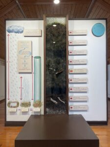
First we had a quick look round the various exhibits – quite interesting but a bit short of details – and tried to find the café. We found it OK but I am sorry to have to reveal that it was closed. Ah well – thank goodness for the trusty Thermos.
Right from outside centre a series of three loop walks explore the immediate environs of the national park. We chose the longest – the red route – which goes up to the top of the nearby and dominant Diamond Hill.
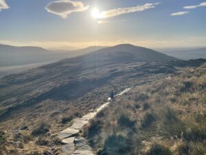
It’s obviously a very much visited peak, as a lot of time and effort has been invested in improving and paving the path all the way to the top. There were a few other walkers around, but it was by no means overcrowded. I imagine it could get pretty busy on a sunny summer bank holiday though.
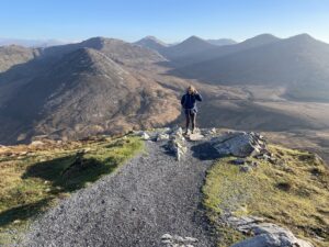
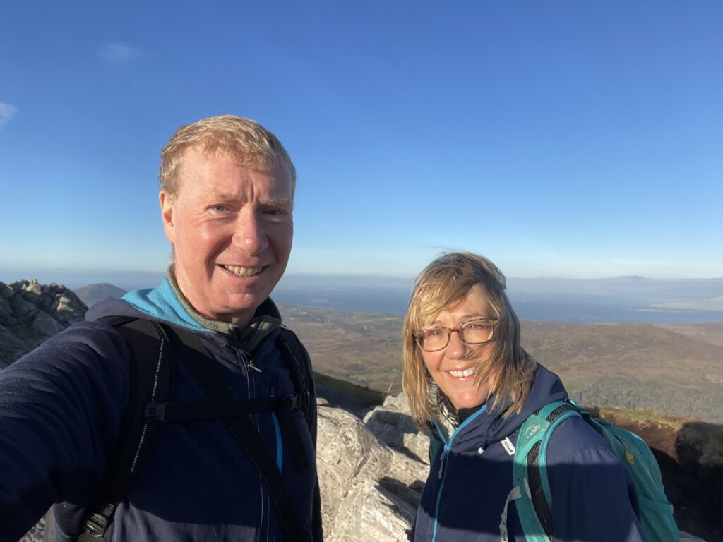
The stunning weather meant there were equally stunning views all the way up, and then in a 360 degree panorama from the top. The well known Kylemore Abbey was clearly visibly down below us, to the north, and the Twelve Bens mountain range stood out impressively to the east.
A cold wind was blowing on the summit so we didn’t stop for long. But on the way back down, we found a sheltered hollow where we stopped and had our packed lunches in the sun.
We finished off the rest of the walk in fairly short order then drove down to the harbour at Cleggan to check out the Inis Bofin ferries. There wasn’t much going on and most places seemed to have closed for Christmas. So we got back in the car again and returned to Cruach Cottage.
We were back at about 4pm and settled down to enjoy a cup of tea and some mince pies. Isn’t that what Christmas is supposed to be all about? Then I lit the fire while Val made some savoury snacks and got the ham in the oven. For dinner we’re having the ham roasted and served with sprouts and cabbage – a delicious if potentially volcanic combination.
And on that note I’ll sign off. A perfect day.
Today’s photos (click to enlarge)
 |
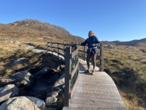 |
| A historical cross section of blanket bog in the visitor centre | The route both up and down (it’s a loop) is well prepared – bridges, boardwalks and paving. Makes it easier for visitors (and they won’t get lost!) and protects the bog too |
 |
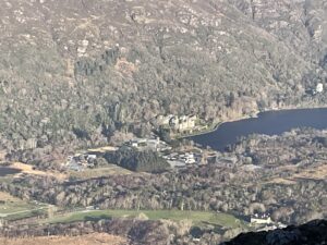 |
| Summit benchmark (442 metres) | Looking across to renowned Kylemore Abbey |
 |
 |
| Val admiring the Twelve Bens on the horizon | Paved route back to base |
 |
|
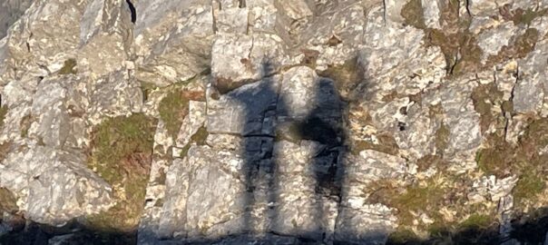
| On the summit | |
Interactive map
(Elevations corrected at GPS Visualizer: Assign DEM elevation data to coordinates )
Max elevation: 422 m
Min elevation: 51 m
Total climbing: 422 m
Total descent: -423 m
Total time: 03:20:05
You can read earlier and later days’ blogs below
Previous day’s blog
Next day’s blog
Ireland home page
 Save as PDF