Ireland day 1500. Thursday 06 November 2025- Getting Ready
| Today’s summary | Spent the morning attending to some more paperwork then had marinieras and hummus for lunch. Went into Malahide to collect some shopping then later went on an evening stroll round the demesne with Val. Rounded off the day with colcannon and black pudding for dinner, then watched some TV. | ||||
| Today’s weather | Mostly dry and bright after overnight rain. Plenty of sun. Light southerly wind. Appx 15c | ||||
 |
 |
||||
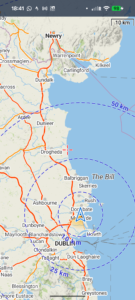
| Today’s overview location (The blue mark shows the location of our route) |
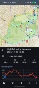
Close-up location (The blue line shows where we walked) (Click button below to download GPX of today’s walk as recorded, or see interactive map at bottom with elevations corrected): Nightfall in the Demesne |
||||
Commentary
I spent the morning dealing with a load of paperwork and other admin. But by late morning we were finished, at which point Val decided to cut my hair (it looks great and every time she does it, it saves €20!) and to tackle some laundry. I meanwhile made some phone calls to resolve a few more more admin loose ends. After all this activity, we were feeling in need of lunch. So we had some marinieras with hummus and pesto, a cup of coffee, and some oat biscuits.
In the afternoon, we both had various jobs to do around town, so we spent an hour or so in the shops and offices sorting everything out.
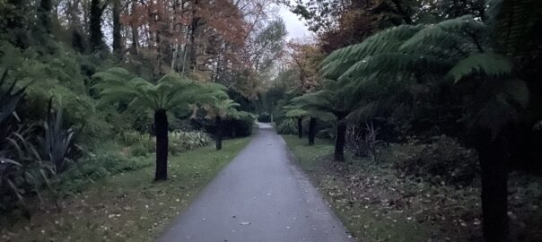
By the time we had done all that, it was already well on the way to evening. We quickly had some refreshments in the flat, then went off on a short walk round the demesne to enjoy the gloaming. It was actually quite ethereal up there. Peaceful, dark and deserted. I think we will have to do it more often, while the evenings are so long.
After that, we just finished off yesterday’s colcannon and black pudding for dinner, then emptied the bottle of wine we had opened yesterday, and retired relatively early.
Today’s photos (click to enlarge)
 |
 |
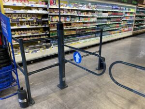
| Tesco have recently installed these new security barriers, and a chicane-type system by the checkouts. Evidently shoplifting must be a problem and perhaps this is the solution | I bought these ziploc bags while I was out on my shopping expedition. I noticed that they are labelled as “dishwasher proof”. Maybe you are supposed to wash them in the dishwasher so they are clean for re-use. Seems like a good idea |
 |
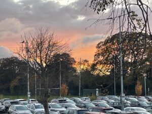 |
| Demonstrating my extensive new haircut! | Sunset over the Bridge Field car park |
 |
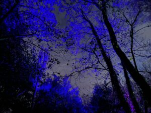 |
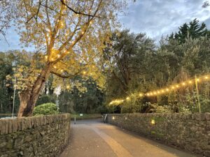
| Festoon lights in the Castle Demesne, ready for “Wonderlights”, which starts in a few days’ time | So is the sky blue and the leaves grey, or the other way round? |
 |
|
| Home for most of the last 1,500 days! | |
Interactive map
(Elevations corrected at GPS Visualizer: Assign DEM elevation data to coordinates )
Max elevation: 27 m
Min elevation: 9 m
Total climbing: 63 m
Total descent: -62 m
Total time: 01:07:05
You can read earlier and later days’ blogs below
Previous day’s blog
Next day’s blog
Ireland home page
 Save as PDF