Ireland day 1245. Monday 24 February 2025- Fuerteventura Day 14
| Today’s summary | Got up reasonably early and hiked up Pico de la Zarza, Fuerteventura’s highest peak at about 807m. A very enjoyable and straightforward round trip, taking just under five hours. Given our early start, we were back at the hotel by just after 2pm giving us all afternoon to relax in and around the pool. Dinner in the hotel again tonight. | ||||
| Today’s weather | Dry and sunny all day, though some cloud on the summit. Moderate to strong northerly wind. Appx 21c | ||||
 |
 |
||||
| Today’s overview location (The blue mark shows the location of our route) |
Close-up location (The blue line shows where we walked) (Click button below to download GPX of today’s walk as recorded, or see interactive map at bottom with elevations corrected): Pico de la Zarza |
||||
Commentary
Well you can hardly come all the way to Fuerteventura without climbing the island’s highest peak. So, that’s what we did today.
We were up reasonably early this morning, and in breakfast only a few moments after eight o’clock. The weather was looking more promising today than yesterday – less cloud, less wind, and a bit warmer. So we quickly decided to pivot back to the walk we had abandoned yesterday, clearing the way for our summit ascent.
Actually, the walk is pretty straightforward and as we had done it once previously, in 2018, we knew pretty much what to expect. And more to the point – the path started more or less right outside the front door of our hotel, so there were no complicated bus or taxi related logistics to contend with.
It’s an out-and-back route to the top: it looks theoretically possible from the map to create a loop out of it. But that would probably involve some challenging navigation and vertiginous paths, so we elected to keep things simple and just go up and back the same way.
It’s a very enjoyable ascent, following a broad ridge steadily upwards on a very well prepared track. We were away soon after 9am so there was hardly anyone about when we ascended, though there we met more people climbing when we were on our way back down.
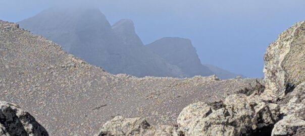
It was quite windy on the desolate ridge today, but strangely the wind seemed to drop as we reached the top. A phenomenon I have noticed on mountains in the UK and Ireland too. Midway along the ascent, the path moves slightly over to the more sheltered western side of the ridge. Along here, there are numerous tabaiba and other shrubs. Last time when we ascended, they were bright green and full of flowers, after a few days of rain. But today everything was looking much more dried out.
Eventually, we made it to the top and had our photos taken by a helpful French couple who arrived shortly before us. Back in 2018, we had enjoyed spectacular views from the trig point but today unfortunately a bank of mist rolled in just as we arrived, so we couldn’t see much at all. The top is supposedly at 807m but strangely I think my GPS registered a bit higher. Anyway we paused to enjoy the moment, then dropped back down a couple of km so we could enjoy our packed lunches in the sunshine.
We continued our progress down after lunch, and particularly enjoyed the brilliant views over Morro Jable – and even as far as La Pared to the east – which opened up as we descended.
Eventually, we made it back to the hotel just after 2pm – a bit dusty and definitely in need of a cup of tea – but pleasingly not too tired. I think twelve solid days of walking in the warm dry sunshine – with a bit of R&R thrown in as well – has done us both a power of good.
Anyway – talking of R&R – I think it’s time to head out to the pool now, and catch a few of those late afternoon rays. Then it’s dinner in the hotel, probably followed by another movie from the Vancouver international mountain film festival.
A great day. I’ve heard people talking about “the Good Life”, and for me I really think this must be what it must be.
Today’s photos (click to enlarge)
 |
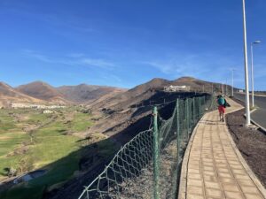 |
| Poolside tranquillity at breakfast-time | Setting out on the early stages of the path, before it turns into a dusty track. The lush green valley to the left is all totally artificial – it’s a golf course. Goodness knows how much desalinated seawater it must consume every day to keep it looking like that |
 |
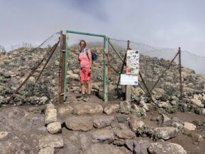 |
| Signpost showing us the way | The summit area is in a protected reserve – there’s a chain-link fence around it to stop you straying too far |
 |
 |
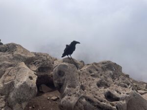
| Hopeful corvid at the top, on the look out for tid-bits | The broad ridge leading back down from the summit to Morro Jable. The valley to the right (which has the golf course in it at the far end) is a perfect U-shape. In northern latitudes, that’s normally a sign of glaciation but down here, where the ice never reached, it’s probably just a feature of the underlying volcanic substructure |
 |
|
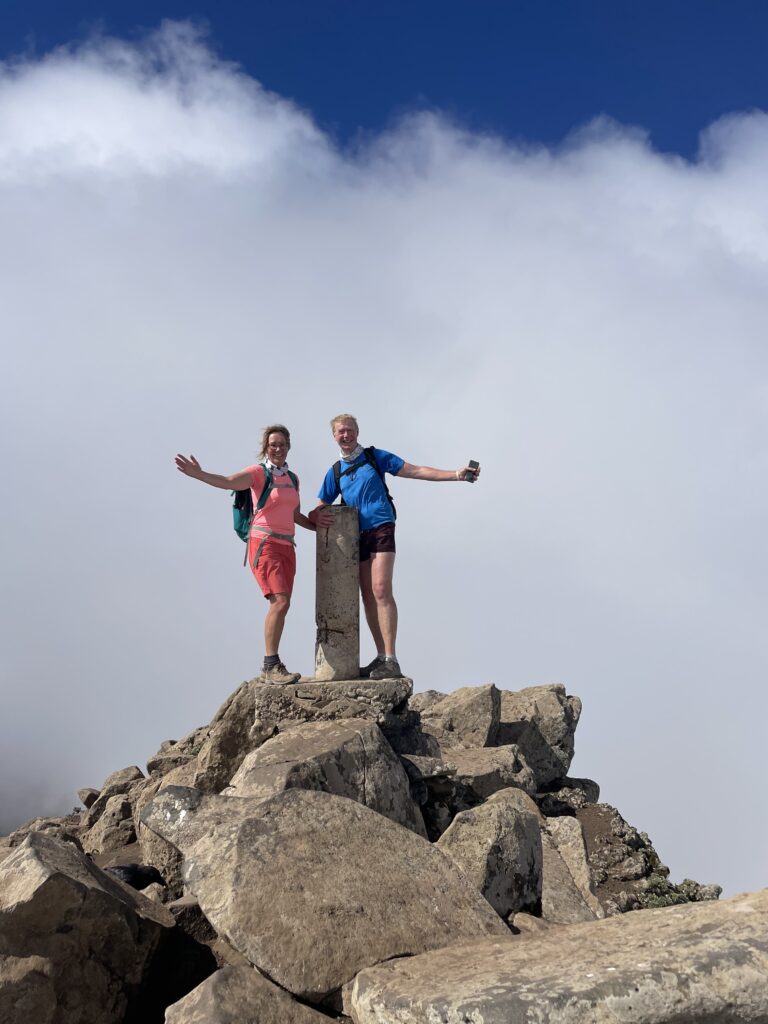
| On the top! Photo courtesy of the French photographer. And by the way, there’s a 500 metre / 1500 ft drop behind me, which is why I’m looking a bit anxious | |
Interactive map
(Elevations corrected at GPS Visualizer: Assign DEM elevation data to coordinates )
Max elevation: 806 m
Min elevation: 49 m
Total climbing: 865 m
Total descent: -865 m
Total time: 04:57:50
You can read earlier and later days’ blogs below
Previous day’s blog
Next day’s blog
Ireland home page
 Save as PDF