Ireland day 1173. Saturday 14 December 2024- Pixel
| Today’s summary | Spent much of the day setting up and then testing the Locus Maps app on the new Pixel 8 phone I got for my birthday yesterday. Initial impressions are favourable. Val was back to Wonderlights tonight, after her absence following the tooth incident. Pork casserole for lunch before she went. | ||||
| Today’s weather | Overcast and gloomy all day with a light shower in the late afternoon. Moderate westerly wind. Appx 9c | ||||
 |
 |
||||
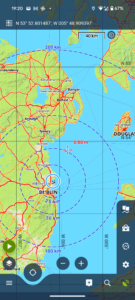
| Today’s overview location (The blue mark shows the location of my route) |
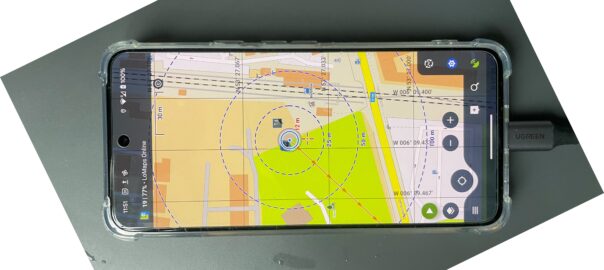
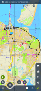
Close-up location (The black line shows where I walked) (Click button below to download GPX of today’s walk as recorded, or see interactive map at bottom with elevations corrected): Locus Maps on Pixel 8 trial |
||||
Commentary
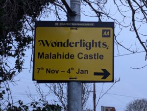
Today felt like the start of a new chapter for us, in a couple of ways. By far the most important was that Val was feeling well enough to go back to work at Wonderlights. She’d been hit by the multiple-whammy of a strong reaction to her shingles vaccine, a dental extraction, and a heavy cold – all in the space of a few days. Unsurprisingly it has has taken her a while to get over all this unpleasantness but today she woke up feeling much better, prompting her to try going back to work. The prospect of Wonderlighting again has really put a spring in her step – she loves it up there – and I am so glad she’s better.
The less significant event was the first outing for the new Pixel 8 phone I got for my birthday yesterday, testing the “Locus Map” navigation app that is only available on Android. It took me most of the day to get it set up – interrupted only briefly to make a quick lunch of pork casserole for us both before Val charged off to Wonderlights just as it was getting dark.
Shortly after Val departed, I also made my way into the gathering gloom, armed with my fully-configured new phone and app, and set off up Paddy’s Hill to try it out. My initial impressions of both the phone and the app were pretty good.
The camera works well and has a slightly longer (digital) zoom than my iPhone. It also has a very good “night mode” and a spirit-level line which is really useful – I have a tendency to take photos with the horizon sloping down to the left and this makes sure that you’re properly horizontal. On the downside, though, I think the colours look a bit less vivid than they do on my iPhone.
On the phone, I also like the pretty neat “Quick Share” app which allows you to send photos and files wirelessly direct from your phone to your Windows laptop (a bit like “Airdrop” does for iPhones and Macbooks). I’m using an eSIM for mobile data (Airalo) and after a couple of initial glitches, that installed straightforwardly and works well too.
The LocusMaps app is looking very promising. I think, so far, that it seems better than any other alternative to the late lamented ViewRanger on iPhone. It’s admirably free of social media integration, and focuses on getting the technical aspects of navigating and managing GPX files right. There’s an enormous amount of functionality, which will take me ages to get to grips with, but some of the features, like distance markers on tracks, and track organisation, are immediate wins for me.
On the downside, the selection of “premium” maps is relatively limited and OS maps of the UK are extortionately expensive. There are no “premium” maps of Ireland (neither OSI nor East-West) though in all cases the “Lo-Maps” which cover the whole world are good enough for most purposes and are free if you take out a subscription for about €25 a year. Surprisingly, you also have to pay quite a lot to download OpenCycleMaps – these are normally free on most apps.
Anyway, I had an enjoyable walk over the hill, and also got an excellent flat white coffee from the Spar shop in Portmarnock halfway round. You can see the photos I took with the new phone, below. But I’m going to stop now and see if I can get to grips with a few more features of my new toy. Watch this space for further developments!
Today’s photos (click to enlarge)
 |
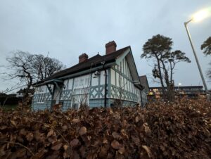 |
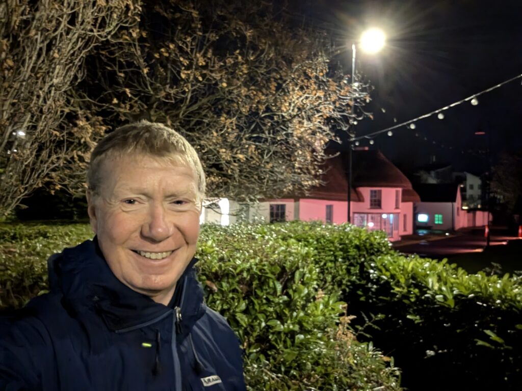
| Val’s back in action – hooray! | The panelled house at the top of Seamount – through the ultra wide angle camera |
 |
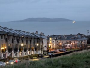 |
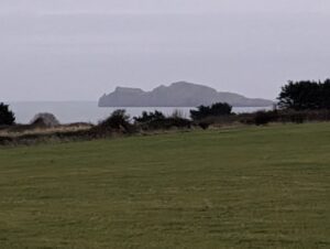
| Looking over Dublin using the maximum 8x zoom (from the Jameson orchard estate) | Another 8x zoom to Lambay island |
 |
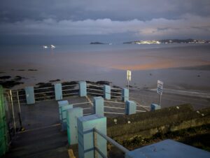 |
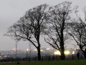
| Ireland’s Eye in the murk | It was almost pitch dark when I took this – the night mode and image stabilisation works well |
 |
|
| Testing the selfie camera. I think I look a bit washed out! | |
Interactive map
(Elevations corrected at GPS Visualizer: Assign DEM elevation data to coordinates )
Max elevation: 50 m
Min elevation: 1 m
Total climbing: 140 m
Total descent: -140 m
Total time: 02:18:05
You can read earlier and later days’ blogs below
Previous day’s blog
Next day’s blog
Ireland home page
 Save as PDF