PW day 15: Mon 07 Mar 2016; Greenhead to Greenlee
| Walk descriptor | Pennine Way | Day | 15 | ||
| Date | Mon 07 Mar 2016 | Start to end time | 07h 27m | ||
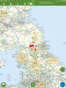
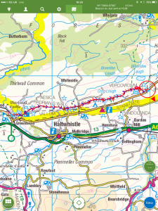
| Start point | Greenhead | End point | Greenlee | ||
| Miles today | 10.70 | Cu miles | 231.21 | ||
| Ft today | 2,235 | Cu ft | 37,990 | ||
| Route miles left | 58.16 | Route ft left | 8,505 | ||
| Today’s weather | Long sunny intervals with broken cloud. No rain or snow. No wind, or very light northerly breeze. Temp appx 4C at noon, well below freezing at start | ||||
 |
 |
||||
| Today’s location (the red cross in a circle shows where I am at the moment) |
GPX based track of today’s walk (click button to download file) GPX |
||||
Commentary
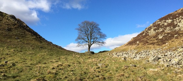
Today was, without a doubt, one of those days that every walker dreams about.
When you’re on a long distance hike like this, the first thing you normally do is to open the curtains and see what the weather is like. Obviously you don’t need to do this if you are camping, as you will know what then weather is like because it is usually leaking into the tent by this stage. But what you see through the window, or feel dropping onto your forehead, will to a large extent determine the quality of your life for the next 24 hours.
And the sight through the window at Greenhead this morning was one of an icy dawn, with a bright wintry sun breaking into a clear azure sky. Your heart always skips a beat at this stage. “Can it be real” you wonder, so you have a closer look to make sure you’re not seeing things. But today it was real – the frost was hard, the sky was clear, and the trees weren’t bent into the wind. So it had all the hallmarks of a great day.
And it was! Because not only was I walking today on mud which through the magic of frost had been transformed from squelch to crunch, but I was also on one of the most historically interesting sections of the whole walk. The icing(s) on my cake today were that the walk was going to be short – at ten miles, the second shortest on the whole walk, and because I would be joined by David, a friend I have known since early childhood. I needed an easy day with good weather to recharge batteries drained by the last few days, which have been tough and challenging.
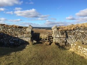
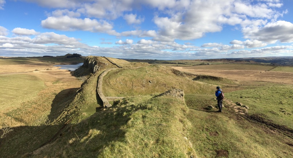
The reason for the historic interest is because this section of the Way runs alongside, or even along, Hadrian’s Wall. Stepping where the centurions had marched, two thousand years ago, was exciting. In my mind I found a strangely reassuring contrast between the changing tides of human fortune, as the Roman Empire came and went, and the timelessness of the scenery the Wall traverses. The wall sits on the top of the natural defensive rampart created by the Whin Sill, itself a relatively junior intrusion into the earth’s crust a mere 295 million years ago. Less than one tenth of the age of the earth.
Although the walk was short, it managed to cram in a lot of the same sort of ups and downs that I’d encountered on the south west coast path in 2014. But the miles and ascent passed easily – today it was impossible to look in any direction and not be impressed by the view. The history, both natural and archaeological, was simply outstanding. It was one of those days when it was impossible to point the lens, and not to capture a brilliant new perspective.
We passed milecastles and forts, marvelled at walls and vallums, and paused frequently to admire the view. And to my delight, David had managed to find some proper food in Haltwhistle, which helped dispel those awful memories of salad, and which we enjoyed while watching the late afternoon sun slowly becoming evening at Milecastle 37.
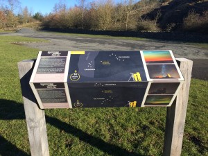
We finished the walk at Housesteads fort, a beautiful spot, world renowned for its outstanding archaeology, fabulous views, and complete lack of a tea shop. But this serious omission aside, I did learn about the special European “dark skies” status that this part of Northumberland enjoys. David was telling me that last night the Northern Lights were visible from Lancaster, so as soon as I’ve finished this blog, and downed my drink, I’m going to finish the day as I started – with my head out of the window, gazing heavenwards, wondering what the omens the sky might reveal.
Today’s photos (click to enlarge)
 |
 |
| Northumberland has special status in Europe for dark skies – here’s the handy guide to what you can see when it’s not cloudy (not often..) | Yes that’s me heading off into the distance, using the special extra long selfie stick |
 |
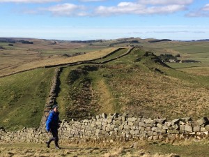 |
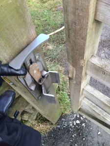
| Unbelievably complicated gate latch mechanism machined out of solid stainless steel. It didn’t work. | David striding purposefully to the next summit |
 |
 |
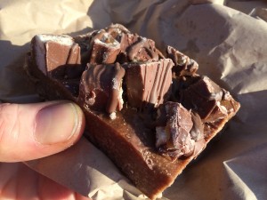
| Turn your heads away, saladophiles. This is what proper food looks like. Chocolate, sugar and lard base, with chocolate, sugar and lard topping. | Milecastle 37, with surprisingly almost complete Roman arch |
 |
|
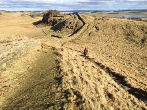
| Looking east from Winshield crags – highest point on Hadrian’s Wall. It felt like you ought to be able to see both east and west coasts of the UK from here – but not sure if you actually could. | |
The previous day’s blog follows below the blue line
 Save as PDF