PW day 14: Sun 06 Mar 2016; Alston to Greenhead
| Walk descriptor | Pennine Way | Day | 14 | ||
| Date | Sun 06 Mar 2016 | Start to end time | 08h 19m | ||
| Start point | Alston | End point | Greenhead | ||
| Miles today | 18.02 | Cu miles | 220.51 | ||
| Ft today | 2,359 | Cu ft | 35,755 | ||
| Route miles left | 68.10 | Route ft left | 10,487 | ||
| Today’s weather | Broken cloud cover with long sunny intervals. Very light north easterly wind. No rain, occasional snow flurries. Temp approx. 4C | ||||
 |
 |
||||
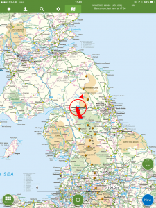
| Today’s location (the red cross in a circle shows where I am at the moment) |
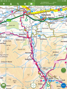
GPX based track of today’s walk (click button to download file) GPX |
||||
Commentary
Squelch, squelch, squelch. Well, if every walk had its own theme tune, these are the words that would have to be incorporated into the tune for today.
I’d been hoping for a “tedious” day, to allow a bit of recovery from the arctic battles of the last couple of sections. So with that in mind, I’d envisaged the walk today as a bit of a riverside ramble. This presumption was based solely on the fact that the route headed north to meet Hadrian, and the river from Alston flowed in roughly the same direction.
Actually, the day was quite hard going and definitely wasn’t tedious. And it wasn’t a riverside ramble either. In fact, it didn’t feature the river at all. Rather, and if I’d only bothered to check the map yesterday I’d have known, it was a high level moorland walk well to the west of the valley. The path wasn’t well trodden – in fact for most of the way there wasn’t really a discernible path at all. Just marker signs at field boundaries and near stiles.
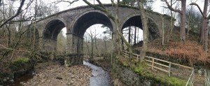
I realised later that part of the reason for the lack of foot traffic might have been down to the fact that running parallel to the Way, for a large proportion of the route today, was a partially disused railway line. The old line has been converted into a smooth, dry, flat track which I suspect a few walkers have seen as a viable alternative to the “real” way, saving miles, hours, and energy. Although the easy option has tempting, I avoided it and stuck to the purist moorland trail.
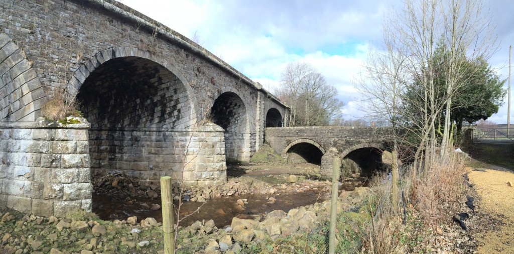
I learned, by the way, that the old railway line has been partly restored as the narrow-gauge South Tynedale Railway, running from Alston to Kirkhaugh. It has recently been awarded £6m of lottery funding, with plans to re-open the line right through to Haltwhistle.
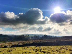
The weather was exceptionally benign today, and at one point I could actually feel the warmth of the sun on my back. It was hard to believe that I was only a few miles and 24 hours away from the blasting blizzards and freezing cold of the previous days. I encountered no snow at all, though the Pennines behind me were clothed in white, as were the distant Cheviots just visible to the north, beckoning me on towards the end of the walk.
As I walked, I became aware that every half an hour or so, I’d hear loud rumbling sounds of distant heavy explosion coming from the north. They lasted all morning and I couldn’t figure out what they were. It almost sounded as if the earth itself had indigestion. I asked the man in the pub this evening about them and it turns out they were most likely coming from the DNV GL Spadeadam test site, a few miles up the road from here. Apparently they blow up houses and trains to see what happens to all the bits.
But no – my abiding memory of today’s walk isn’t the weather, the scenery, or the explosions. It was of the mud, the bog, and the ankle deep water standing on the path. I think that every single footstep today ended in “squelch”. Eighteen miles of wet. None of the luxurious paved walkways of the southern sections of the way, just an unadulterated morass of sticky quagmire. A true reference point for Pennine Way Classic. I can’t imagine that this section ever dries out, and I have an uncomfortable suspicion that there could be more of this to come, as over the next three days I span these lower-lying regions between the Pennines and the Cheviots.
Putting the wet to one side, along the way I enjoyed far reaching views in all directions. Towards the end, as spirits were beginning to sink a bit, exhausted by squelching, I spotted to the east the Great Whin Sill – the hard basaltic intrusion which forms the uplifting foundation for Hadrian’s Wall. And in the other direction, against the setting sun, I was surprised to see the Galloway hills basking in the sun, way beyond the Solway Firth. Merrick, Corserine and the Rhins of Kells – all awaiting exploration on another day.
By the end of the day today I reached Hadrian’s Wall – or rather the Vallum (ditch) which precedes it. I’m spending all of tomorrow walking on the Wall – which promises to be both scenic and historic. And at only ten miles, luxuriously short, too.
Today’s photos (click to enlarge)
 |
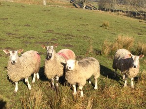 |
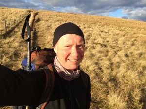
| Looking a lot more relaxed today | Yes I know these are sheep but there are subtle differences, just like people. The one third from left is a Texel, but I think the other 3 may be Bluefaced Leicesters. But I stand to be corrected.. |
 |
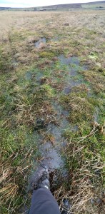 |
| A bit of this yesterday wouldn’t have gone amiss! | Doing the Pennine Wade today |
 |
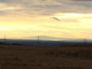 |
| A nice viaduct on the line from Alston to Haltwhistle. A victim of Dr Beeching but now happily being revived as the South Tynedale Railway | Approaching Hadrian’s Wall at the end of the walk this evening, looking west to the Galloway hills (beyond the pylons) |
 |
|
| Curious bridge in a bridge at Burnstones | |
The previous day’s blog follows below the blue line
 Save as PDF