PW day 11: Thu 03 Mar 2016; Middleton to Langdon Beck
| Walk descriptor | Pennine Way | Day | 11 | ||
| Date | Thu 03 Mar 2016 | Start to end time | 05h 19m | ||
| Start point | Middleton | End point | Langdon Beck | ||
| Miles today | 9.58 | Cu miles | 168.21 | ||
| Ft today | 1,385 | Cu ft | 27,891 | ||
| Route miles left | 118.68 | Route ft left | 17,707 | ||
| Today’s weather | Moderate cloud but some sunny intervals. Mostly dry with light drizzle later, light north westerly wind. Temp approx. 4C | ||||
 |
 |
||||
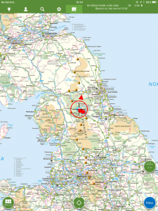
| Today’s location (the red cross in a circle shows where I am at the moment) |
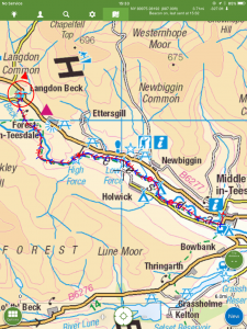
GPX based track of today’s walk (click button to download file) GPX |
||||
Commentary
Today was a really good day, although it started inauspiciously.
There is a bug in my website which has been interfering with photo uploading, especially over low quality internet connections. The problem has been getting worse as I have migrated into the remoter north Pennines, to the point where it was taking 3 or 4 hours to upload photos, when it should only take a few minutes. I contacted my web-hosting company, and they sent me a reply which was so technical it might as well have been written in Martian.
So because the hosting company were of no use unless you come from the outer reaches of the solar system, and because the bug was really annoying me, I vowed to get up early this morning and do my best to fix it myself. So I was up at 5:30, and eventually, after 2 hours googling, I found not an answer but a work around. It took another 2 hours to implement it, so by 9:30, after a hasty breakfast, I was sorted out. If anyone’s interested I can send the solution but basically it involves FTP and a plugin called “Add from Server”.
So after this bit of impromptu internet surgery, I set off a bit later than planned – but without really too much concern as today was a short day, up the Tees valley heading for Langdon Beck.
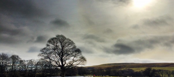
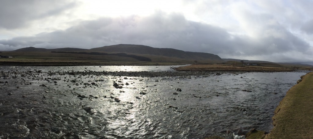
I’m not usually a fan of valley walks, as they tend to be a bit farmyard-y, but today was an exception. For a start, the Pennine Way today was both “Gold” – because large stretches of it were paved and thereby mud-free, and “Lite” – because it was short and easy. Only nine miles to cover, and no major hills. But more to the point, it was scenically beautiful. The Tees is a lovely river, especially up here, with waterfalls, wooded banks, and deep gorges along the way.
First up was Low Force – a spectacular cataract of racing water, diving down narrow gaps between huge boulders, creating a foamy spray as it went. The churning pools reminded me of nothing more than giant vats of Guinness. Then, a couple of miles further on, I came to High Force, one of the “biggest” (however that is defined) in Britain. Today, after recent rain and with still-saturated ground draining off into it, it was impressive. The roar of the downfall (and no wind could have been strong enough to upturn this fall) was deafening and, being a February midweek, I had the place to myself. No hordes of tourists or yappy dogs to spoil the experience. But best of all, and in contrast with Hardraw, I didn’t have to pay to view this natural spectacle.
As you climb past High Force, the countryside undergoes a sudden transformation. In the space of only a few hundred yards you seem to leave behind the rural lowlands and transition into a much remoter, wilder-feeling valley. No neatly manicured fields up here, just bracken, sheep and heath.
I paused at High Force to eat the packed lunch I’d bought at the B&B that morning. The sandwiches and crisps were fine, but the lunch bag also contained a rather mysterious small box whose contents I couldn’t discern. I opened it with some trepidation, for fear that it might contain something liquid and messy. But to my horror, it was something far worse. It was salad! Well that might be fine for day-trippers not straying far from their cars, but for a long distance hiker, it’s absolutely the last thing you want. There are so few calories in salad, you probably expend more energy eating the stuff than you get out of it. Next time I’ll have to make my own and make sure that the salad is discarded and instead the box filled with millionaire’s shortbread and cake.
After passing a massive quarry with complex mechanical equipment which looked like it were eating a nearby hill complete (actually it is a whinstone mine, used for building and roadworks), I was soon in Langdon Beck. Despite the late start and leisurely pace, I was there before 4. Plenty of time to check out the IT and to prepare for the much harder trek over the Pennine backbone to Dufton tomorrow.
Today’s photos (click to enlarge)
 |
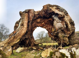 |
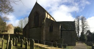
| Unusual church in Middleton – one of only three in the country with the bell tower separate from the main church (the tower is at the top of the churchyard, to the far left) | Unusually photogenic tree stump. Hard to judge the scale – could be a giant redwood or a bonsai.. |
 |
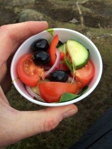 |
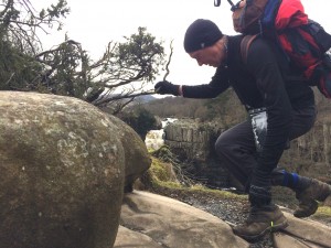
| Action shot (actually I didn’t realise the self-timer on the camera was about to go off..) – High Force in the background | Salad. OK for gerbils but not hikers. |
 |
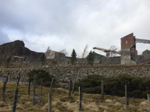 |
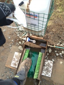
| The yew trees which clothe the riverbank near High Force are infected with a distant relative of potato blight. Hence the sheep dip for people, to kill off the spores | Mountain-gobbling quarry just above High Force |
 |
|
| Glorious, silvery, upper Teesdale, near Langdon Beck | |
The previous day’s blog follows below the blue line
 Save as PDF